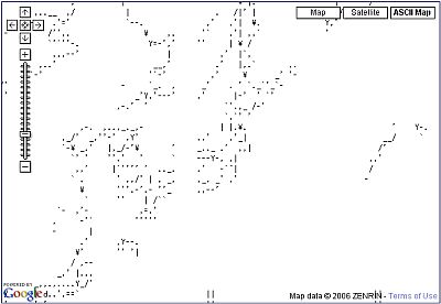
A way to print and create your own ultra high-resolution world map with the entire wall
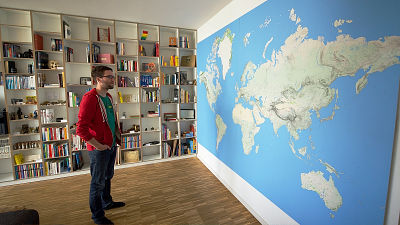
A man who made a huge map with the DIY spirit of "You can make it yourself if you do not get what you want" appeared. It seems that it was also a series of interesting discoveries while having various difficulties to make a huge map that covers the entire wall of the home.
Printing a wall-sized world map
http://www.dominik-schwarz.net/potpourri/worldmap/
Dominic M. Schwartz who men made a huge map here. Online travel search service "KAYAKIt is a person who will serve as a Europe SEO officer of.

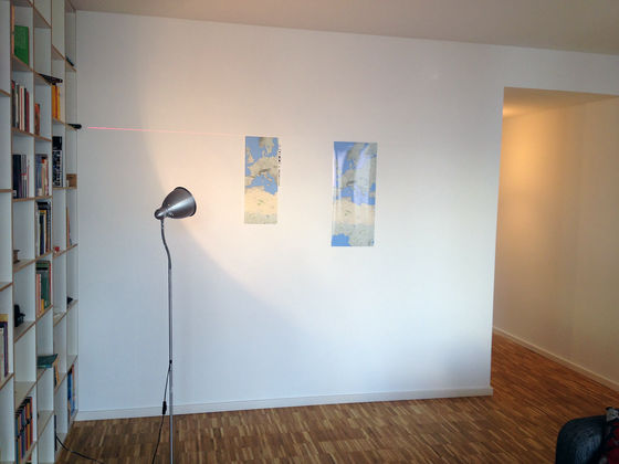
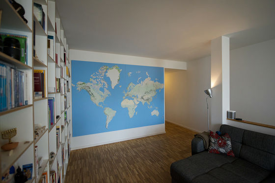
Mr. Schwartz 's handmade map is extremely difficult to obtain in general 3 meters by 2 meters in length. You can see that it is quite huge compared to the height of Mr. Schwartz who stands before.

Mr. Schwartz, "I loved the map since I was a child", he said he wanted to get a large and fine map anyway. Schwartz who searched for the largest possible map on the market is noticed one fact that is here.

It seems that "It is said that if the width is 1.5 meters class, a map close to the desired level can be found, but if it gets bigger than that level the level of precision of display drops." In other words, it was that the display of letters and terrain was expanded in proportion to the size of the map, but the reason was that it was hidden by the way maps were used. When it becomes a map with a size exceeding 1.5 meters, usage is limited to uses such as posting in the school's classroom, so the size of characters and the amount of information are limited in view of ease of viewing.
Furthermore, Mr. Schwartz searched for all kinds of maps using the Internet, but hope for reasons such as "It has not reached the size of hope" "Only large cities are listed" "boundary line is over emphasized" I can not find anything. I found something close to the ideal, but still it seems that I could not find the quality map that I was searching for after all, only certain areas were lineuped.
The only means left by Schwartz who could not find the map he wanted to do so far is "Make it yourselfIt was only the thing called.
◆ Looking for map data that can be used freely
Mr. Schwartz who decided to make a huge map by his own work, initially sets the target size3 meters wide × 2 meters high, And the resolution of the image300 dpiI decided. Next, we will start selecting an online map to realize this quality.
· Candidate 1:OpenStreetMap
Mr. Schwartz tried OpenStreetMap, which anyone can edit the map with open source, but rejected it because the quality of the data was not good. However, it seems that OpenStreetMap has been impressed with the high editing quality.

· Candidate 2:Bing Maps
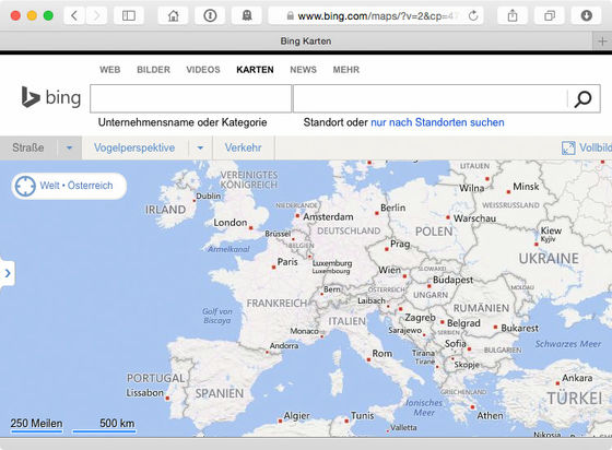
Although it seems that the data quality was a passing point, it is judged that the image quality is not good. In particular, I was told that I was not satisfied with the fact that the surroundings of the letters were strangely blurred.
· Candidate 3:MapQuest
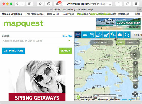
The original data is MapQuest same as OpenStreetMap, but it was said that display with high designing ability by layer function was good. However, as the roughness of data, especially when zoomed in and displayed in detail, got hurt, this also dismissed.
· Candidate No. 4:Google Maps
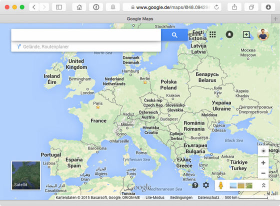
Sharatsu says that it should be said that it finally settled on Google Maps. Especially in Google Maps, the judgment of "what to display / what to do" is accurate for each zoom level, and it seems that high quality has become a deciding factor.
◆ Is there no legal problem?
Mr. Schwartz, who decided to use Google Maps, worried about "Is there a legal problem?" However, this time it is "personal project", "it is not open to the public, it does not sell", "because it is accessed from an ordinary browser and data is acquired using the" print "function" He seems to have judged that there is no illegality.
About printing
It is very sophisticated to have a very fine technique to print very precisely 300 dpi to the size of the entire wall. If you leave it to a professional printing company it will be somehow a problem, but in that case it will be necessary to place orders of hundreds to thousands of copies, and as in this case it is called "only one"One offThere is no one who can readily respond when it comes to work of. Of the 10 companies that made inquiries, only 5 companies have responded, and 4 of them have declined that they are "impossible".
The client who finally decided it was a print shop who was surprisingly in the neighborhood. When I tried speaking at a print shop I found at the outbreak of errands, the owner seems to be very enthusiastic, and he seems to have been able to cooperate quite ahead of time. The conditions decided here are as follows.
· To fit the size of 3 × 2 meters, cut the Arctic Circle and the Antarctic Zone. However, the map itselfMercator projectionBecause the North Pole and the South Pole were made to be distorted largely because they were made with, there was no major problem even if cutting.
· Since it is impossible to output a size of 3 × 2 meters as a single piece, divide the map data into two. In order to make the parting line inconspicuous, we chose a position that is closest to the center of the map and has a lot of parts passing through the ocean.
Schwartz 's project, which started on orbit, first enters selection of paper to use. When comparing the same data on glossy photo paper and matte matte paper and comparing it, it was judged that there was a lot of reflection on photo paper, and it was judged that problems would arise especially when it gets bigger size, so we decided to use matte paper Decided.
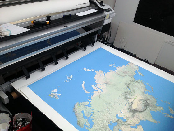
Once the paper has been determined, it will start printing. The printer I used was a business machine called "EPSON Stylus Pro 11890". Data capacity is1.25 GBThe map data will also be divided into two sheets and printed. The print quality was extremely high, and it was possible to clearly read up even a very fine character of only 4 points, and it was possible to obtain a realistic finish that feels the height of the topography. The costs incurred here are based on printing fee and data processing cost329 euros(About 44,000 yen).
It is not realistic to paste the printed map on the wall as it is. For that purpose, Ms. Schwartz asked a professional contractor for work. I asked was a craftworker called "Plasterer" and it seems that it was a person like "walled craftsman" in Japan.
Asked a craftsman to be introduced from a print shop, they asked a map to be pasted on a panel made of polyvinyl chloride called "Foamex panel" which is light and flexible, and decided to put it on the wall. Using this panel, you can also point the pin to the map.
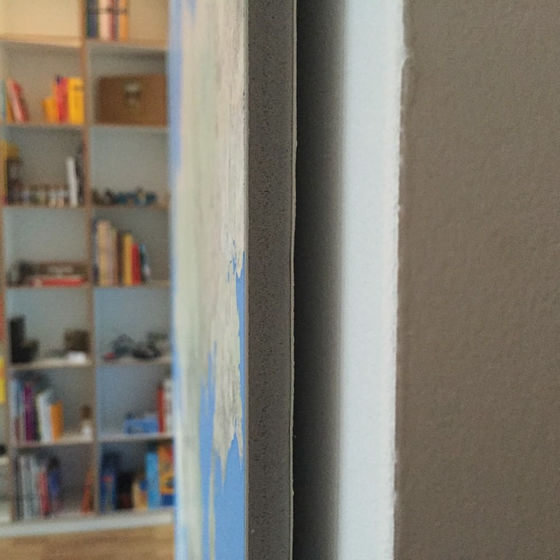
A map panel delivered after pasting is completed. The person in charge of the work said that it was quite a "craftsman temperament", although the work was wonderful, it seems that the smell of cigarettes attached to the surface could not be taken for two days. Cost is work and delivery fee399 euro 99 cents(About 54,000 yen).
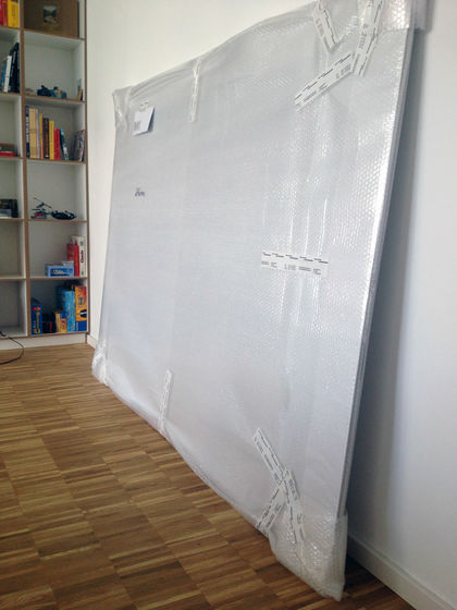
Mr. Schwartz who attempted to install the finished panel, but because of its huge size the work is difficult. It is a series of hardships because just a little positional deviation influences indeed.
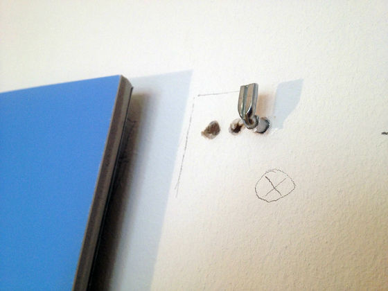
As a result of several trials, ultimately ask another vendor to install a frame reinforcing the panel, and the installation on the wall is completed. Although it seems there was a trouble such as falling from the wall after installation, the cost paid to the trader here is410 euros(About 51,000 yen).
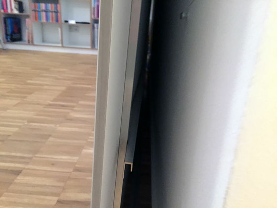
Although it is not the last finish, Mr. Schwartz also shows attention to pins that stab the map. Schwartz says that it was a dream to set up a pin on a map stated precisely, succeeded in locating a pin of a size appropriate for its fineness. We succeeded in obtaining a thin pin of 0.4 mm which is half the size of a general 0.8 mm pin.
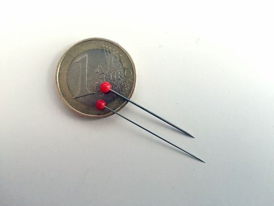
Furthermore, Mr. Schwartz also sticks to the color of the pin. Because of special pins, pin head was only red lineup, but Schwartz performs coloring by myself just as "this is fortunate". It is not a general paint, but chooses a type of phosphorescent type that absorbs light and shines in a dark place. "That's great if the pin glows when it gets dark?"
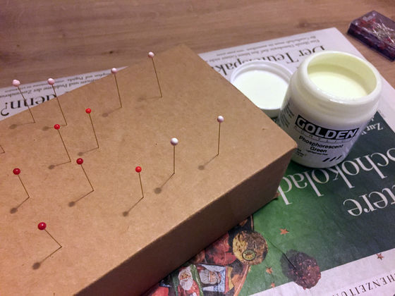
However, Schwarz is a bit disappointing that he could not get as much effect as I expected. It seems that a good solution has not been found so far, because the appearance is not good in a bright place because it painted a color, and conversely the map of the bottom could not be seen well when it became a dark place. Also, because it is so huge, I am also looking for ways to light up the whole map well.
As a future prospect, Ms. Schwartz seems to consider setting up a projector and displaying various contents on the map. For example, you can display the route of the airplane on which you got, display the location where Twitter was murmured on the map, and display political and statistical data on the map, possibilities are various It seems to be thought.
Related Posts:
in Design, Posted by darkhorse_log


