A satellite photograph image of Nepal attacked by an earthquake of magnitude 7.8 is being released
Magnitude of 7.8 that occurred in central Nepal on 25 April 2015Nepal earthquakeMany casualties and victims are in, and as of the 28th Japan timeThe dead are over 4000 people, The tough situation continues that the 72-hour time limit that the survival rate sharply drops approaches. further,In Everest an avalanche occurs due to an earthquakeThere are casualties appearing.DigitalGlobeProject to make use of artificial satellite photographs advanced by "Tomnod, We confirmed the facilities and roads collapsed in the event of the earthquake and released local satellite imagery so that we can grasp the rescue route beforehand and solicit volunteers to tag the collapsed facilities etc It is.
Tomnod
http://www.tomnod.com/campaign/nepal_earthquake_2015/
In the above site, it is possible to check the pictures taken by the satellite one by one in detail. The entire map is displayed on the right side of the screen, and confirmed places are added one after another.
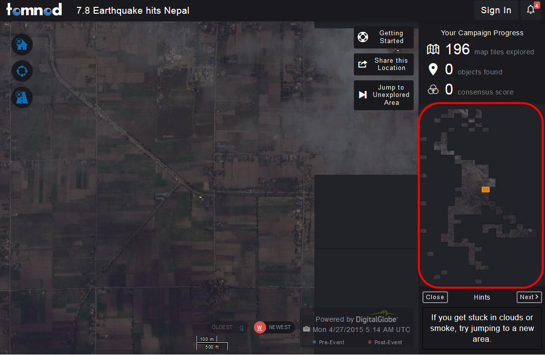
Furthermore, if you click "OLDEST (Q)" and "NEWEST (W)" at the bottom of the screen or enter "Q" or "W" with the keyboard, it is possible to switch the landscape before and after the disaster display It was getting.
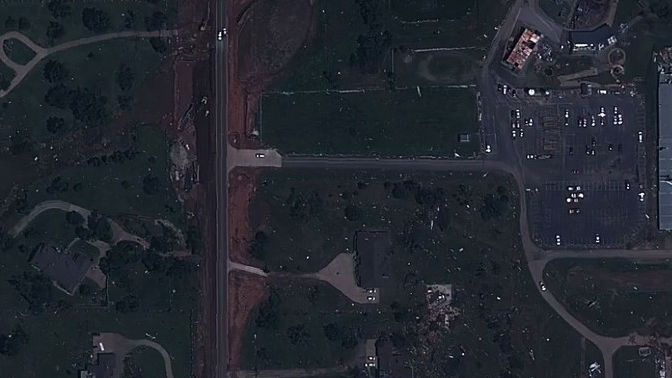
Here is an example of a satellite photograph taken at 14:13 on April 27, 2015 in Japan time. On the site, it is possible to check such images in detail.
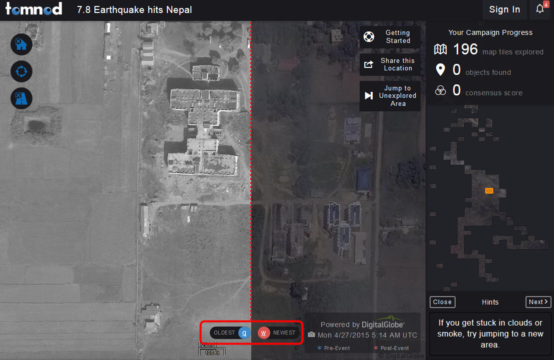
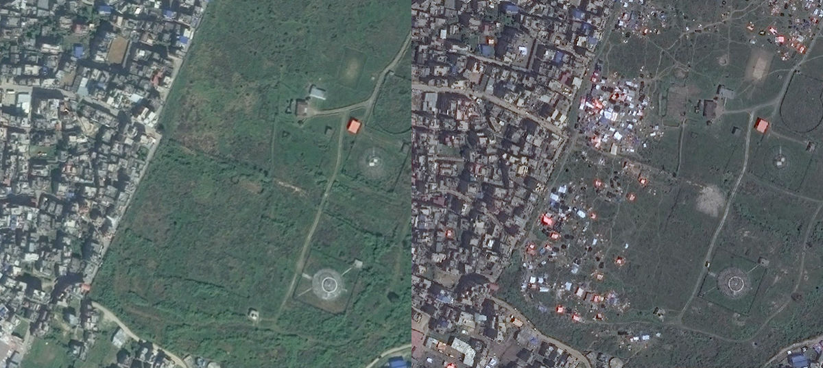
Below is a satellite image of two photos before 2013 (left) before the disaster and after the quake (right). Before the earthquake, you can see that a lot of people gathered after the disaster, where it was like a grassy place.
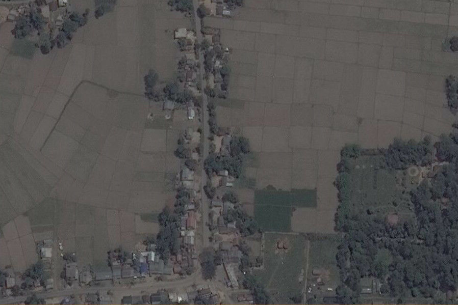
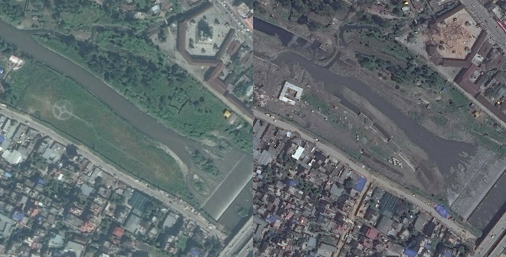
Comparing another satellite image, you can see that the pentagon facility in the upper right is collapsed and you can see that the facility is built in a place like the bank of the river on the left side.
Also, Tomnod's site is looking for volunteers to tag the damage situation based on satellite photographs. With the map displayed, clicking "Damaged Building" or "Damaged Road" on the left side of the screen and then clicking on the corresponding point on the map tagged it was possible to make the damage status data It was.

Related Posts:

in Web Service, Posted by darkhorse_log