How to make the activity base of 'Islamic country (ISIS)' all-around with Google Earth
To unravel the world unilaterally declare the establishment of an independent Islamic state by controlling Syria in a civil war situation "Muslim country (ISIS)Attempts to make "naked" by analyzing the activity status of the activity using the information published on the Internet is being done.
Bellingcat - Gun Safety, Self Defense, and Road Marches - Finding an ISIS Training Camp
https://bellingcat.com/resources/case-studies/2014/08/22/gun-safety-self-defense-and-road-marches-finding-an-isis-training-camp/
Anti-US / anti-Israel terrorist organizationAl QaedaArmed organization derived from "Islamic State in Iraq and al-Sham (ISIS)Suddenly declared the establishment of an "Islamic country" in the region spanning Syria and northern Iraq on June 29, 2014, and is currently underway for Iraq's capital city Baghdad.
ISIS expanding its influence against the background of abundant funds and military force, on August 24, 2014, on August 24, 2014, the date of public dissemination of images of public execution to disconnect James Forree of American journalist to the whole world The momentum is increasing on the day. This public execution is regarded as a retaliation against the US bombing that involves the Syrian civil war, but the situation has become a muddy situation, such as the decision to continue air strikes in the United States.
In order to clean up its Islamic fundamentalist organization ISIS,Google EarthThe method of locating the activity base by utilizing the data of the Internet and the information scattered on the Internet has been clarified.
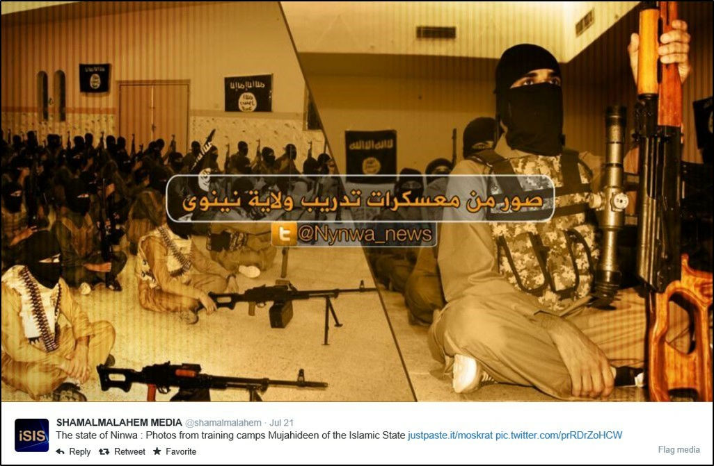
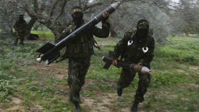
this is,ISIS official TwitterPosted the state of ISIS activities. A picture of a group of black masks with a gun is posted. Since ISIS publishes information on activities through various media such as the Internet and TV, it is this "method" to search the ISIS base by analyzing these published pictures.
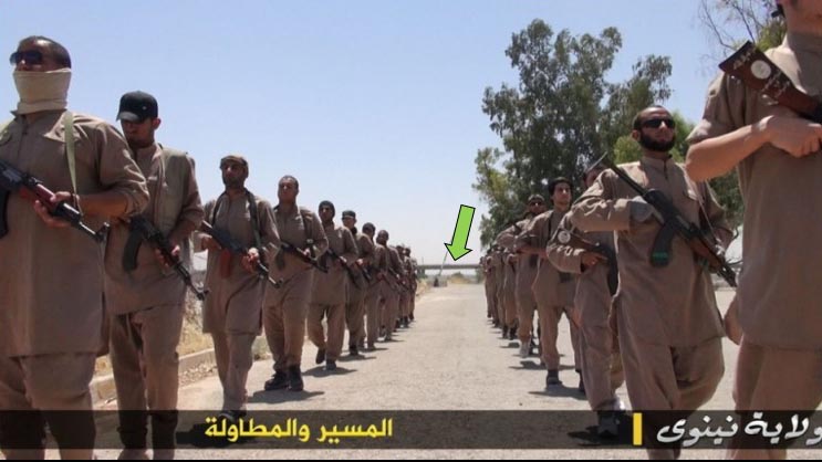
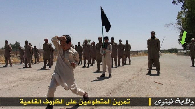
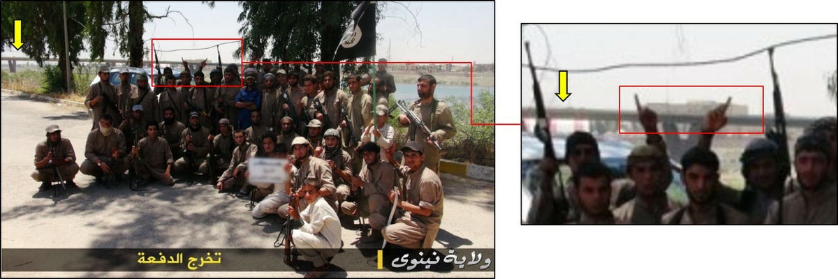
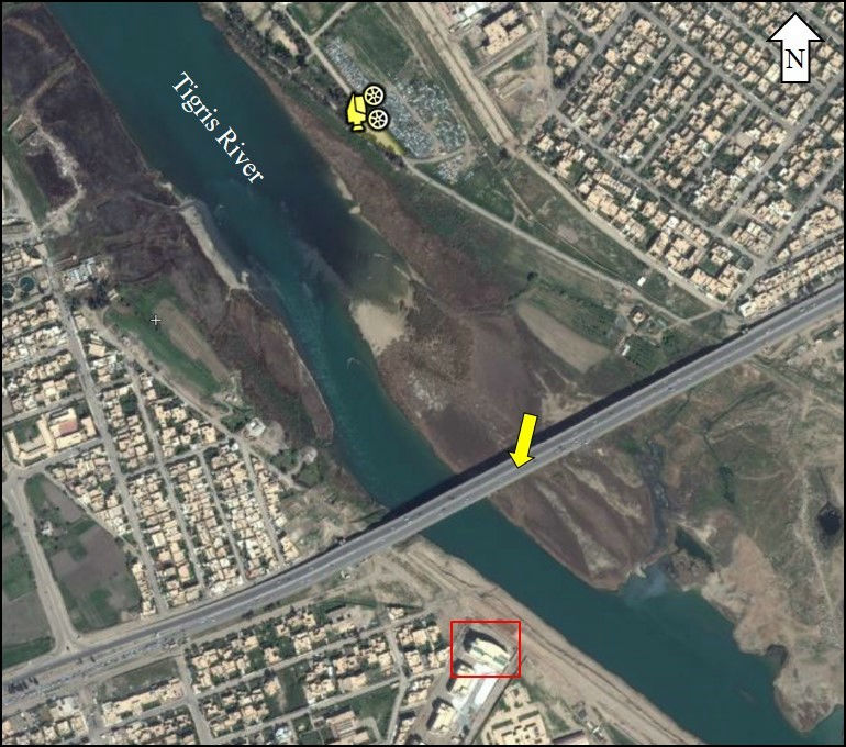
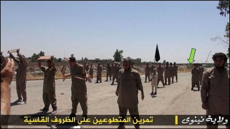
This is a picture of a fighting training drilled in July 2014. You can see the bridge appears in the red arrow.
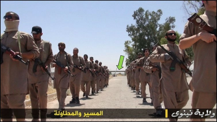
You can see a bridge over this big river also in this picture.
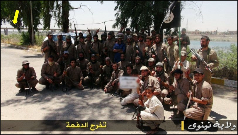
Also a bridge in this picture.
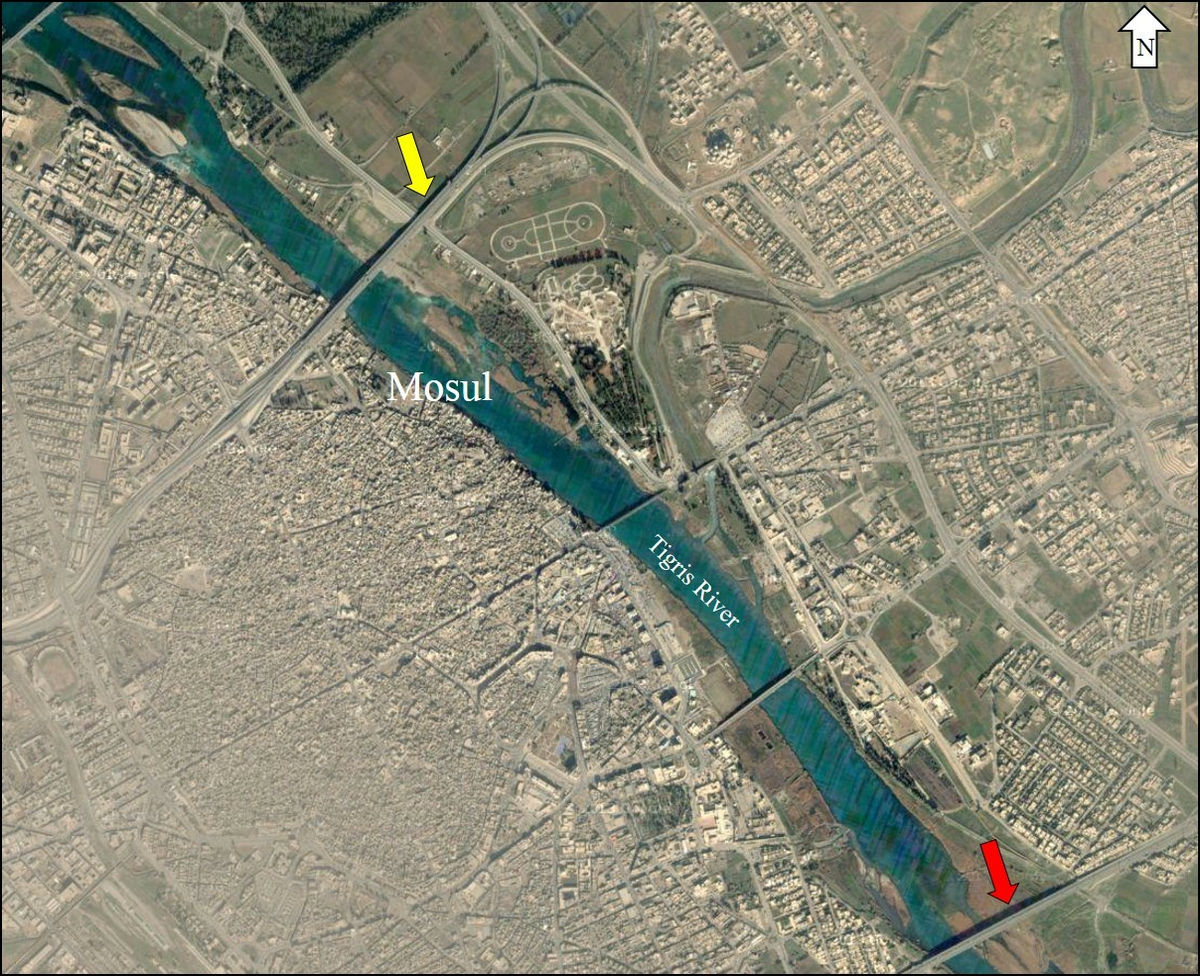
Mating the bridge in these pictures with the data analyzed by Google Earth turned out to be a bridge over the Tigris river in Iraq / Mosul.
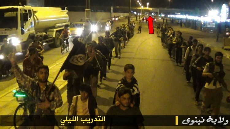
This is a picture of the graduation ceremony of armed training (left). A large building is reflected in the upper left of the photo beyond the bridge.
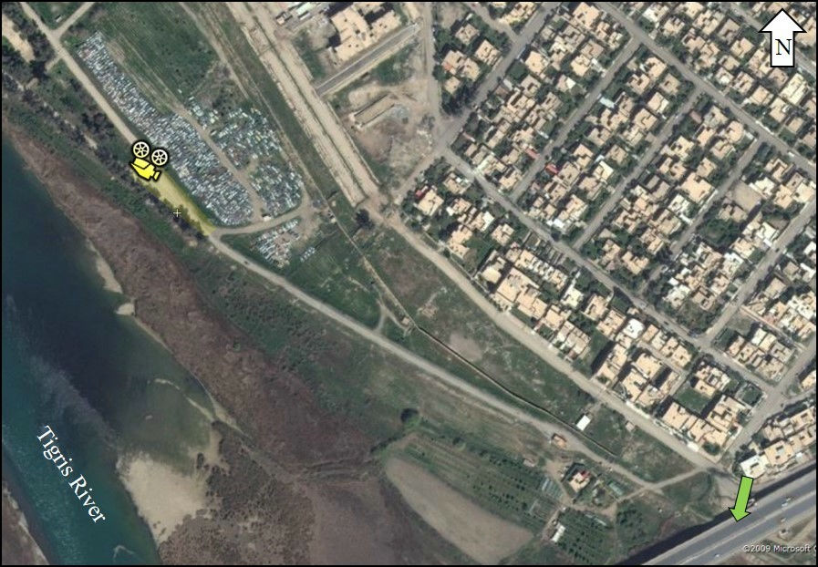
This building (red frame) was also found. In this satellite photograph, camera shooting location is specified by the camera mark. ,
In this training photograph there is a bridge on the road and a tree on the right.
I can guess that another photo is the same place.
Shown by yellow green arrow is the bridging of the road as earlier, and it is specified that a large space on the upper left corner of the satellite photo is taken place.
Next, Google's photo sharing servicePanoramioI will try to utilize. The picture on the left is published by ISIS and the picture on the right is posted to Panoramio. You can see that the characteristic objects indicated by the red frame and the yellow frame are in agreement.
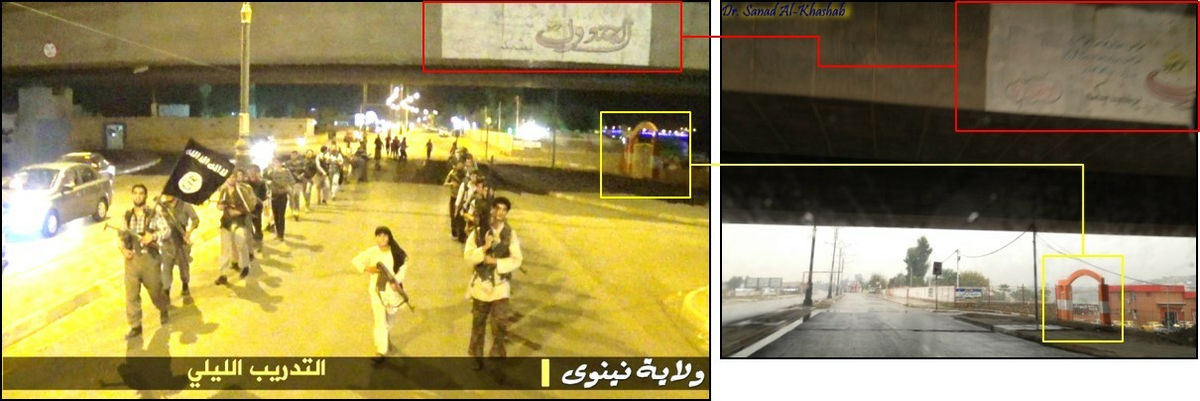
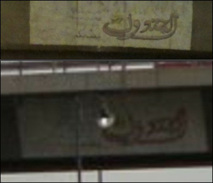
The letters written on the side of the bridge are exact matches.
I found the same street as another photo of Panoramio.
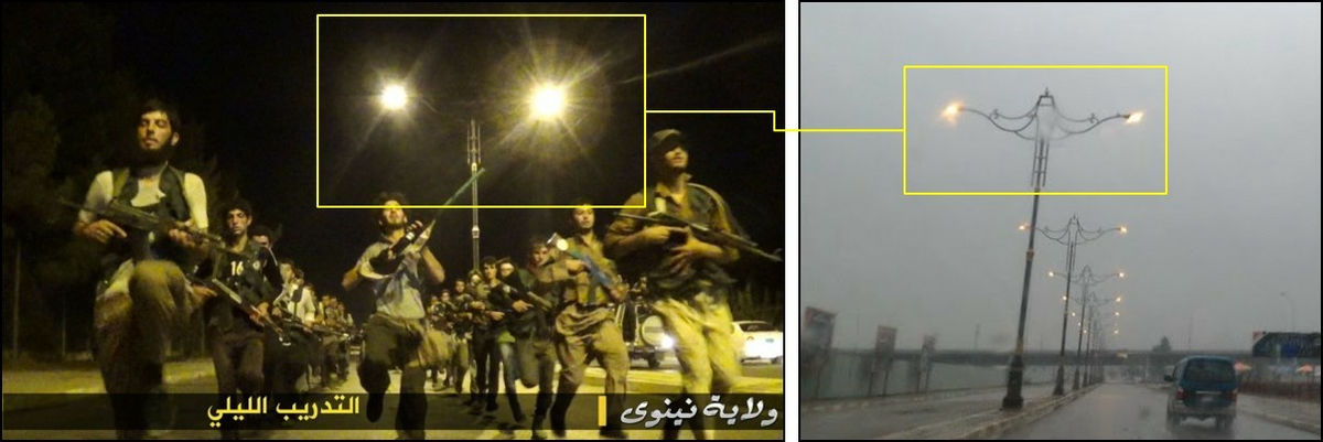
Signs are also the same.
This is the same steel tower.
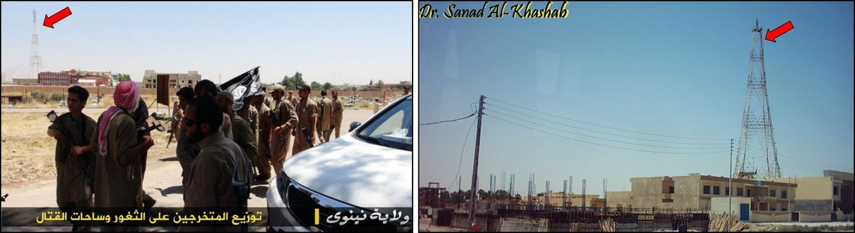
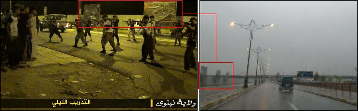
The red arrows of this satellite picture show the shadow of a big steel tower. It is understood that these new shadows make it possible that new buildings are made.
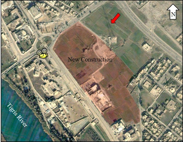
Satellite photograph seems to be a patchy picture of buildings being constructed.
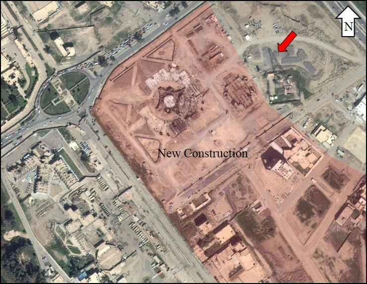
By analyzing the satellite photograph, it is also understood that I moved about 3 kilometers by training.

New commercial satellite "WorldView-3Google launched satellite pictures furtherIncrease resolutionAs it is certain that ISIS 's behavior will be analyzed in more detail if anyone wants to do it via the net.
Related Posts:

in Note, Web Service, Posted by darkhorse_log