Murder scene spotted on Google Maps

By
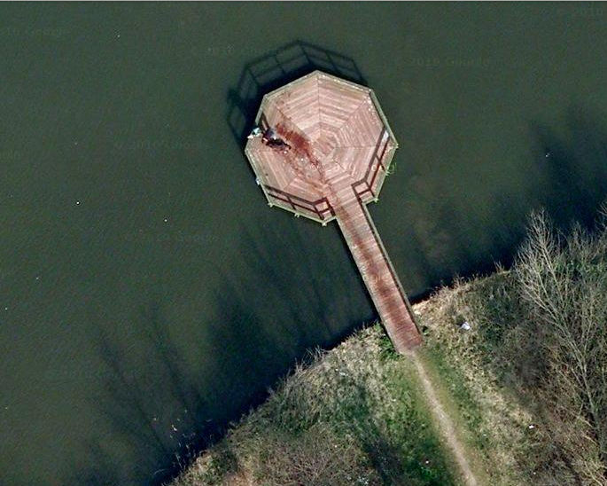
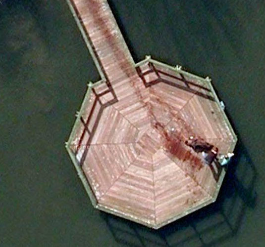
Google Street View has occasionally captured horrifying moments, like a tiger stalking a parking lot or a shadowy transaction , but now aerial photos from Google Maps have been spotted capturing a murder scene, sparking controversy.
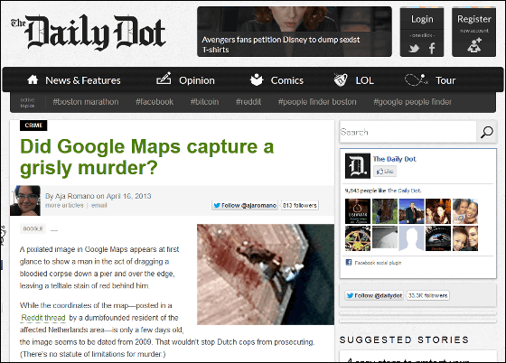
Daily Dot | Did Google Maps capture a grisly murder?
http://www.dailydot.com/crime/google-maps-view-murder/
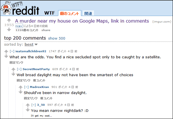
This was revealed in a
A murder near my house on Google Maps, link in comments : WTF
http://www.reddit.com/r/WTF/comments/1c7y2y/a_murder_near_my_house_on_google_maps_link_in/
When
However, if
In addition, there are the following examples of murder cases where Google Earth and other tools were the key to solving the crime.
◆01: The murder of Mr. and Mrs. Koura

In the 2010 murder of the Koulas, Eric, the son who first discovered the bodies, was charged and found guilty of murder. However, the method of murder of the couple was apparently professional, and it is possible that Eric was not the one who killed them. There is also a theory that the perpetrator hired a hitman, but when giving the hitman the address of the target, he mistakenly specified the Koulas' house on Google Earth, which led to the couple's death, as the bank employee who had received the threatening letter lived nearby. Support groups are rushing to find out the truth.
◆02:
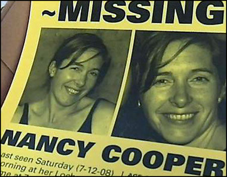
Nancy Cooper's husband, Brad Cooper, not only left traces of his wife's email monitoring, but also used Google Earth to map the distance to the place where he would dump the body after the murder. Cooper was sentenced to life in prison in 2011, but appealed the sentence in 2012.
◆03:
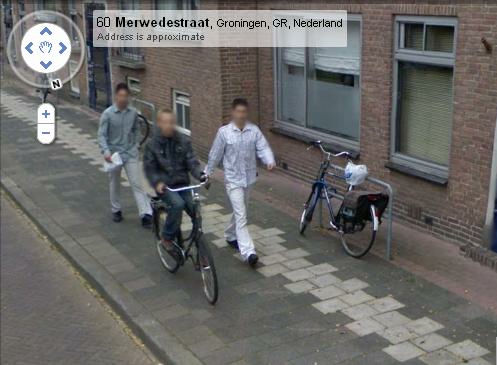
In 2008, a 14-year-old boy in the Netherlands had his bicycle stolen by force. The bicycle was never returned, but six months later, while browsing Google Street View, the boy discovered a photo of himself riding his bicycle. The photo was taken just before the theft, and two bike thieves were seen behind him. With the help of Google, the police were able to take action again, and the twins responsible were arrested.
◆04:
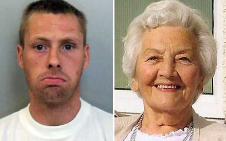
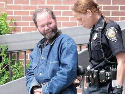
85-year-old Patricia Thompson was the victim of a robbery that was committed using Google Earth. In 2010, British authorities used Google Earth satellite images and other evidence to arrest suspect Stephen Hodgson for her murder. Hodgson was sentenced to life in prison.
◆05:

By ZORIN DENU
Santoshi Kumari, a military engineer in the Punjab region of India, was partying on a rooftop during the Karva Chauth festival when a stray bullet hit her in the head. Authorities used Google Maps to track the bullet's trajectory and pinpointed the man's house. The man confessed that he was testing the gun he had just bought on the night of the festival to see if it worked, and was charged with negligence and manslaughter.
Related Posts:


in Free Member, Note, Posted by darkhorse_log