I tried using the "Live ship map" where you can see the position of the ship going around the world from SDF destroyers to tankers to passenger ships
The web service which can be seen by displaying the location information and destinations etc. of countless boats sailing offshore on the map is "Live ship map"is. This service is obliged to be installed on vessels that make international voyages of 300 tons or moreAISIt displays information on ship name and position, course and course sent from (Automatic Identification System) on Google Maps, so you can see what kind of ship is traveling everywhere in the world It is possible.
Live ship map - AIS - ship movement and ship position
http://www.marinetraffic.com/ais/jp/
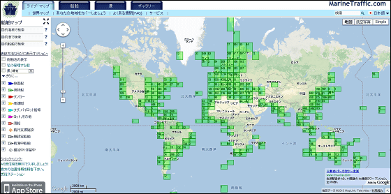
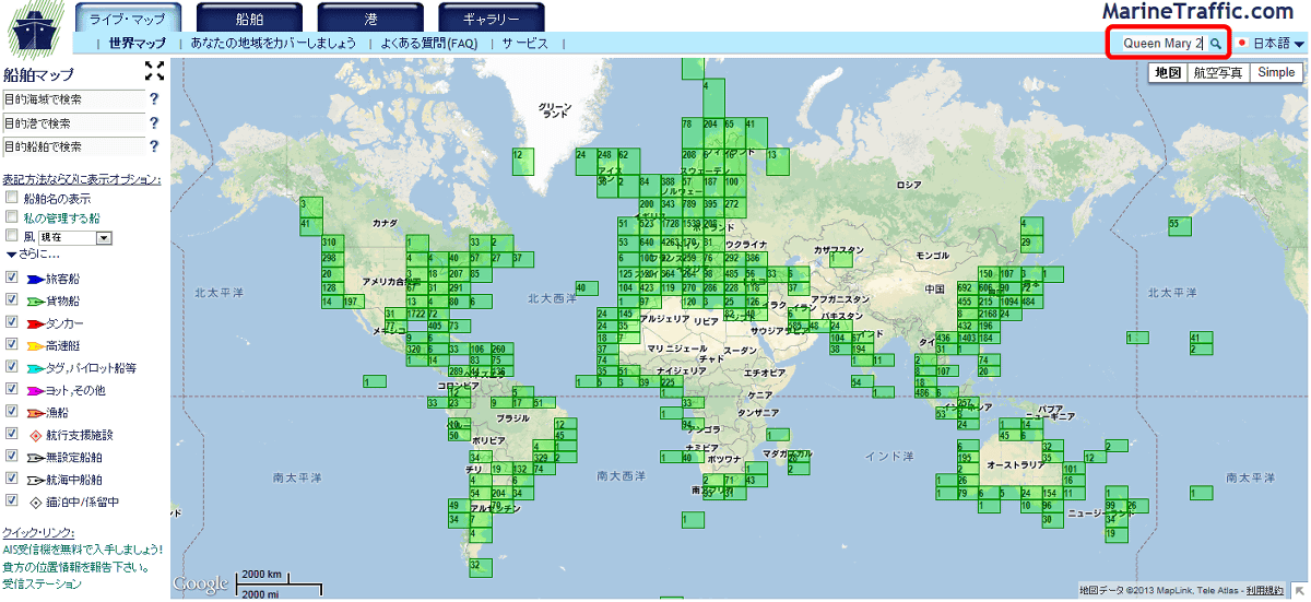
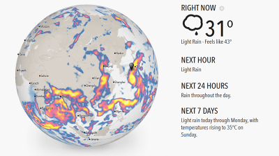
"Live ship map"When I try to access it, it looks like this.
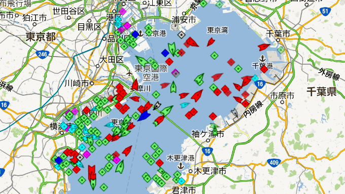
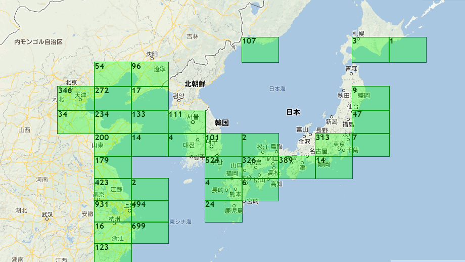
If you expand the area you want to see, you can see the number of vessels sending information from AIS sailing in that area.
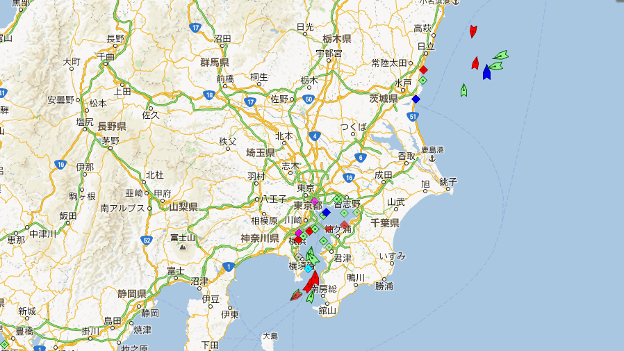
Further enlarging the map allows checking the course and position of the ship.
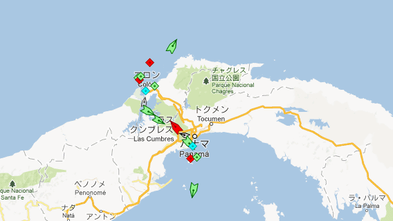
Key points connecting the Pacific and the Atlantic between the AmericasPanama CanalIt looks like ships are gathering.
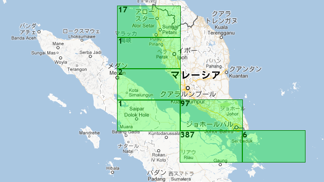
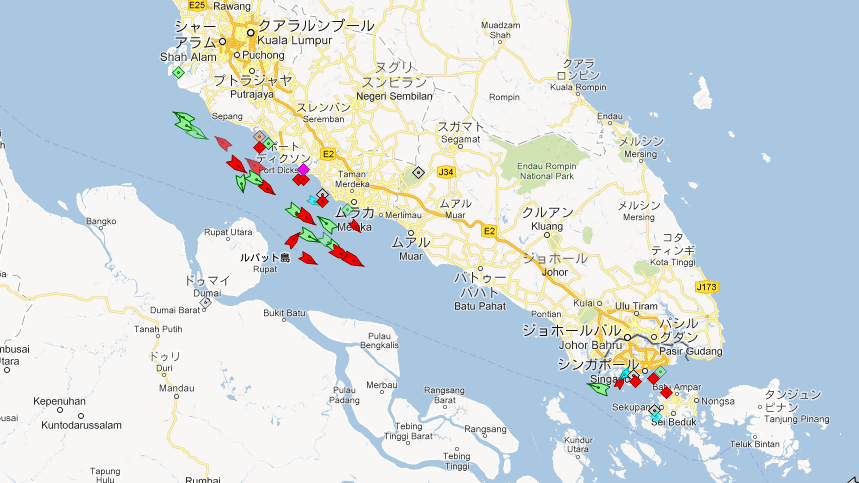
A key point on maritime traffic linking the Pacific Ocean and the Indian OceanStrait of MalaccaIt is like this.
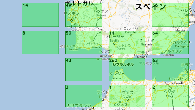
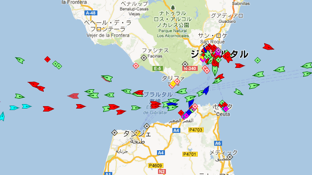
Between Spain and AfricaStrait of GibraltarIt seems to be considerably crowded.
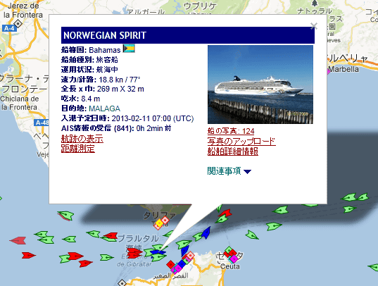
By clicking on the mark of the ship displayed, it is possible to view detailed information.
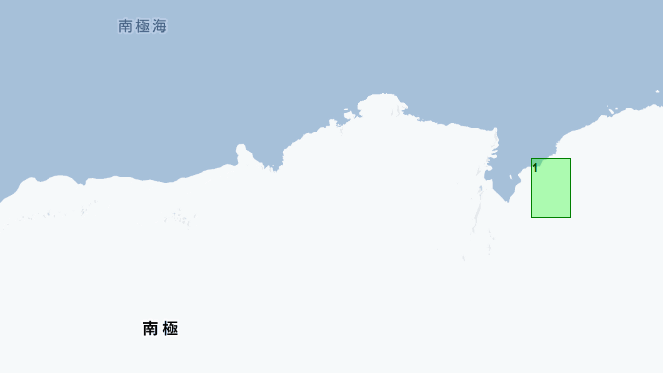
There is also a ship in Antarctica.
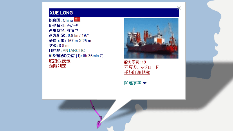
When I clicked on it, it was a ship called "XUE LONG".
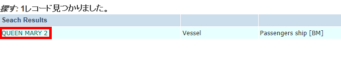
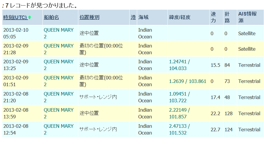
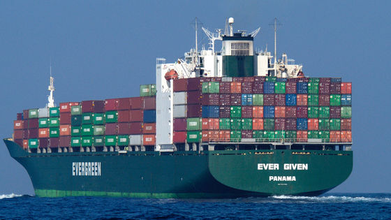
If you enter the vessel name in the search window on the upper right and press the enter key you can also see the detailed information of the ship and where you are navigating. This time a luxury liner "Queen Mary 2"I tried searching.
Since the corresponding search results are displayed, click "QUEEN MARY 2".
You can see ship information with photos.

In addition to the size and ship registration, the position that was sailing the nearest is also displayed.
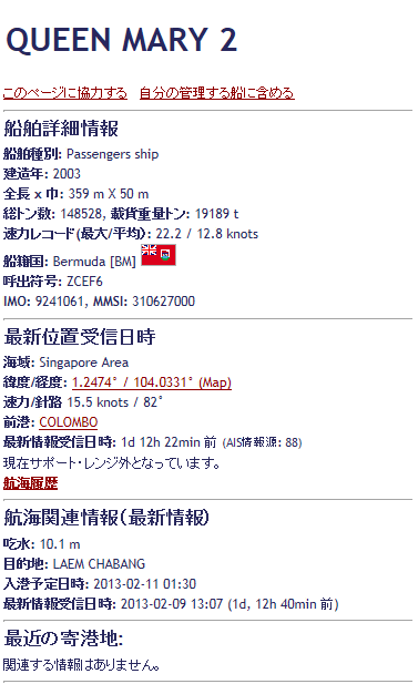
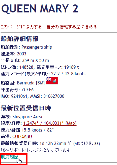
In addition, you can see more detailed navigation situation by clicking the navigation history.
It is located at latitude 1.2639 and longitude 103.861 on February 9, 01:51 on February 9, 2013, which is two days before the article creation date. After about 12 hours, it moves to latitude 1.2474139, longitude 104.033, and on the early morning of the next day 10 You can see that it was sailing somewhere in the ocean.
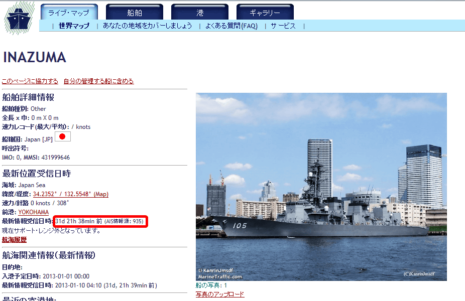
By previous interviewGot aboardThe results of searching by the Maritime Self Defense Force's "escort ship ina" are as follows. As expected, because it is not easy to find the location immediately before, the location information is displayed for more than one month ago.
I will try navigation history.
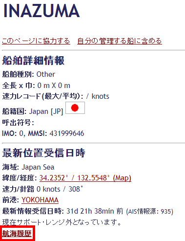
"There is no related information" has been displayed.

That's why it's a system that allows you to watch the world that you do not usually see much about the ship's navigation situation around the world, so if you want to shoot a ship or something, you often hear about "Holmes It may be interesting to see how the maritime traffic in areas such as the Straits, the Malacca Strait and the Suez Canal are going.
Related Posts:

in Web Service, Posted by darkhorse_log