How AI can be used to rediscover forgotten and abandoned oil and gas wells

If oil and gas wells dug to extract oil and natural gas are left abandoned after drilling is completed, they release greenhouse gases and harmful substances into the nearby ground and water. A research team from the Lawrence Berkeley National Laboratory in the United States has reported on an attempt to use AI to discover abandoned oil and gas wells that have been forgotten and left undocumented.
A Deep Learning Based Framework to Identify Undocumented Orphaned Oil and Gas Wells from Historical Maps: A Case Study for California and Oklahoma | Environmental Science & Technology
https://pubs.acs.org/doi/10.1021/acs.est.4c04413
AI Helps Researchers Dig Through Old Maps to Find Lost Oil and Gas Wells – Berkeley Lab News Center
https://newscenter.lbl.gov/2024/12/04/ai-helps-researchers-dig-through-old-maps-to-find-lost-oil-and-gas-wells/
In the United States, where oil and natural gas has been extracted for about 170 years, it is estimated that there are between 310,000 and 800,000 'undocumented orphaned wells (UOWs)'. These are not registered in official records, so their locations are unknown, and there are no operators or owners who are financially solvent.
If these wells are not properly plugged, they can leak oil and chemicals into nearby water sources, release harmful substances such as benzene and hydrogen sulfide into the air, and emit methane , which is 28 times more potent than carbon dioxide and contributes to climate change.
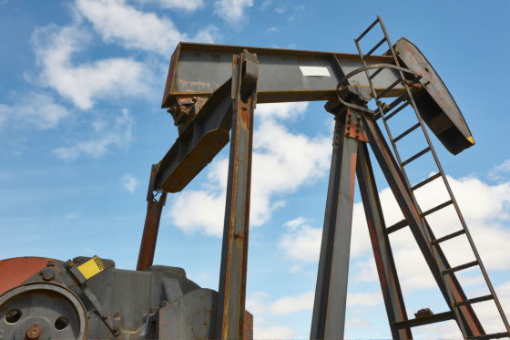
To find UOWs, researchers use tools such as drones, laser imaging and sensors, but it is difficult to thoroughly search the entire U.S. So the research team came up with a way to find UOWs by combining modern AI with old topographical maps.
'AI is a modern and rapidly evolving technology, but it shouldn't just be associated with modern data sources,' said Fabio Schura, a postdoctoral researcher and lead author of the paper published in the journal Environmental Science & Technology. 'AI can extract information from historical data and improve our understanding of the past on a scale that was not possible just a few years ago.'
Looking at the map below, you can see hollow circles in various places. These marks represent oil or gas wells, and it is possible that UOWs, which are not recorded in the documentary records, can be found on these old maps.
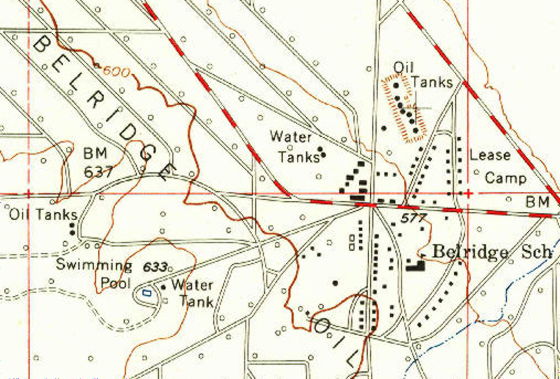
by Historical Topographic Map Collection/USGS
To use AI to find oil and gas wells on old maps, the research team trained the AI to identify the correct symbols from a variety of visual cues. Because the old maps were digitally scanned from the real thing, they may be dirty or faded, and may contain symbols that are easily confused with oil and gas well symbols, such as the number '9' and the letter 'O.' The AI was trained to ignore similar marks without being fooled by dirt and other factors.
Because the old maps were geotagged, the AI could obtain the coordinates of oil and gas wells marked on the maps and compare them to the documented coordinates of oil and gas wells. The team also built a system to detect potential errors in the coordinates and a tool for humans to check whether the AI was interpreting the map symbols correctly.
Using the AI they trained, the team surveyed Los Angeles and Kern counties in California, and Osage and Oklahoma counties in Oklahoma, and found 1,301 potential UOW sites.
So far, 29 UOWs have been identified using satellite images, and 15 UOWs have been found during field surveys. The UOWs identified by the research team are within an average range of 10 meters from the location predicted by the AI, and it is believed that AI can be a large-scale approach to identifying the location of UOWs. In addition, since this research minimized the risk of mistakenly identifying existing oil and gas fields as UOWs, it is highly likely that there are more UOWs than those found this time.
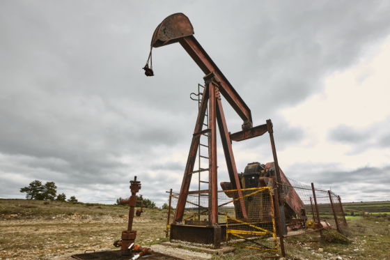
The AI-based mapping of UOWs is part of the Consortium Advancing Technology for Assessment of Lost Oil & Gas Wells (CATALOG) , a large-scale project led by Los Alamos National Laboratory . CATALOG is working to develop ways to rapidly measure methane leaks from UOWs, as well as ways to scale up detection and confirmation of UOWs using drones equipped with a variety of sensors.
'The right way to tackle this problem is a multi-layered approach,' said Shura, arguing that UOW's problems could be solved by combining multiple data sources, such as data detected by AI from old maps, estimates from past oil production, satellite images and sensor data.
Related Posts:
in Science, Posted by log1h_ik


