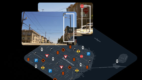
Google's 'Street View' undergoes its biggest update yet, with images to be added to about 80 countries, including new countries such as Namibia and Bosnia, as well as Japan
Google's Street View and Google Earth are set to get their biggest update ever, with new imagery for Bosnia-Herzegovina, Namibia, Liechtenstein and other countries, as well as new imagery for Japan, Serbia and Argentina.
3 imagery updates to Google Earth and Maps
Google is updating Street View images across dozens of countries - The Verge
https://www.theverge.com/2024/9/24/24252979/google-maps-updated-street-view-images
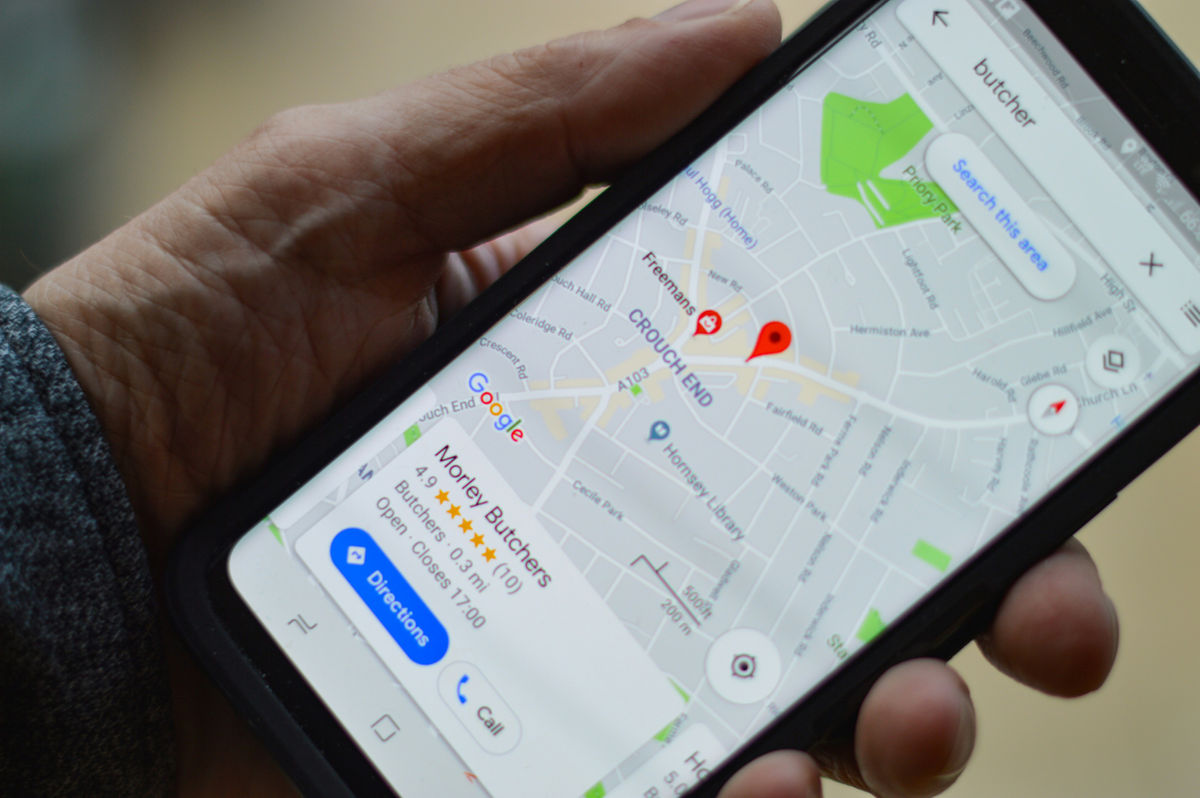
According to Google, Street View will be expanded to about 80 countries and imagery will be updated in several countries, including Bosnia-Herzegovina, Namibia, Liechtenstein, and Paraguay, which did not have Street View before.
'You'll be able to explore the picturesque countryside and medieval villages of Bosnia-Herzegovina, the sandy mountains surrounding Namibia's capital, the Alps and castles of Liechtenstein, and the beautiful rivers of Paraguay. You'll also be able to virtually wander the streets of foreign cities and see the shops and buildings up close,' Google said.
It was previously known that Street View vehicles would begin operating in Namibia in 2023.
LEFA secures Google contract to map Namibia
— The Brief (@TheBriefLive) September 18, 2023
Local startup LEFA has secured a contract with global tech giant Google to map the country.
The project, spanning 17,000 km, will provide an intimate digital perspective of Namibia's unique landscapes, towns, and cities, which will be… pic.twitter.com/SSeCLDN4cq
In addition, imagery will be added to Street View from countries around the world, including Australia, Argentina, Brazil, Costa Rica, Denmark, France, Iceland, Japan, Mexico, New Zealand, Philippines, Rwanda, Serbia, Spain, South Africa, Switzerland and Uruguay.
In the community of 'GeoGuessr,' a game in which players guess locations based on Street View images, there were welcoming voices such as 'Serbia will definitely be interesting,' and 'I'm really happy about Namibia. It's one of the most beautiful countries in the world. It should be a great location.' GeoGuessr has tricky strategies such as guessing a country based on the shape of utility poles and the dirtiness of the camera, but the addition of images may lead to new strategies.
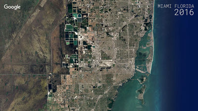
In addition to expanding Street View's coverage to more countries, Google Earth and Google Maps will also be updated to provide clearer satellite imagery. Google's 'cloud removal technology,' which uses 'Cloud Score+ AI' trained on millions of images, will recognize and remove clouds, cloud shadows, haze, and fog, and will continue to display real-world weather patterns such as ice, snow, and mountain shadows on the map, allowing you to see 'a clearer and more accurate view of the Earth.'
It will also allow users to view historical imagery on the Google Earth web and mobile apps, a feature that was previously only available on the desktop app, Google Earth Pro .
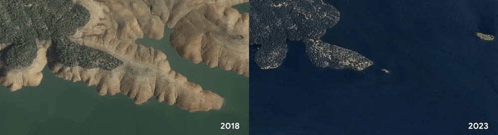
Google introduced the app as a 'brilliant visualization of how the Earth changes over time,' with users able to see time-lapse footage of London and Berlin in the 1930s, as well as Lake Oroville in the U.S. filling up with rainwater after years of drought that had significantly reduced its water storage.
In addition to the above, Google is also working to make it easier for researchers and organizations to use Google Earth for projects such as creating custom maps. Projects will soon be viewable from a new Google Earth home screen design, and the associated updates are detailed in a Developer Blog post .
Related Posts:


in Web Service, Posted by log1p_kr