Detailed drawing of submarine cable tightly around the world
On January 30 the Internet connection of coastal countries of Egypt, India and Persian Gulf was disconnected due to submarine cable breakage,70% of the Egyptian net is down, and in India the band is 50% to 60%That's right, at the moment this is not a terrorism to block network communications,Causes caused by the scrap of the discarded cable damaged the cableIt seems to be.
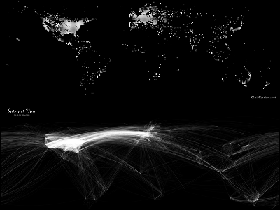
Actually, the Internet is supported by the submarine cable that is stretched around the world like this, but there was a submarine cable map explaining how it actually is.
In addition, the wallpaper of "submarine cable map" supporting the Internet of the whole world.
Details are as below.
Even so, submarine cables are really stretched around the world.
SeaCableHi.jpg (JPEG image, 1703 x 1037 px)
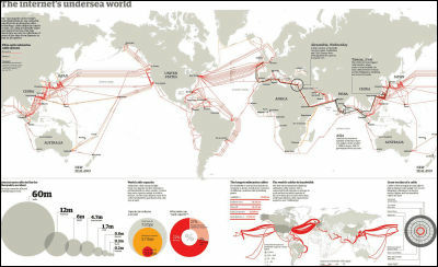
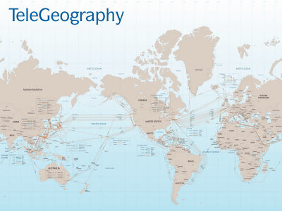
The red line of the world map is the size of the band. America and Europe are bright red. The communication speed of cable connecting North America and Europe in 1958 was 640,000 bps, but now it seems that it is over 7 trillion (7,000,000,000,000,000,000,000 bps).
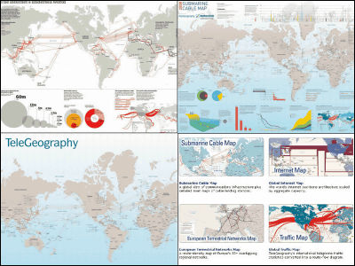
"Submarine Cable Map 2008" which became the basis of this map can be seen from the TeleGeography Research site, and it is written in various ways in detail.
Submarine Cable Map 2008: Maps: TeleGeography Research
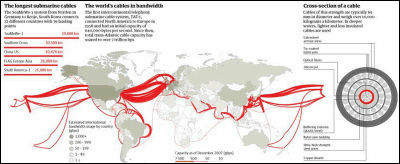
An enlarged view of over 120 submarine cable maps worldwide is as follows.
Cable_Map_big.gif (GIF image, 1067 x 768 px)
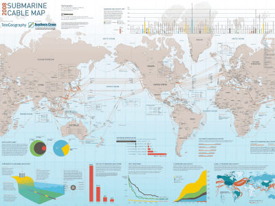
A wallpaper version is also distributed, so that you can read it a bit better.
Image of 1024 x 1280 pixels
TG_CableMap_ 1024 x 1280.jpg (JPEG image, 1280 x 1024 px)
Image of 1200 x 1600 pixels
TG_CableMap_ 1200 x 1600.jpg (JPEG image, 1600 x 1200 px)
The real map is 0.9 meters by 1.2 meters and it seems to be sold for 250 dollars (about 26,000 yen). It is possible to purchase from online via credit card, it will be shipped within 3 days by air mail, so it seems you can buy it even from Japan. You can purchase from the following.
Purchase: TeleGeography Research
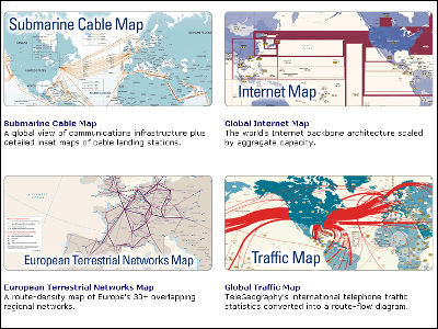
There are other maps of the band of the backbone, map of the transfer amount of the whole Internet, and so on. None of this is quite interesting.
Wall Maps: TeleGeography Research
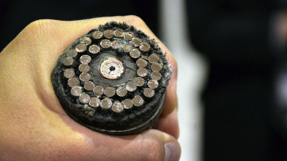
In addition, this site explains in detail the submarine optical fiber cable laying ship.
NTT WORLD ENGINEERING MARINE CO., LTD │ submarine line blunt knowledge │ cable laying ship
List of ship actually active in active service
Cableships 1
Related Posts:


in Note, Posted by darkhorse_log