The El Niño phenomenon is continuing to develop and is predicted to reach historical strength in the second half of 2026.
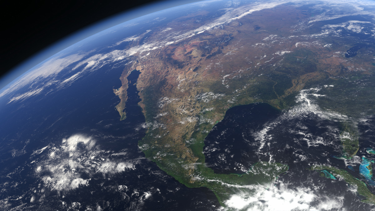
Super El Niño Keeps Growing as New Forecasts Reach Record Territory Ahead of Winter » Severe Weather Europe
https://www.severe-weather.eu/long-range-2/super-el-nino-growth-accelerating-to-record-strength-fall-winter-2026-2027-forecast-impact-united-states-canada-europe-fa/
US forecaster says more than 90% risk of a very strong El Nino | Reuters
https://www.reuters.com/business/environment/us-forecaster-says-more-than-90-risk-very-strong-el-nino-2026-08-13/
El Niño is a phenomenon in which the trade winds that blow from east to west in tropical regions weaken, causing sea surface temperatures in the central and eastern Pacific Ocean near the equator to be 0.5°C or more higher than average. Generally, when El Niño occurs, global temperatures rise, and the risk of extreme weather events such as droughts and heavy rains increases.
The El Niño phenomenon is already occurring in 2026, and meteorological agencies around the world are closely monitoring the situation. It is known that the El Niño phenomenon will intensify further in the summer of 2026, and there is a high possibility that it will develop into a 'Super El Niño' from autumn to winter of 2026.
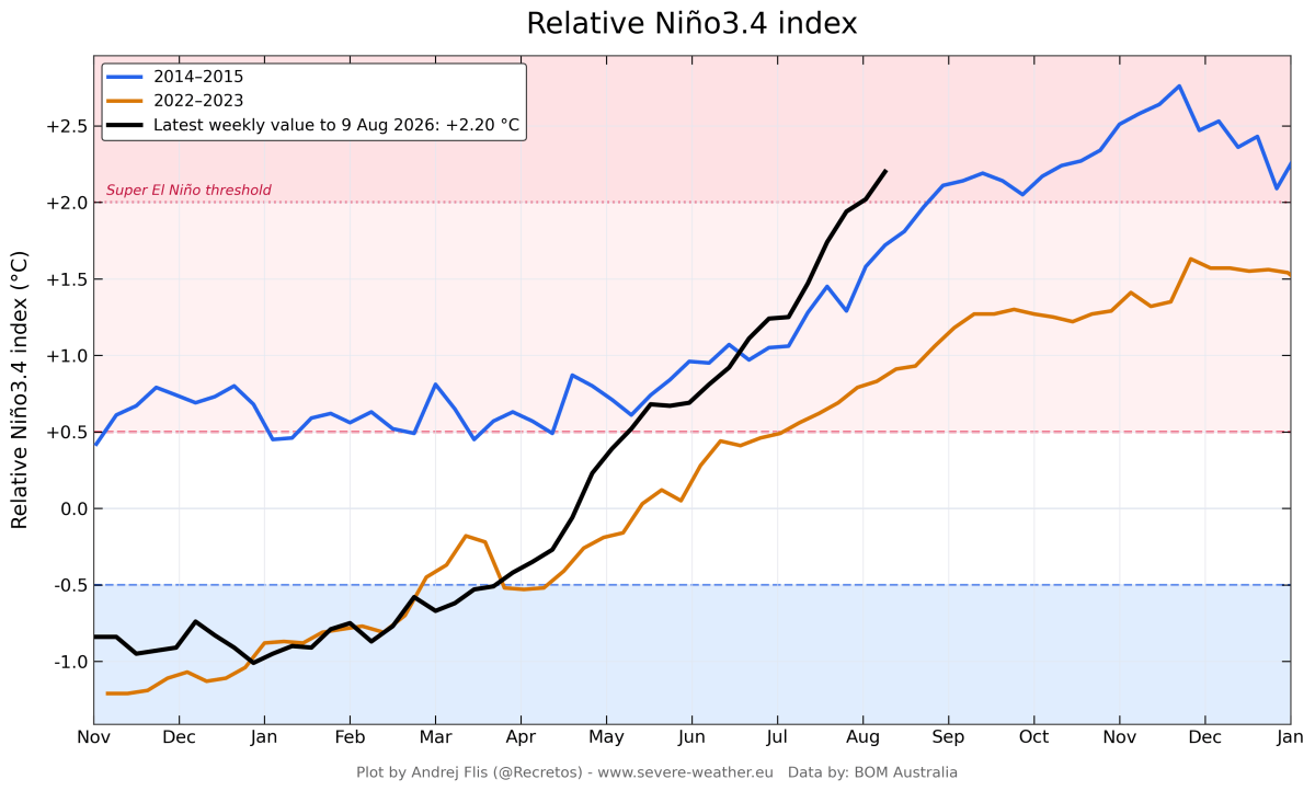
A Super El Niño is a term that refers to a condition where sea surface temperatures are 2°C or more higher than average, and the weather website Severe Weather Europe has already pointed out that a Super El Niño is developing.
The following diagram, created by the European Space Agency (ESA), shows typical atmospheric circulation in the tropical Pacific region. Normally, an updraft occurs off the western coast of the tropical Pacific near Indonesia, which is then carried by trade winds to the waters off Peru where it descends, forming an atmospheric circulation known as the ' Walker circulation .' Additionally, ocean currents flowing from east to west create a tropical warm water pool in the western Pacific, while cold deep water is carried to the surface in the western Pacific.
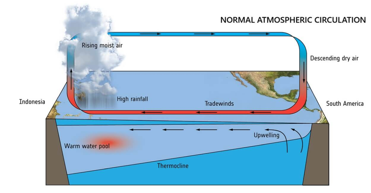
by ESA
However, when atmospheric pressure drops in the central and eastern Pacific, a high-pressure zone forms in the western Pacific, disrupting the Walker Circulation. Severe Weather Europe explains that this causes the tropical warm water pool that was in the western Pacific to spread eastward, leading to a rise in sea surface temperature.
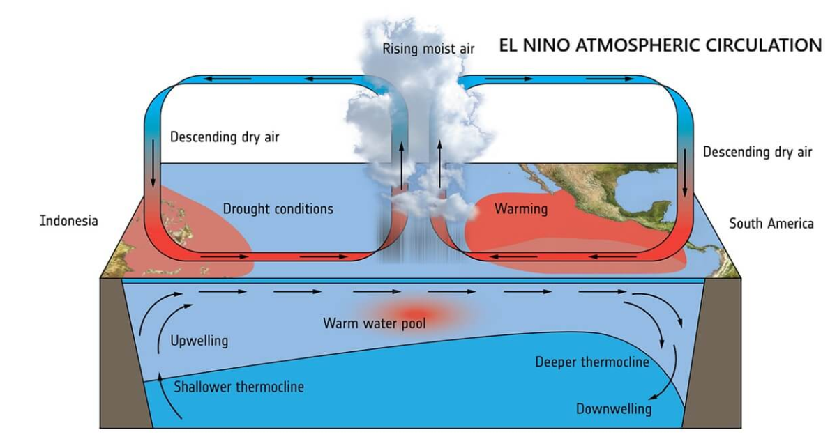
by ESA
Super El Niño is a rare phenomenon that occurs less than once every 10 years, but Severe Weather Europe, based on its latest analysis data, points out that the 2026 event will follow the exact same process as past super El Niños.
The image below shows the results of an ocean analysis released by the National Oceanic and Atmospheric Administration (NOAA) on August 9, 2026. The colors, from orange to red, black to gray to pink, indicate that sea surface temperatures are higher than average. The gray area on the right represents the Americas. It can be seen that a wide area in the eastern Pacific is colored pink, indicating that sea surface temperatures are more than 5°C higher than average.
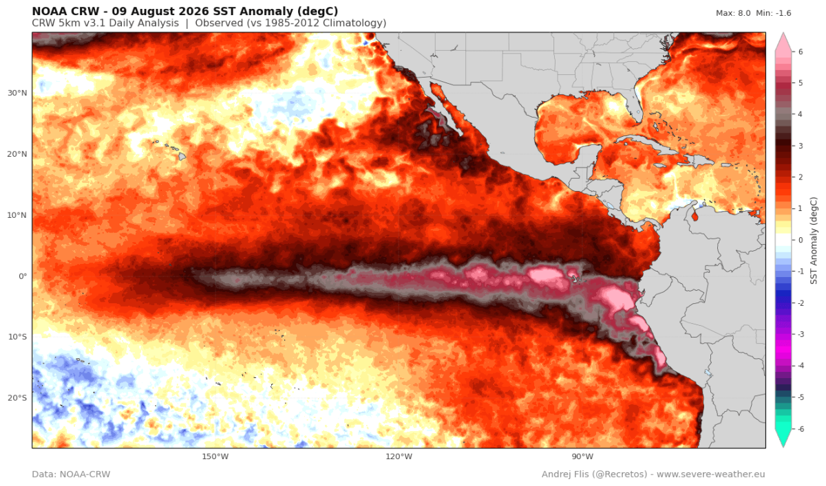
by NOAA
The graph below shows the relative
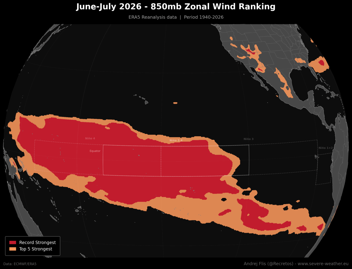
The following diagram shows how strong the westerly wind anomalies in the tropical Pacific region were in June-July 2026 compared to the past 86 years. A wide area from the eastern to the western tropical Pacific recorded westerly wind anomalies that were among the top 5 (orange) or the strongest on record (red), indicating a breakdown of the trade winds that normally blow from east to west.
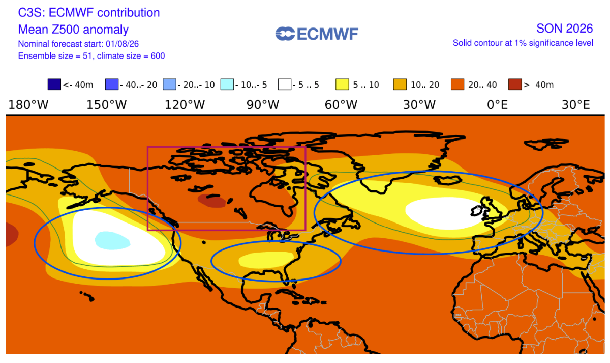
Severe Weather Europe predicts that a pressure pattern typically seen during 'El Niño winters' will occur in the fall of 2026. This pattern is characterized by an unusually high pressure system over Canada, low pressure systems extending from the Pacific Ocean to the southern United States, and over the North Atlantic Ocean, as follows:
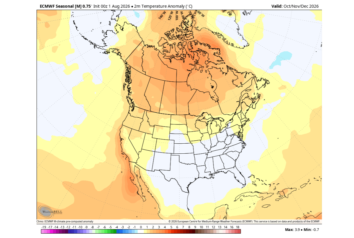
The following diagram shows how temperatures in the United States and Canada from October to December 2026 are expected to differ from average. Temperatures are projected to be significantly higher than average in the northern United States and Canada, while temperatures are expected to be roughly average in the south-central and southern United States.
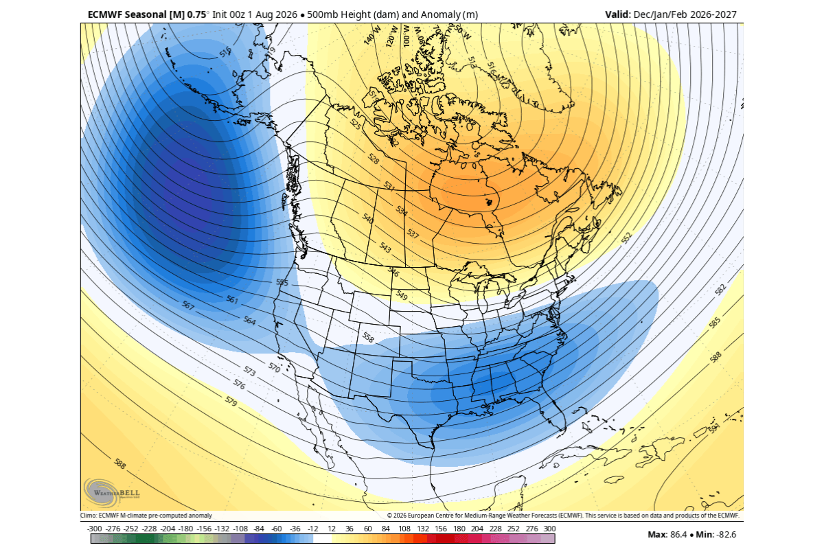
This pattern is expected to intensify further during the winter of 2026-2027, with strong low-pressure zones lingering over the North Pacific and southern United States, and strong high-pressure zones over Canada. This pressure pattern is likely to cause unusually cold temperatures in much of the United States and southwestern Canada in February 2027, and heavy snowfall is highly probable in the central, eastern, and northeastern United States.
Related Posts:




in Science, Posted by log1h_ik