How drones are becoming indispensable in the construction industry?
Easy to fly everyone, and also has a high stability multi-copter, commonly known as "Drone"Has expanded its place of activity to the field of industry beyond hobby use. The current state of drone spreading widely in fields such as surveying, building and infrastructure improvement is the media in the field of engineeringENGINEERING.comIt is summarized.
Are Drones Becoming Essential to Construction?> ENGINEERING.com
https://www.engineering.com/BIM/ArticleID/16686/Are-Drones-Becoming-Essential-to-Construction.aspx
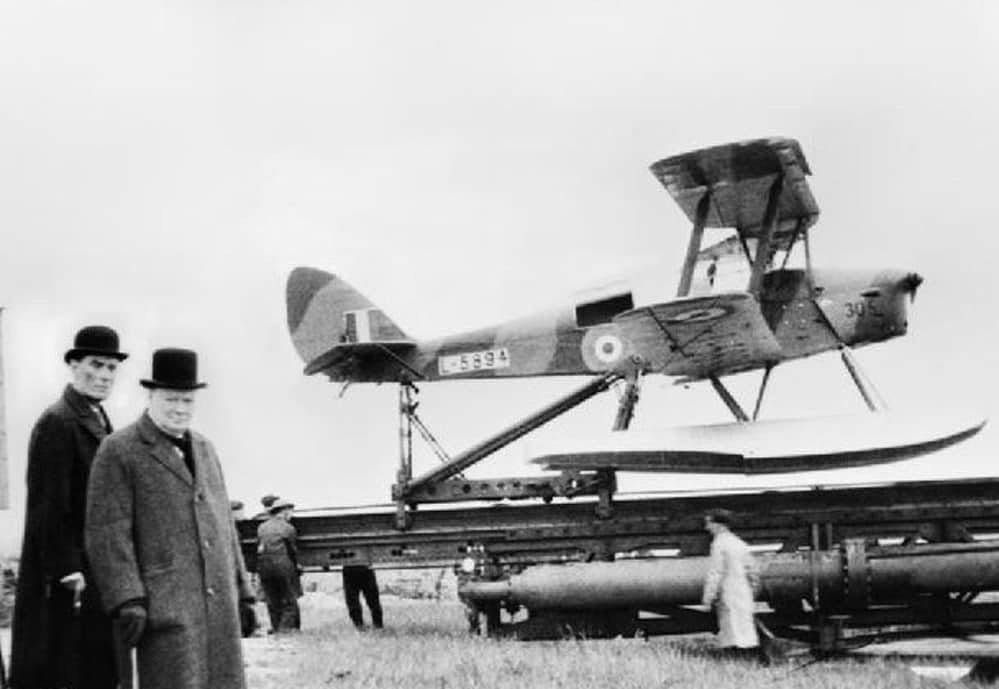
The name "drone" is originally a term that refers to "unmanned aerial vehicles", and its origin originates from unmanned aircraft developed around 1940. Initially it was promoted as an unmanned aerial vehicle that was unmanned and attacked enemy areas, and it was said that it was used as a shooter for attack training next. "De Havilland Queen Bee" built in 1935 is an aircraft that can be controlled by radio, meaning "a bee without having a needle in the butt and collecting pollen" means "Drone (male bee) The name was given.
But now drone is not just used for military purposes. Research firm Gartner predicts personal drones to reach 4.6 million units by 2020, while Goldman Sachs predicts that the market size of military aircraft and civilian aircraft drone will be $ 100 billion a year (about 11 trillion dollars We expect to grow into yen).
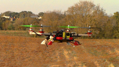
Quad Cotter 's "Drones" whose name recognition has been rapidly rising since around 2010, but the first commercial item appeared in 1989. It was KEYENCE (KEYENCE), a Japanese sensor manufacturer, that made "GyroscopeIt was released under the name of.
KEYENCE Gyrosaucer TVCM 1991 - YouTube
After that, a year of about 20 years passed until the world big break in 2010, but Parrot's "AR.Drone" made that chance. After that, as the DJI's "Phantom" series appeared, the drone industry became booming, and the world of aerial photography using on-board cameras expanded greatly. In addition, it was around this time that "3D Robotics" (3DR), which puts its name in the industrial drone, started.
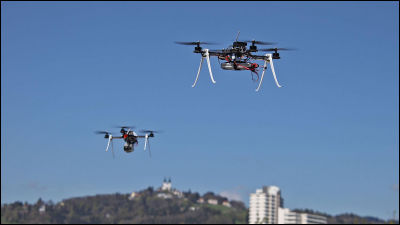
The drone which can carry out various vehicles unmanned and can also hover is a construction field such as surveying which grasps the entire site from the sky, grasp of seed spraying, growing situation, We are promoting the utilization in various industrial fields in the field of agriculture · livestock such as grasping. Provide drone based surveying and resource survey servicesDroneDeployCEO of Mr. Mike Win said about the industrial application of Drone, "By using two possible applications, photos and maps obtained from drone, 3D models, what is happening on the construction site Understand accurate grasp of progress and grasp the terrain before constructionBIMIt is planning by modeling the construction site by processing with software. "
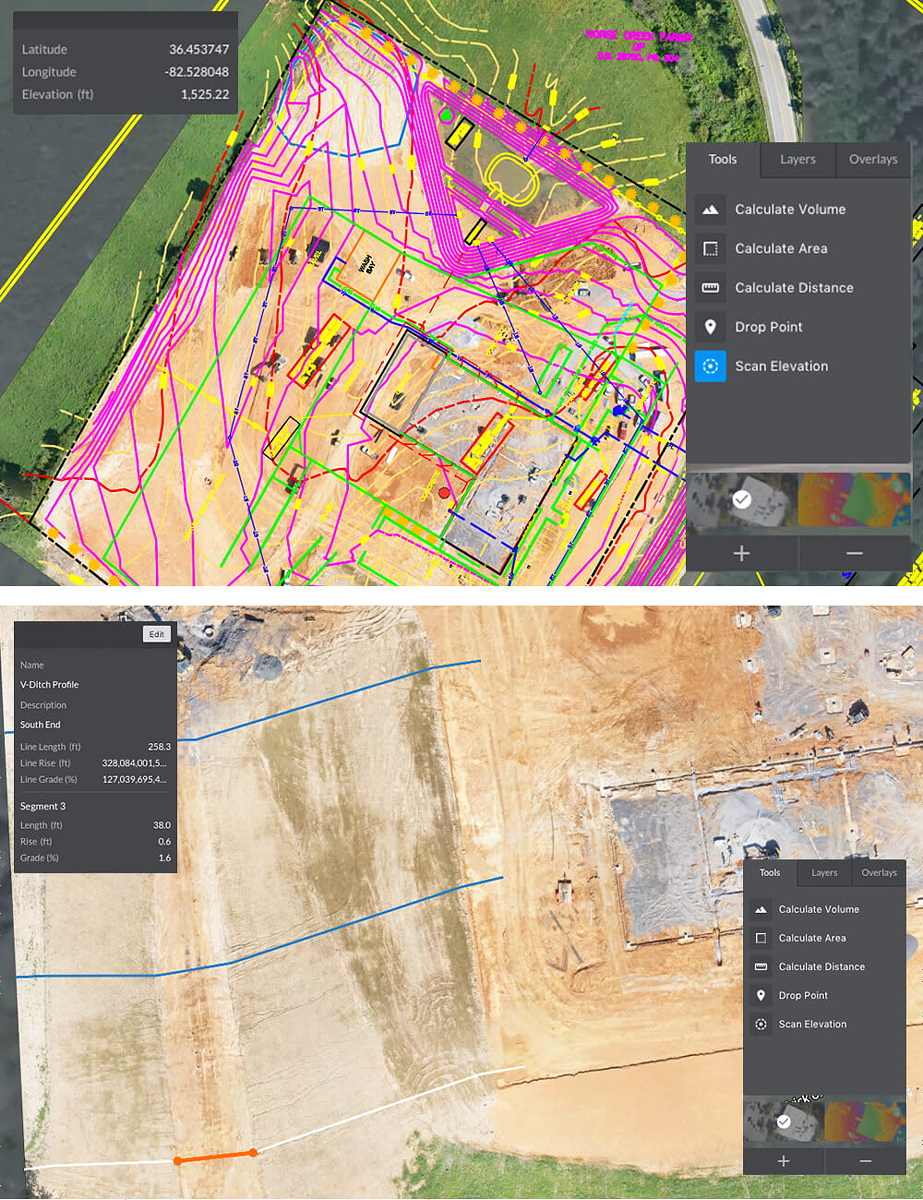
Conventionally, surveying has been carried out using a mobile surveying unit that uses a device "LiDAR" that accurately measures using a laser such as Timber or Leica companies, but with the advent of drone, the same work It is now possible to do it in a much more cost-effective way. Data such as high definition images and images taken by Drone flying over the surveyed area, topographic information and other data are converted from 3D models and 2D maps using software provided by many software providers such as 3DR, DroneDeploy, Autodesk It is summarized in.
Moreover, by recording the whole and the construction of construction using a drone, it becomes possible to three-dimensionally grasp the change every certain period. Provide 3D CAD and engineering solutions using itAutodeskTristan Randall, CEO says, "There are various use cases, such as examining wind turbines using images and videos with or without 3D modeling, mapping a huge mine as a whole," said Tristan Randall.
The following movie is an example of 3D data created by scanning the outdoor theater "Red Rock Outdoor Theater" using the natural rocky mountain in Colorado, USA in a drone.
3DR and Autodesk scan the Red Rocks Amphitheater - YouTube
Provide a drone surveying serviceKespryMr. Jason Nicholas, product marketing manager, talks about the benefits of using drone from the pre-construction stage. A construction contractor uses a drone to investigate the height of the ground of the entire construction site beforehand and uses it to compare it with the terrain changed by construction, so that it helps grasp the progress of the civil engineering work. Moreover, it seems that it became possible to map the area that took several hours to measure in a few minutes while keeping the safety of the site by using the drone, at the same time. By acquiring such data, it becomes possible to grasp the volume of earth and sand carried out or carried in by civil engineering works.
In this way, by conducting surveying using a drone, it will be possible to carry out the survey at least six times more costly than before. By skipping unattended drone and regularly collecting data, construction companies will be able to carry out ongoing quality assurance and quality control that was impossible in the past.
You can check the content of the solution that Kespry's integrated drone and software is integrated in the following movie. It is said that it enables on-site surveying with resolution of 2 cm at maximum by highly accurate measurement by GPS (GNSS) and data processing after measurement.
Kespry - The Complete Aerial Intelligence Platform for Industry - YouTube
Also, it can be said that technological innovation in recent years enables advanced operations and settings to be performed only with smartphones and tablets. The tool "Live Map" released by DroneDeploy can determine the route the drones will fly on the screen of the tablet and can perform the survey. In the following movie, you can actually see how the photographs of the ground surface sent from the drone are placed on the map, skipping the drones by manipulating the screen of the tablet.
Introducing Live Map - YouTube
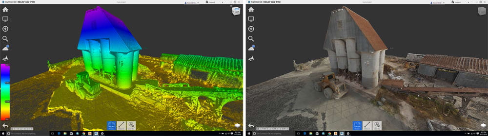
It can be said that Autodesk is a pioneer in 3D mapping using drone. In the following movie, you can see how to shoot hundreds of buildings three-dimensionally using drone and replace them with 3D data.
Autodesk ReCap 360 Workflows - Working with 2D and 3D reality data from Aerial Images - YouTube
In this way, although it is a drone use at the construction site that can be expected to be effectively effective, there are still elements that are still obstacles at present. In the past it was said that there was a time when "accuracy" of the obtained data became a problem, but it is said that the problem has already been cleared in general. Rather, it is said that the problem which can be said to be the largest is "People's hesitation (hesitation)".
Also, it is the introduction of regulation by the Federal Aviation Administration of the United States (FAA), which is the biggest barrier to drone utilization. According to Federal Airlines Regulation 107, since items such as unnecessary aircraft must be carried out under the supervision of a person who has been certified when flying an unmanned aerial vehicle, it is a limitation on the use of Ka wide field It is said that there is an aspect to be.
On the other hand, attempts are also being made to fly drone at airports that are far more restrictive than general land. In this project, 3DR and Atkins et al. Who prepared the airport facilities, air traffic control, drone made flight with the FAA after coordination.
The first commercial drone flight at a major US airport - YouTube
In this way, the movement to utilize drone at the site of construction is actively progressing in the world. There are also challenges to be cleared such as legal issues, but in recent years the spread of the drone, which is said to be the largest innovation, can fully expect innovation in various industrial fields.
Related Posts: