A situation where the fitness tracker application "Strava" highlights the location of a secret US military base
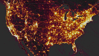
A new function "Heatmap" that appeared in the service "Strava" that can record and analyze activities such as jogging and cycling using GPS information such as smartphones, the existence of the US military secret base never absolutely revealed as normal There is a situation that highlights.
Fitness tracking app Strava gives away location of secret US army bases | Technology | The Guardian
https://www.theguardian.com/world/2018/jan/28/fitness-tracking-app-gives-away-location-of-secret-us-army-bases
Strava's fitness tracker heat map reveals the location of military bases - The Verge
https://www.theverge.com/2018/1/28/16942626/strava-fitness-tracker-heat-map-military-base-internet-of-things-geolocation
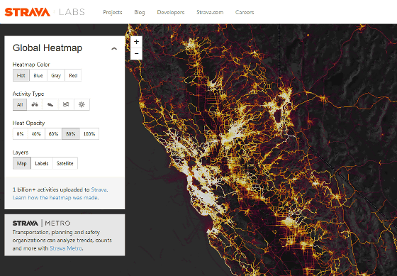
"Heatmap" that appeared in Strava is a function that shows activity in many places on the earth by coloring activity data of people who use the application. When you open the Heatmap page, you can see that innumerable lines are displayed above the topographical map around San Francisco, and the places where much activity is displayed are lighter in color.
Strava Global Heatmap
https://labs.strava.com/heatmap/
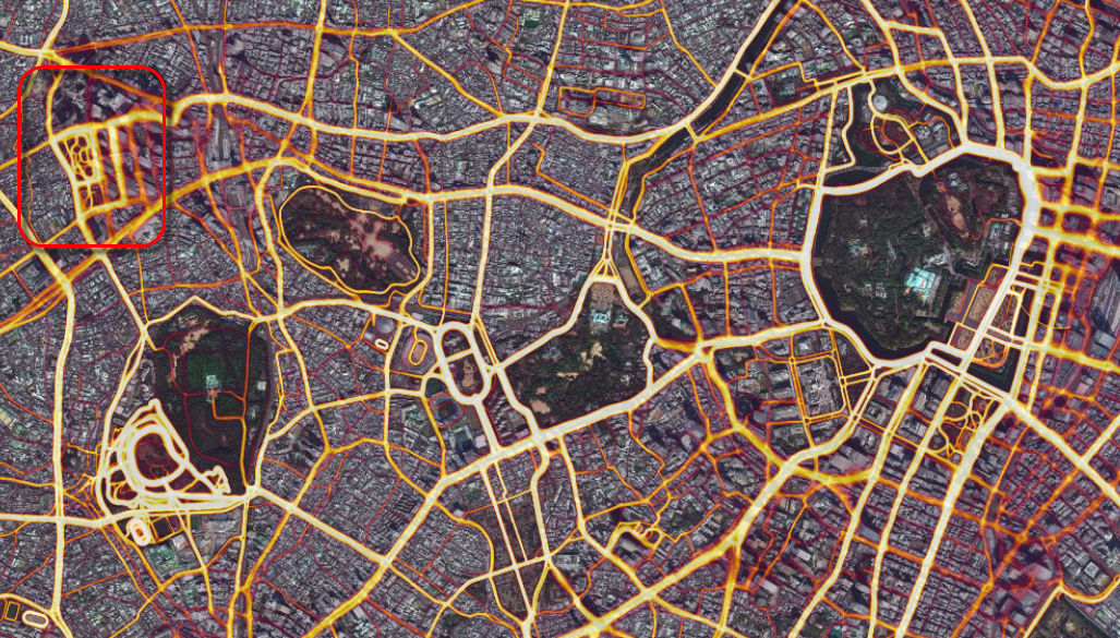
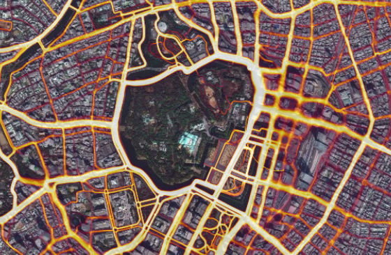
When you look up the city center of Tokyo, you can see that the area around the Imperial Palace where you see many runners is very bright. Also, you can see that there are many activities in the Meiji Jingu Gaien Garden and Yoyogi Park in the west direction from the Imperial Palace, and also around the Tokyo Metropolitan Government Office located in the upper left of the map.
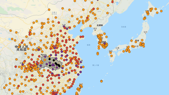
It is a Heatmap function that makes it clear at a glance what kind of place people are doing activities, but it seems to be a slight annoying situation for the US military. The tweet that Tobias Schneider murmured was the beginning when that was discovered. With the comment "Fitness & social media company Strava releases the activity heat map function, it is excellent for identifying the location of military bases", together with the comment that Syria's "Fumimeen Air Force Base" I am tweeting the map screen.
Fitness and social media company Strava releases activity heat map. Excellent for locating military bases (h / t to@ Nrg 8000).https://t.co/n5RWcI7BJFpic.twitter.com/7zzNcYV 42e
- Tobias Schneider (@ toobiaschneider)January 27, 2018
Apparently, soldiers and staff in charge at the base are using smartphones and active trackers "FitbitThe fact that all the activities were recorded by performing business and training while turning on the tracking function of the cause was caused. The following tweet map shows that the action pattern of military officials in the base which is probably somewhere in Syria appears to be clearly shown, and that the place considered as the main facility is bright and clear I understand.
Somebody forgot to turn off their Fitbit. Markers trace known military outposts, supply and patrol routes.pic.twitter.com/7YTzoqKgDl
- Tobias Schneider (@ toobiaschneider)January 27, 2018
This may be a big hurdle for the US military and others who perform a highly confidential mission and are making the existence of the base not known to the partner country. Analyzing conflicts around the world Nathan Ruser, an analyst at Institute for United Conflict Analysts, said to Twitter, "Strava's Heatmap is great, but it is not favorable for operation security (mission safety)" I post a tweet.
Strava released their global heatmap. 13 trillion GPS points from their users (turning off data sharing is an option).https://t.co/hA6jcxfBQI... It looks very pretty, but not amazing for Op-Sec. US Bases are clearly identifiable and mappablepic.twitter.com/rBgGnOzasq
- Nathan Ruser (@ Nrg 8000)January 27, 2018
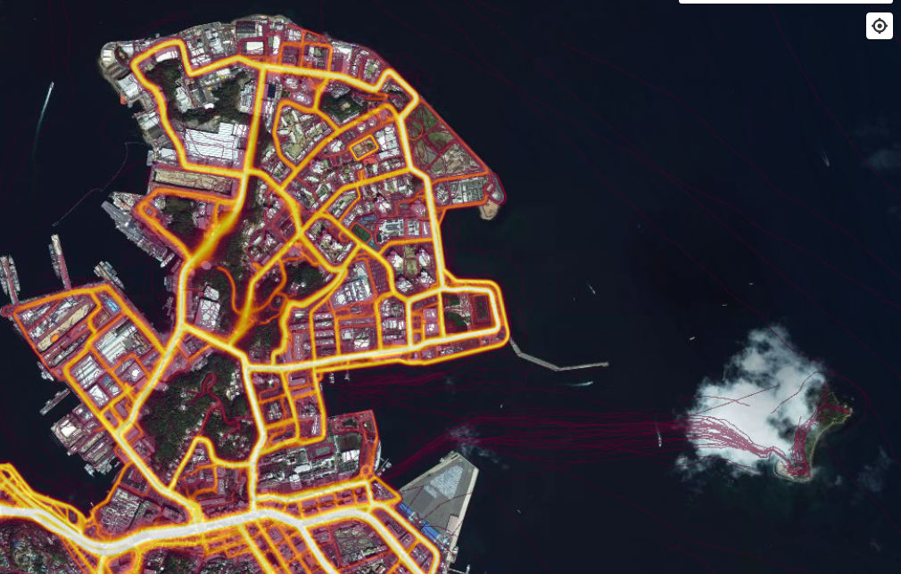
I checked what kind of situation the base in Japan is. Yokosuka base in Kanagawa prefecture is such a feeling, it is not a secret base, so especially novelty part seems to be. However, it is unknown whether it is a military official or an ordinary person, but you can see that there is a certain flow of people in 'Sarushima' in the offing.
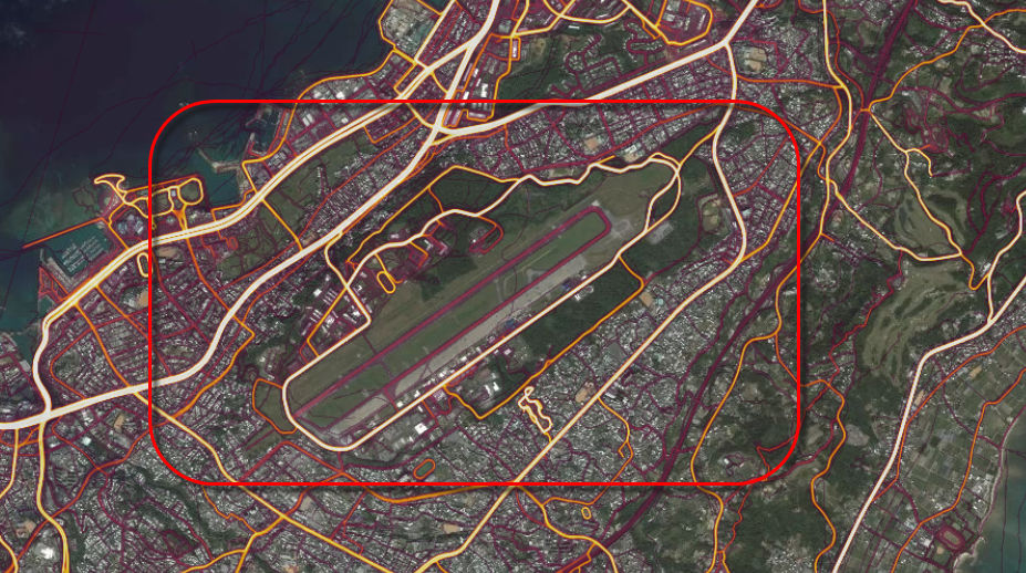
Futenma Air Station in Ginowan City, Okinawa Prefecture, is like this. It is impossible to distinguish whether there are too many surrounding traffic and concerned with the military or general Okinawa citizens' behavior. You can see that many people are visiting "Iko no citizen park" shaped like the alphabet "B" in the south of the runway.
Under such circumstances, it is unknown when Strava takes some action at the time of article creation. Ruser says, "It is very dangerous for soldiers to train with the tracking function on like ordinary citizens, which is a dangerous thing, which is a reflection of the usual training situation, You should not make the lights brighter "and the alarm bells are ringing with tweets.
If soldiers use the app like normal people do, by turning it on tracking when they go to do exercise, it could be especially dangerous. This particular track looks like it logs a regular jogging route. of life info from this far awaypic.twitter.com/Rf5mpAKme2
- Nathan Ruser (@ Nrg 8000)January 27, 2018
It is a Heatmap function that unexpected harm is revealed, but it can be said to be a very worthwhile function if it is the original usage. When I up the Imperial Palace, I found that many runners are doing jogging ......
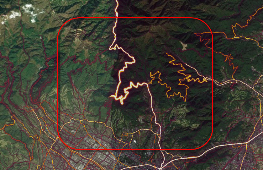
Kanagawa prefecture gathers a lot of bicyclistsYabitsu PassAlso, you can see that only that part is shown bright.
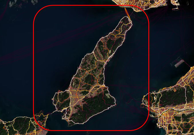
You can see that the route of "Awaichi" (Awaji Awajishima), a classic of the Kansai long ride course, also looks bright and clear.
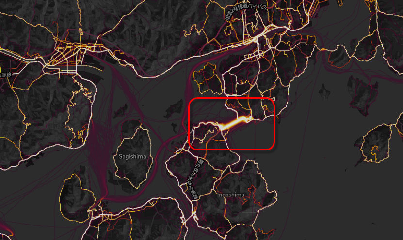
Looking at the popular "Shimanami Kaido" in recent years, it is clear that the brightest is the big bridge "Inojima Ohashi" which appears first when I cross over the island is the brightest, but beyond that It is interesting to see how people do not go so much to the route of.
Related Posts:


in Mobile, Software, Web Service, Posted by darkhorse_log