When a geographically loving human goes round the world, this map remains in hand at hand
I liked watching the map all the time. The tip of a winding road, the small island floating in the sea, the chest when it is imagined what kind of place it is high. I want to go on a trip.
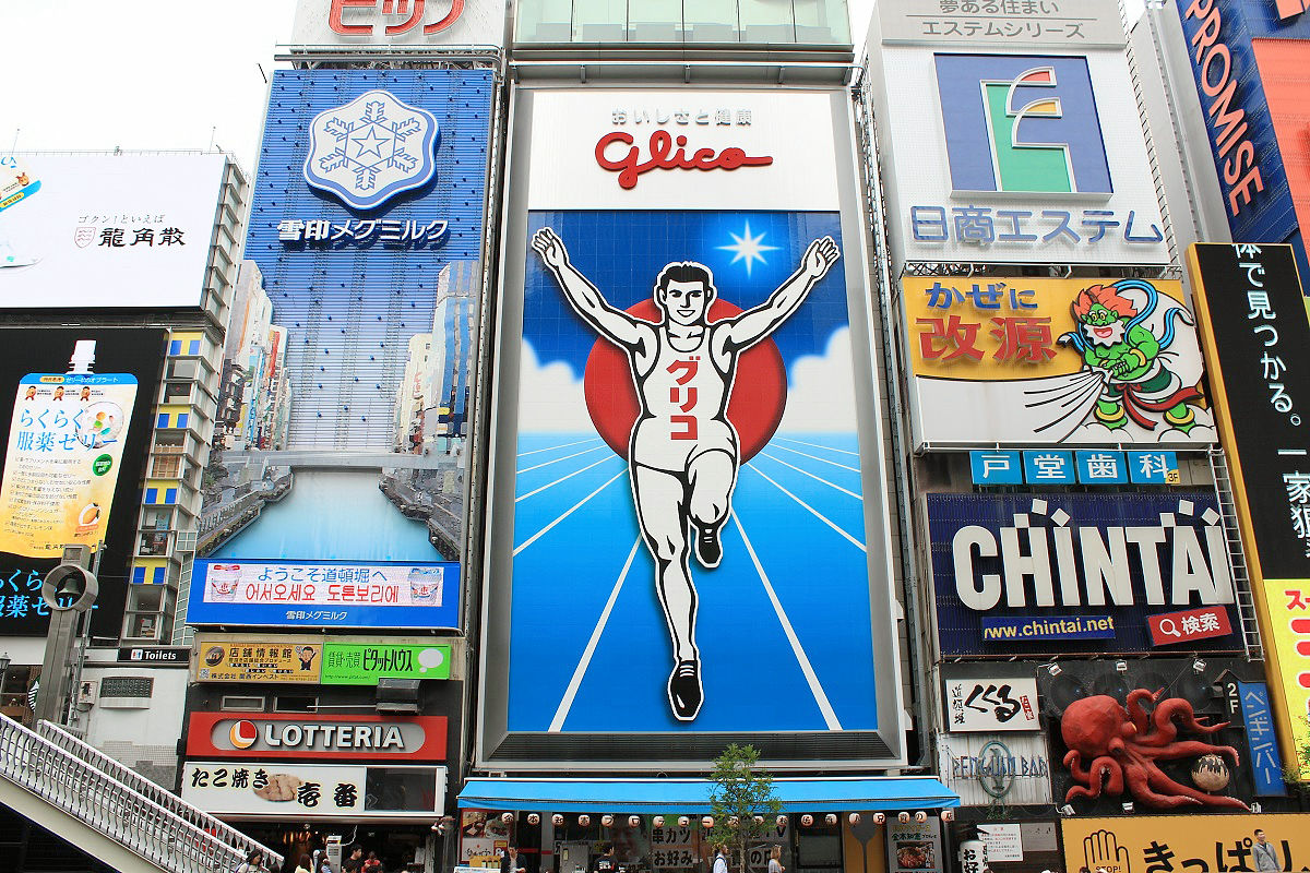
Hello,Takuya SAITO who did a round around the world by bicycle @ CharridermanI love geography and chile. The administrative division of slender Chile in the north and south is divided into states from the north in order. It looked like a Dharma-dropping fuselage. I can get excited just by that.
◆ I like geography
Tokyo and Osaka for Japan, Moscow and Peruberg for Russia, Mexico City and Guadalajara for Mexico, Athens and Thessaloniki for Greece, Accra and Kumasi for Ghana, and not only the first city, but also the second city.
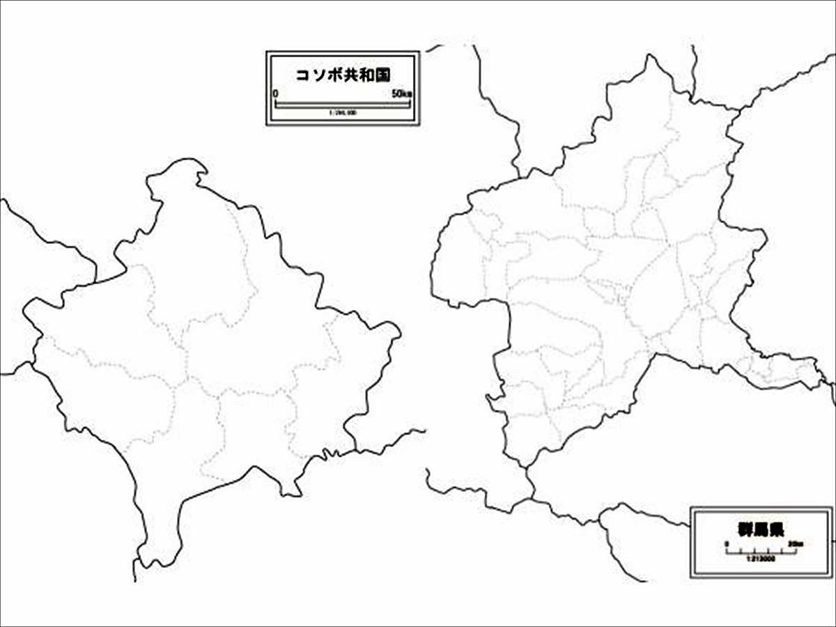
Is not it like the shape of Kosovo and Gumma prefecture? It is the same that Maebashi (prefectural office location) and Takasaki, Pristina (capital city) and Prislane, and the first and second cities are competing.
ByWhite map, world map, Japan map free 【White background drawing store】
But was considerably changed in the large merger of Heisei, Ishigaki if Ishigaki in Okinawa, Miyakojima if hirara, Kagoshima of Amami Oshima because City, Tanegashima if Nishinoomote, Goto if Fukue City, Nagasaki Prefecture, Hyogo Prefecture Awaji Island If it is Sadamoto City, Niigata Prefecture's Sado Island if it is like Ritsu City I liked the city of a remote island that has a presence. Similarly, Oita Hita City, Gifu Takayama, as of Aizuwakamatsu, Fukushima, located in the basin was also like the city of "orphaned Muen".
Between Borneo Island and the Philippines in Indonesia, the two routes of Palawan in the north and Sulu archipelago in the south (Philippine territory) are like a bridge connecting big islands and islands.
With this kind of feeling, I am a pretty geographical person.
◆ Trigger
In the first place, the chance was primary school class. There was a problem of filling the prefecture in the Japanese map of the white map with the social time of elementary school fourth grade society. While suffering from the position between Tottori prefecture and Shimane prefecture, the only answer in all classes in class. That's why I was good at getting in geographical relationship. I liked looking at the map. When I was in junior high school I was addicted to memorizing the country name and the capital name. I also learned the capital of Sri Lanka "Sri Jaya Waldana Placotte".
There was also longing to overseas. So, you may have chosen a dream of circling the bicycle world.
◆ around the world and a map
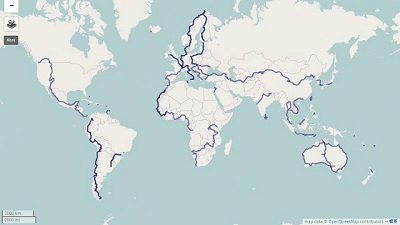
In a round of the bicycle world 150 countries and 13 million 1214.54 kmI turned around the world to my heart.
The early stages of the trip ran while watching the map. The local map was something we had to keep going forward. When Garmin 's GPS is acquired in West Africa, the map is no longer essential, but still a paper map was suitable to grasp the overall sense of distance. I also gathered it because it is a mement of my trip. It was a standard of one country map.
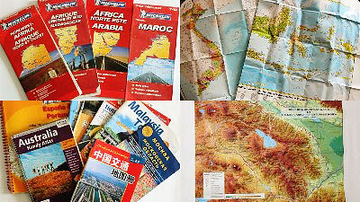
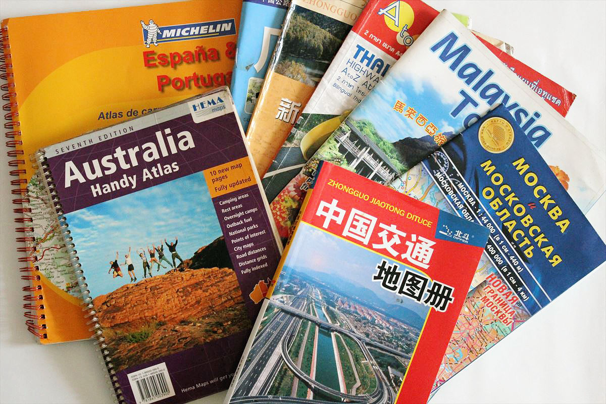
That way, I gathered maps of various parts of the world.
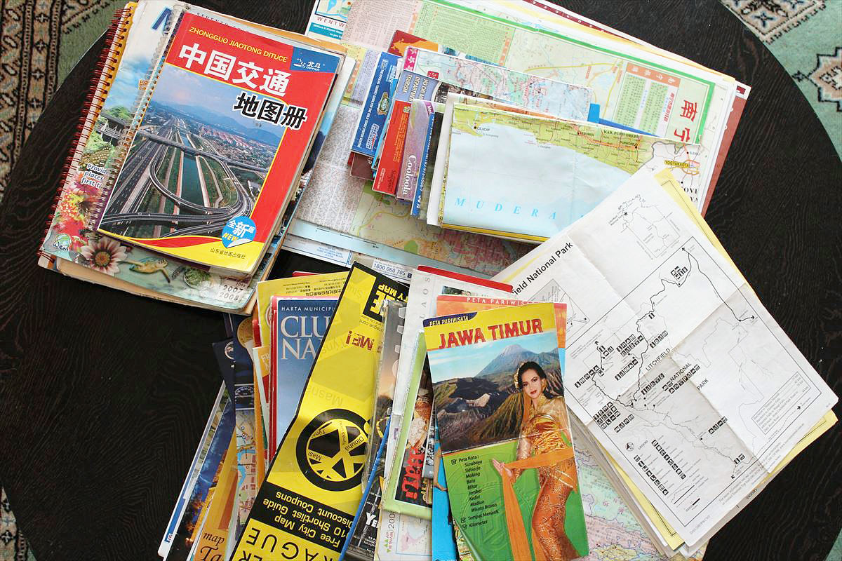
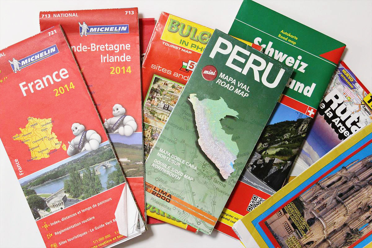
The booklet type map looks like this.
The map I used in Thailand was a solid favorite and it was quite a favorite.
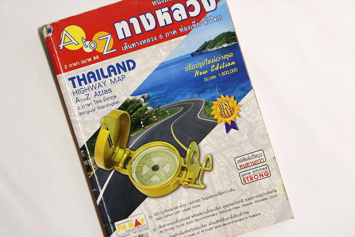
There is also English notation so it will be saved. Thai letters can not be read. It covers both national roads and local roads, and the difference in elevation is also color-coded. This convenient map also contributes to Thailand's driving distance of 3168.58 km in seventh place in 150 countries.

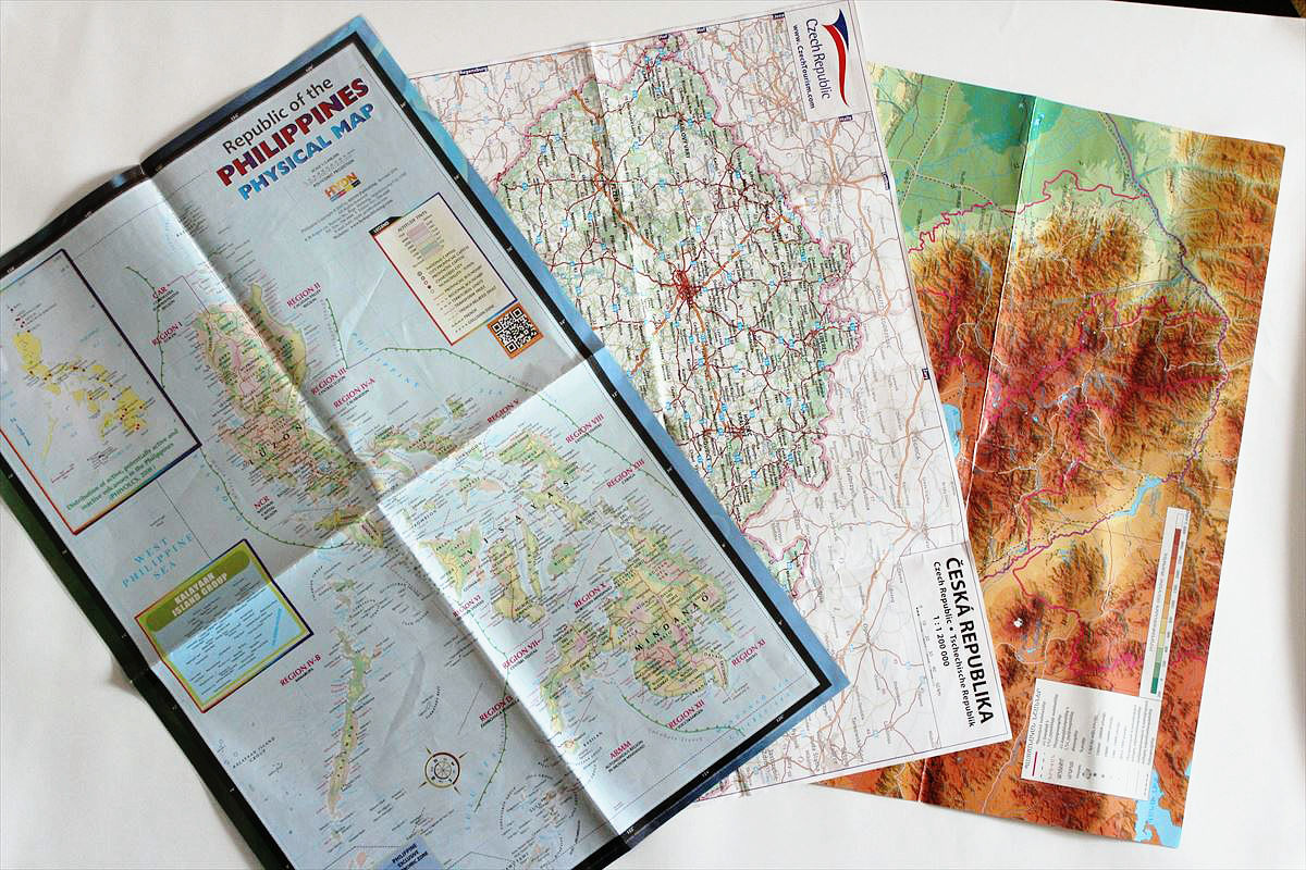
There were a lot of folding type large format maps. You can feel that you are in a journey when you are looking into these maps widely spread out.
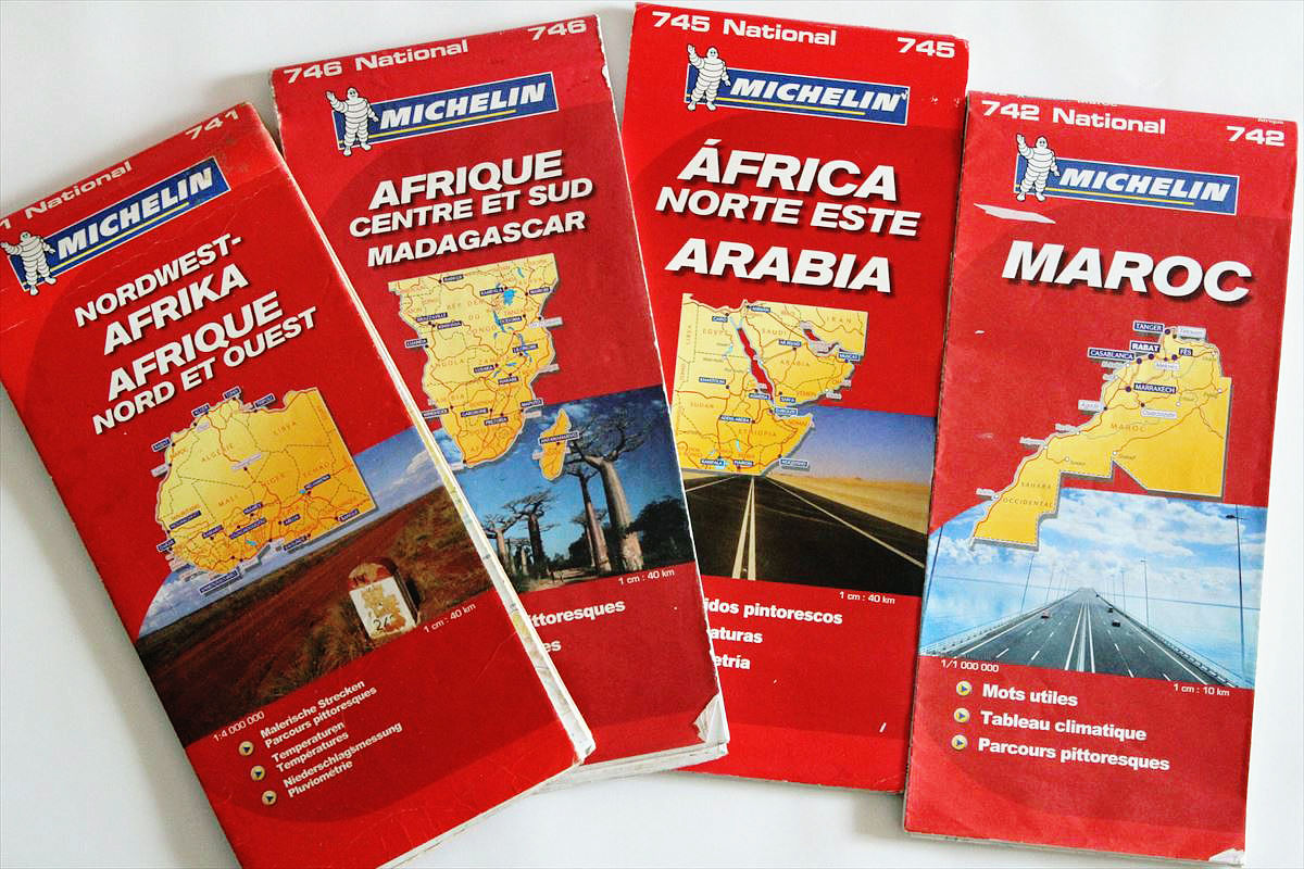
There are many countries in Africa, but recognition of the Charida neighborhood is enough that three books in the northwest, northeast, south of the Michelin Map are sufficient. I am a mania so I bought a Moroccan version as well. However, there was also a prejudice called Michelin Map, and in Africa I forgot to search the map. In West Africa there was nothing but a map, but in East Africa and South Africa there might have been a map of domestic production.
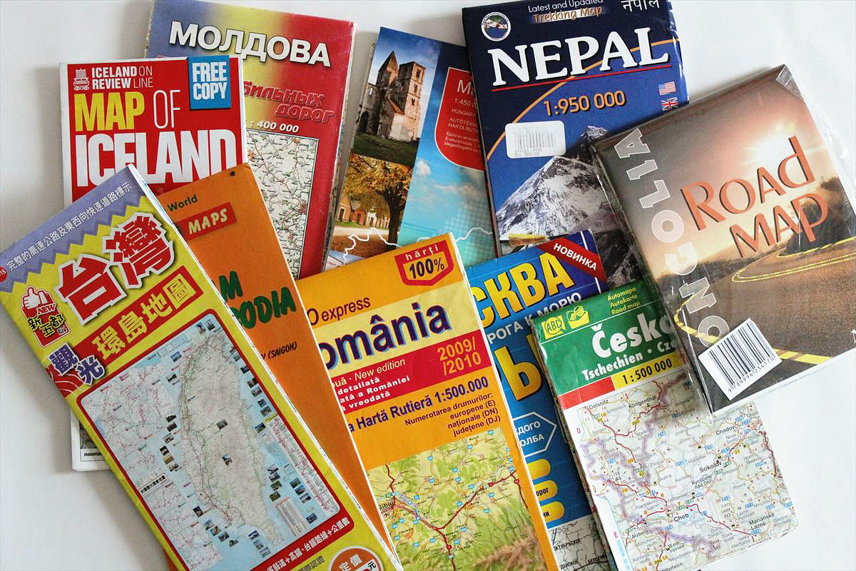
The road map to use for traveling is also important, but I also collected a map that shows the shape of the country at a glance.
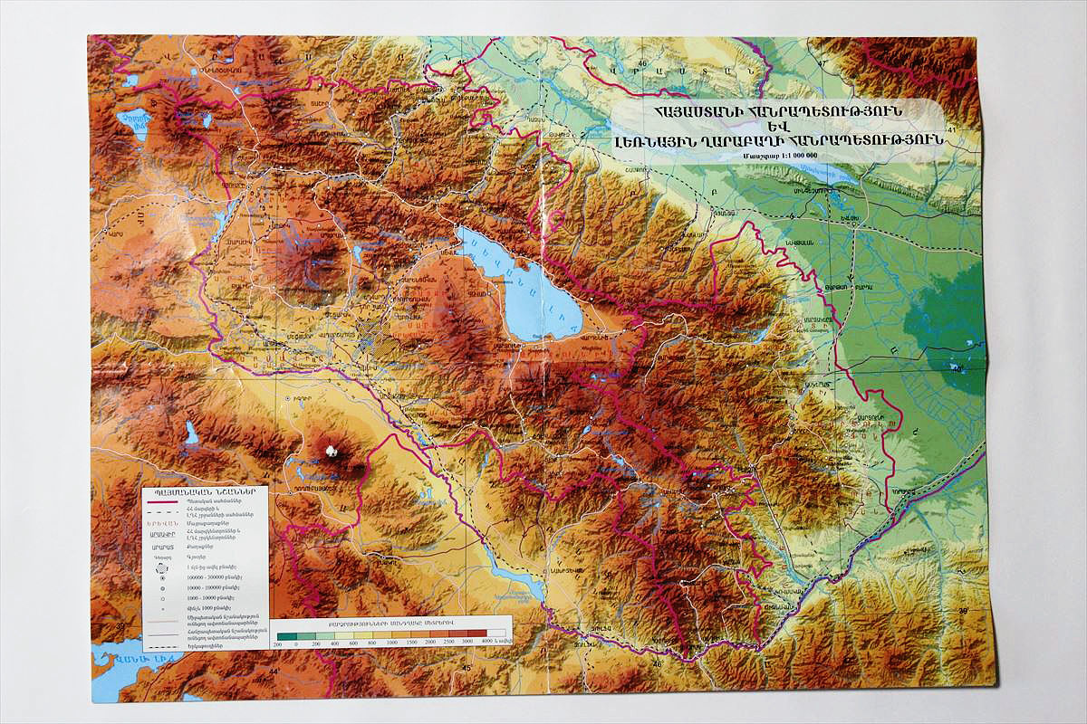
Armenia in the Caucasus region is a mountain countrySeveral big passesExceeded. Because it was quite a hard work, I wanted a topographic map where altitude can be understood at a glance. This rough rocky skin is Armenia.
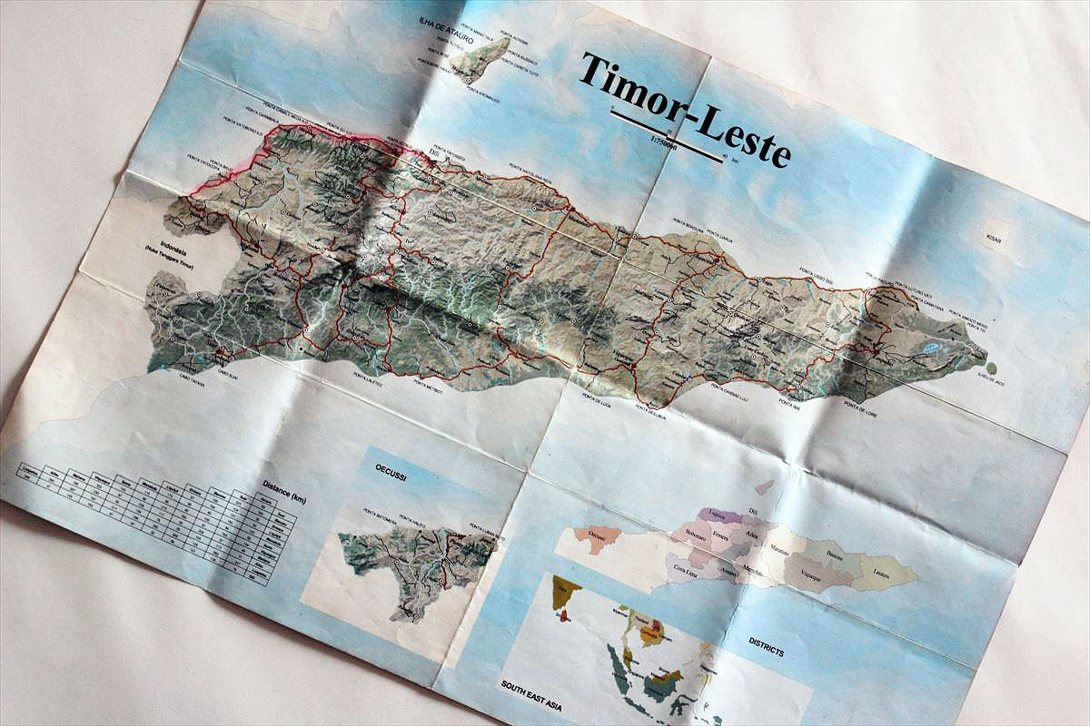
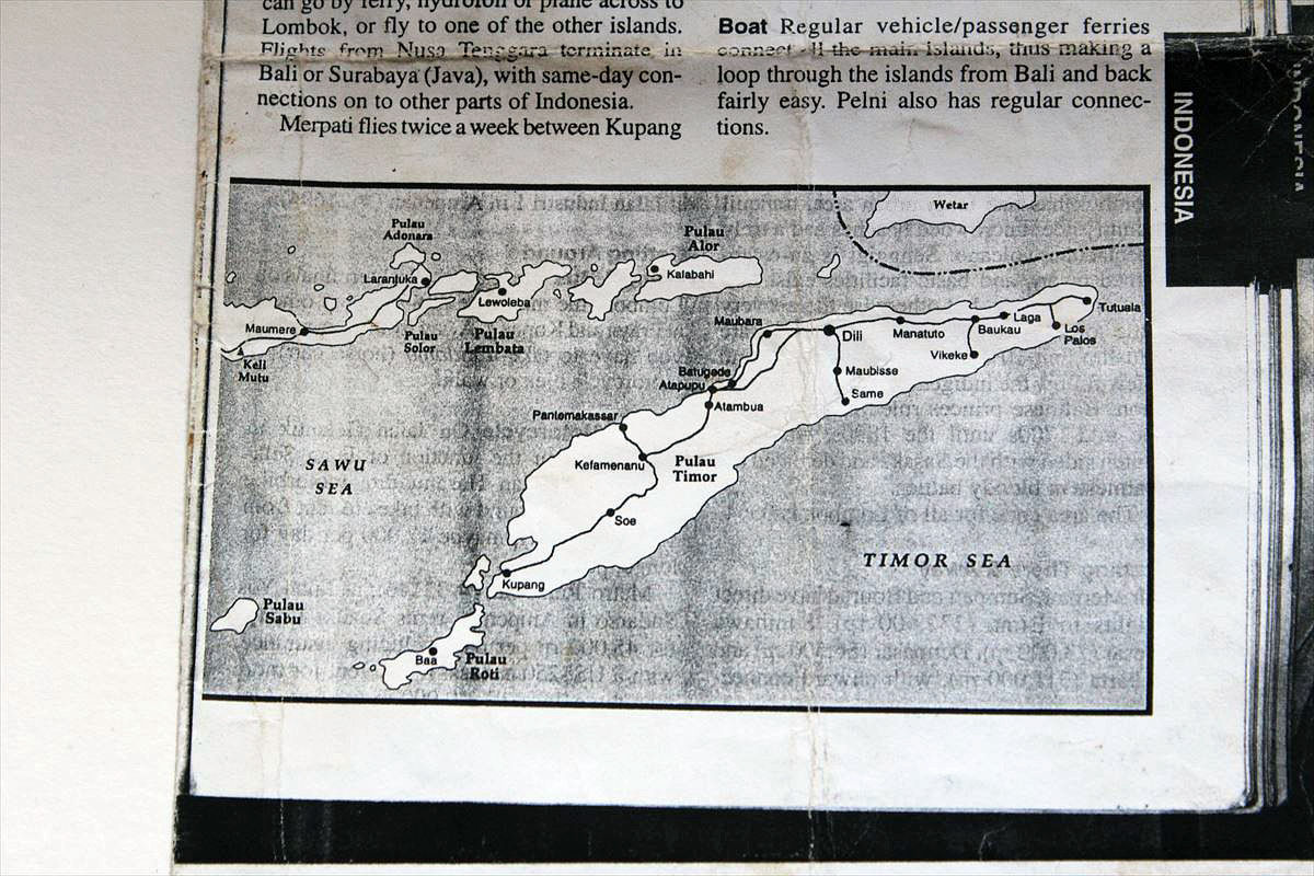
East Timor who was the second country can not find the map no matter where I look for it. When I thought about it at a travel agency, a Chinese owner took out this fine map. Moreover, I handed it down for free. I can not throw it away. There are as many memories as the number of maps.
When I entered West Timor from East Timor it was Indonesia. I can not find a map here either. Since there was no choice, I went while watching a copy of the guide book that I had at hand. I did not grasp the sense of distance at all and it was serious.
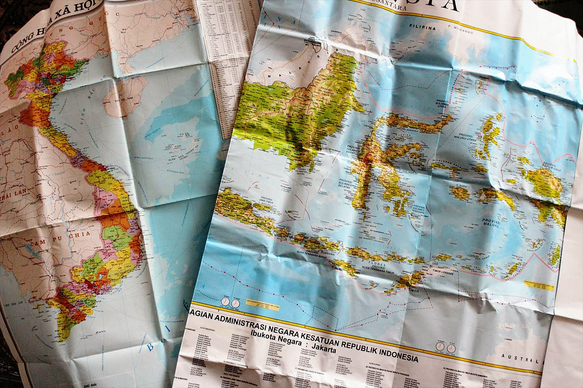
Vietnam and Indonesia were purchasing huge maps that could cover the Chabobashi. Indonesia of the map consists of a number of the island looking for a minor island as if a treasure hunt irresistible since it is possible to indulge in thought.
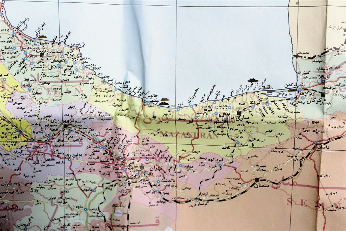
The map of Iran was also oversized.
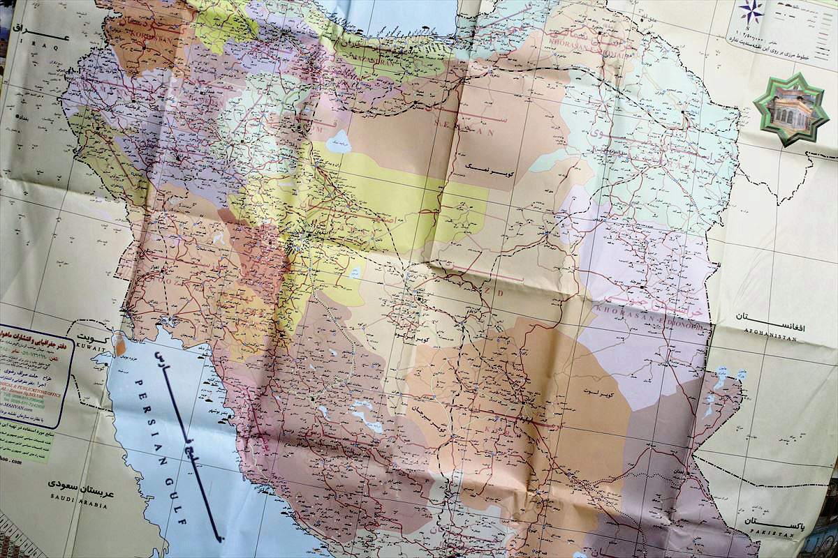
However, the map can not be read per Persian character. But I was drawn to the atmosphere, did not I?
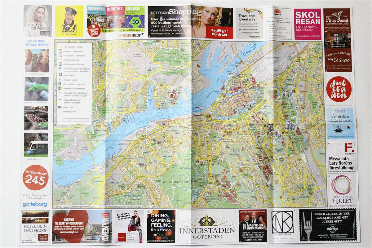
There were some maps of the city as well as the map of the country. Here is a fun way of seeing the map here.
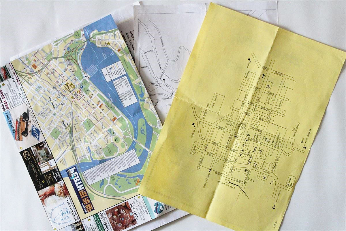
The city map of Goteborg in Sweden. It was a map of feeling such as a town in the west.
· Are you missing a map?
I was organizing a lot of maps at hand like this, but I could not find a map per Mexico, Peru, Switzerland. I thrash "I threw it away," but I found another cardboard when I looked for a room. The whole continent of the Americas was packed with about half of the baggage around Europe. The rest of the map was also there. "I can play another don!I feel like that.
Corrugated cardboard filled with memories of the trip.
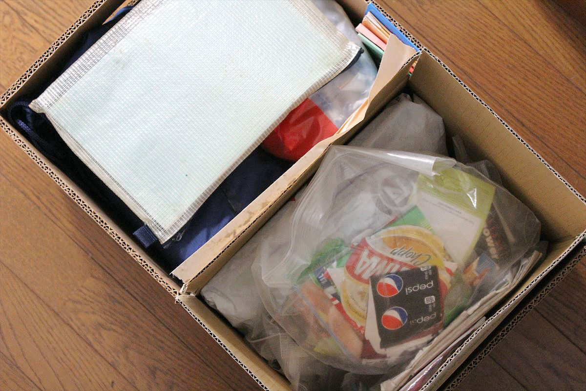
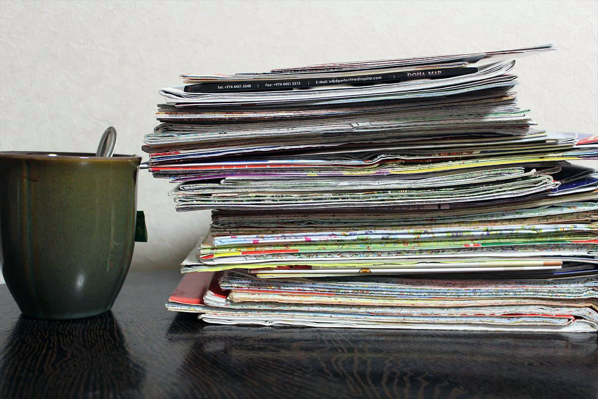
This amount of map was buried.

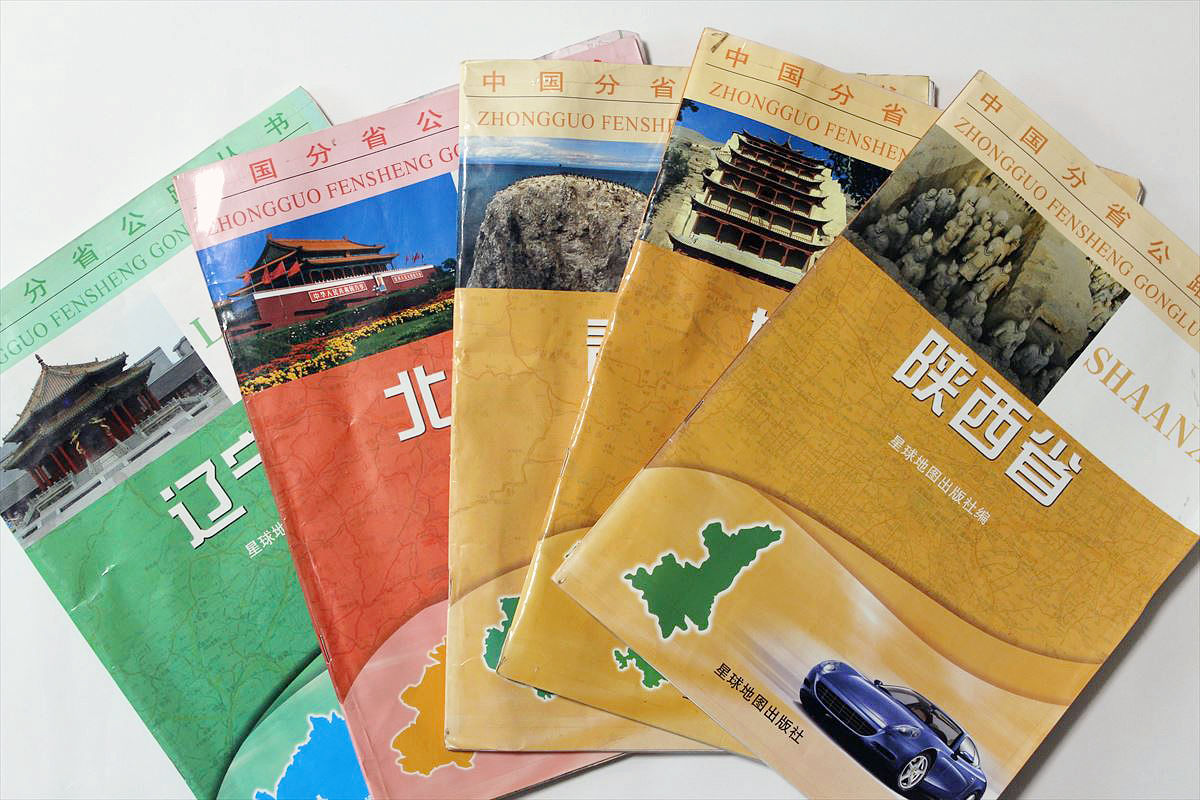
When traveling in China, I purchased a booklet type map for each province. Apart from that, we also have a map covering the whole of China.
I found a map of Mexico, Peru and Switzerland and I am relieved. By the way, I also bought a British version and a French version of the Michelin map in the second Europe.
If you fold up all the large format maps, it will be about this height.
For the moment, collect them and seal them in a container box. I would like to use it even when I make a guest house someday, but what will happen. There is a concept that I want to make places where I can see the map as much as I want.

◆ Utilize tourist information offices
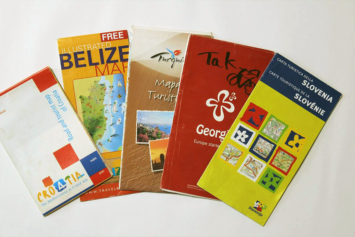
Overseas, I bought a map at book stores, gas stations, souvenir shops and so on. Another thing, do not forget the local tourist information center (tourist information), too. When you stop by a tourist information office, you get a map for free.
Free map of each country available at tourist office.
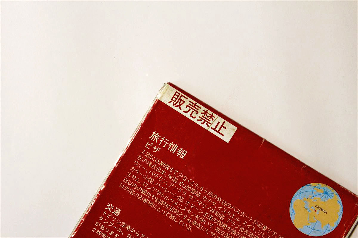
There was a Japanese version of the map of Georgia (Georgia). Whether it is also a reseller, it says "sales prohibited" on the reverse side.
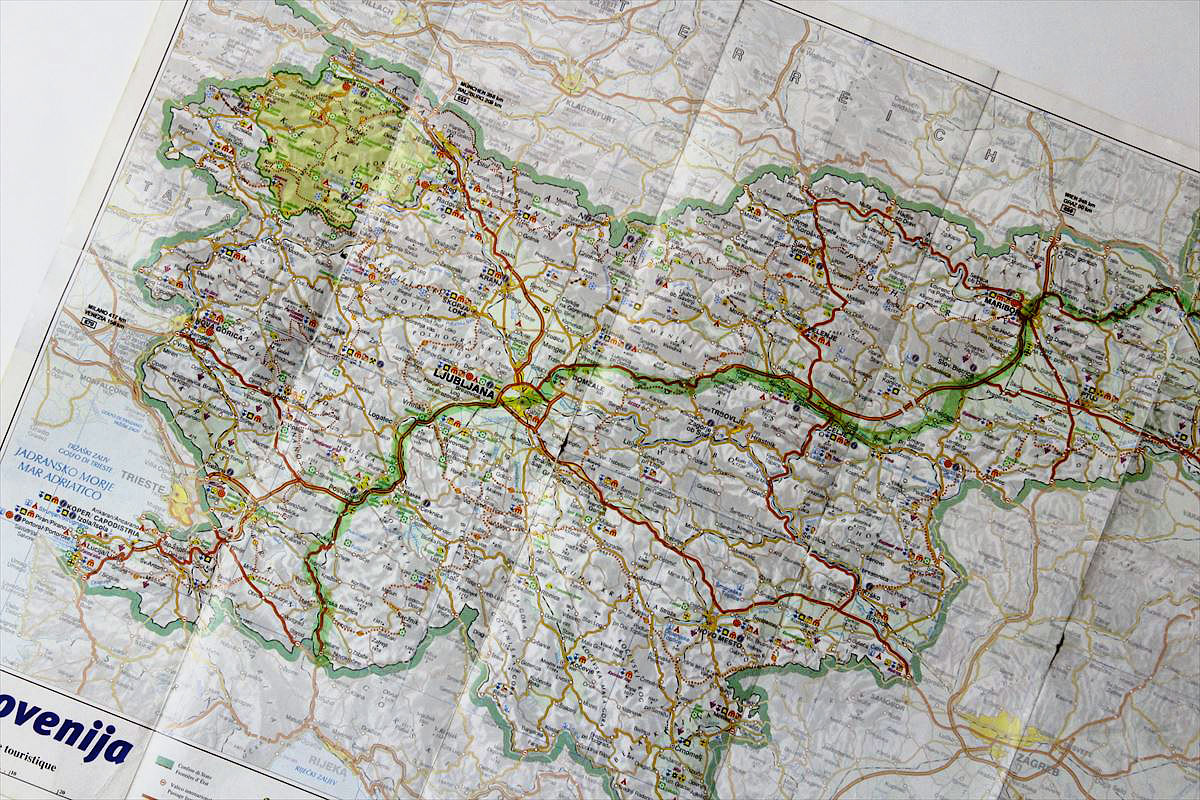
A map of Slovenia that seems to be mistaken as a commercial item.
America got a map for every province.

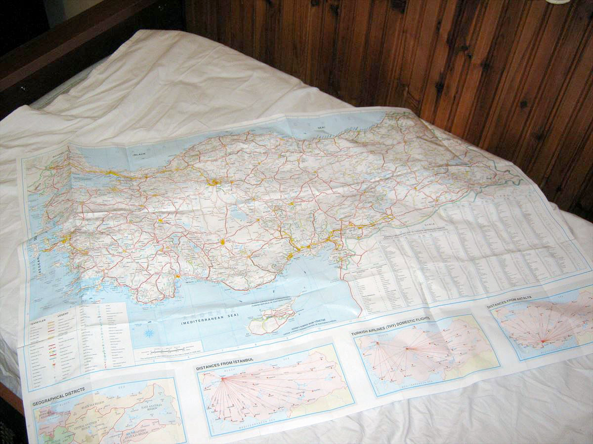
The most amazing free map in the world was this Turkish map. My throbbing did not stop on a perfect map without a fault.
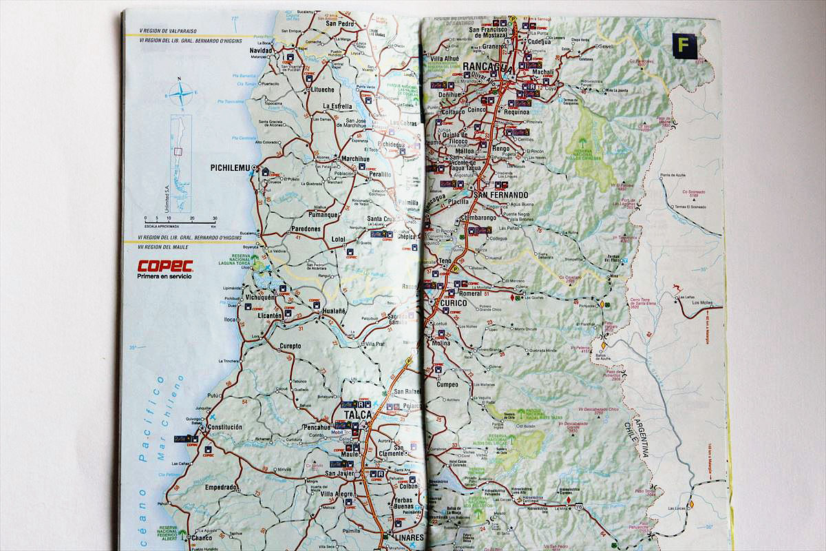
Chile also had a free map. This is available at gas station called Copec (Copec).
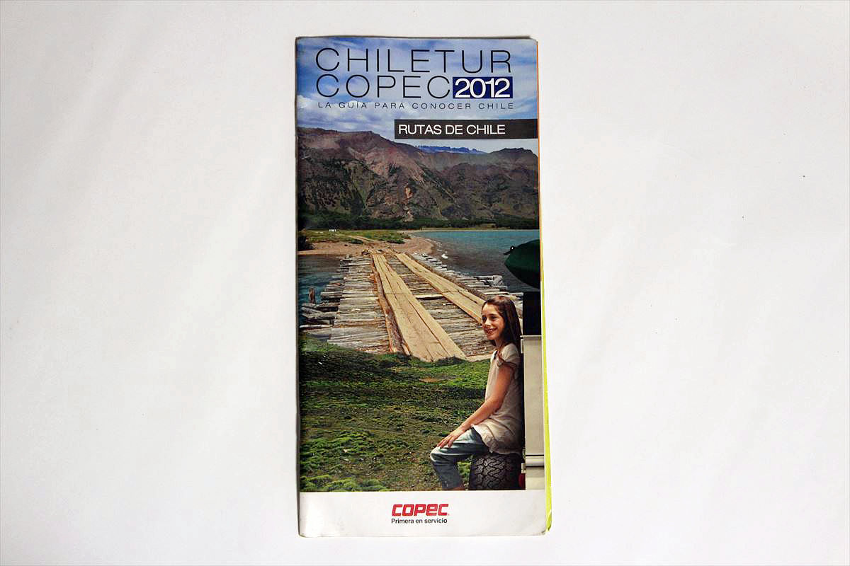
It was a highly accurate map that I could not think free too. In exchange for free, Kopec's petrol station located throughout Chile is marked.
◆ Recommended copy
Even if the collector's person is the same thing, I will purchase multiple "for storage" "practical use". In the same way it was convenient to copy the map and separate it for storage from practical use. Use of the map of the outdoors, use care with or become Luffy keeps when a strong wind or gets wet with rain. If you fold-type large format maps widen frequently, creases will be damaged and you will be torn. For that reason I got a map and first it was a copy. I used the map I copied so mainly.
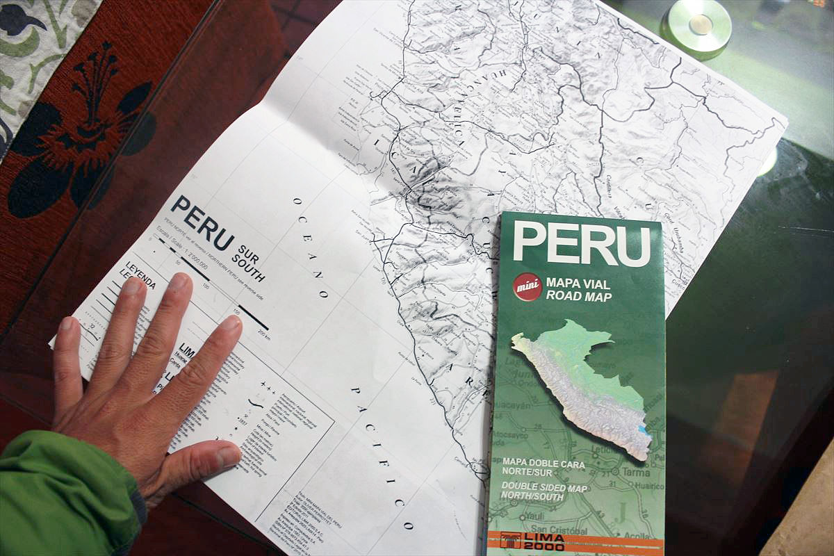
Map of Peru.

If you copy like this, the original is not damaged.
◆ Recommended map
A tablet terminal to a smartphone, if it digitized it may be enough with an application. Still the traveling is more exciting when there is a paper map. In bed of cheap in tent, I liked the time to look at the map wherever I should go. It was a blissful moment.
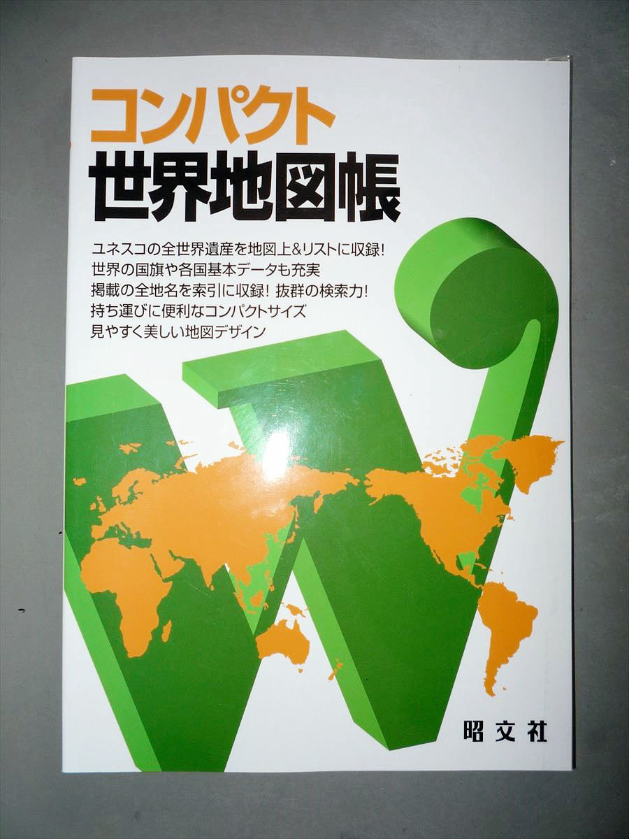
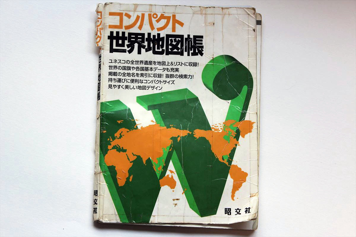
If you carry a map on a journey, Shobunsha's "Compact world map book"Is recommended. Although it is compact in A5 size, there is accuracy as high as the high school map book. Popular tourist destinations such as Europe and Southeast Asia had more detailed maps.
It was used from 2009 to 2014.
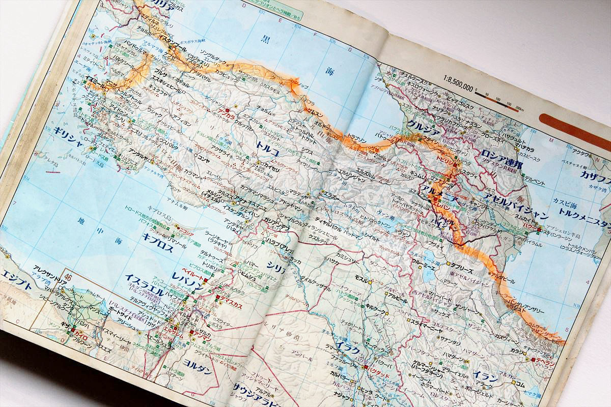
Behold, passion that ran through Turkish coastline all the while. By pulling with the line marker the route I ran, it will be useful for explaining the trip.
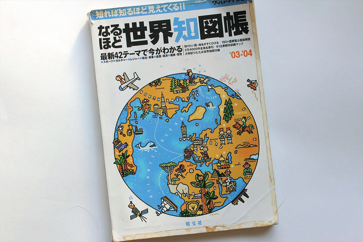
If you keep it at home, Shobun's "Indeed the chart of knowledgeIt was recommended. With the power-up of the high school map book, I was able to immerse himself in the map world at a deeper level. Must see not only the map but also the material page to know the world using graphs and illustrations.
I have told much about the map. The long journey has ended but I would like to continue to look at the map in the future. There are many places I want to go still in Japan and the world.
(Sentence / photo: Takuya S. Narou Charriderman
Cycling around the world for a bicyclehttp://shuutak.com
Twitter@ Shuutak
Facebook Pagehttps://www.facebook.com/chariderman/
DMM lecture requesthttps://kouenirai.dmm.com/speaker/takuya-shuto/)
Related Posts:
in Column, Posted by logc_nt