I climbed Mt. Fuji, Japan's best, that I should climb once in my lifetime

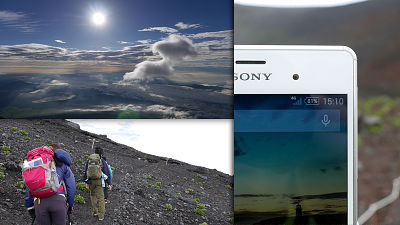
Summer at Mt. Fuji which is the highest in Japan with an altitude of 3776 mClimberCrowded with. A group of young people, families, elderly people and a lot of people aimed for the summit. I was able to climb as I was working at the fifth consecutive Yoshidaguchi. You can see the majestic figure that praised the skirts anywhere, but you can not see the crater that has broken up carefully from the top. It was a nice climb with a nice weather.
Hello,Takuya Sudo @ circle around the world bicycle @ Charridermanis. As I worked at Mt. Fuji, I also did a mountain climb.
Climbing
This summer I worked at Mt. Fuji. Since continuing working from July 10, I finally got a break on August 9, so I got up at 4 o'clock and aimed for Mt. Fuji. I was tired, but since I did not want to work, I only have to climb Mt. Fuji. I will walk toward the summit at 4:30 in the morning. Fuji is a toll roadFuji Subaru LineIt is the start from the fifth stop of the end point (altitude 2305 M). It becomes Yamanashi prefecture side.
You can come by bus until the fifth stop of this Fuji Subaru line end point. Not only from Fujikawaguchiko Town at the foot but also from Shinjuku in the city, I was surprised that Fujikyu bus was out. Routes climbing from this "Yoshidaguchi" are also the most popular for mountain climbers, as are many mountain huts. There are also other routes climbing Mt. Fuji from Shizuoka prefecture's "Fujinomiya mouth", "Gotemba entrance", Yamanashi prefecture "Sukiguchi".
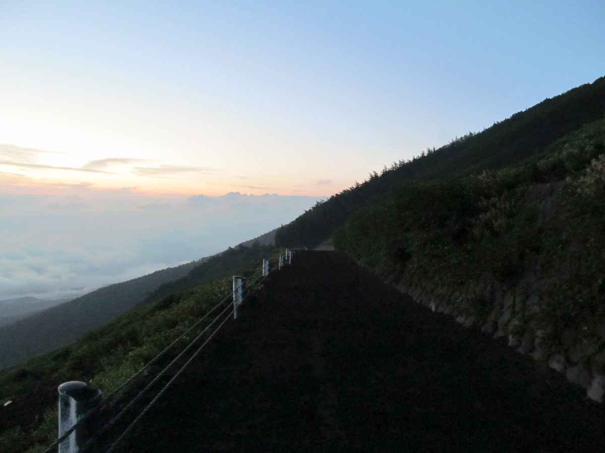
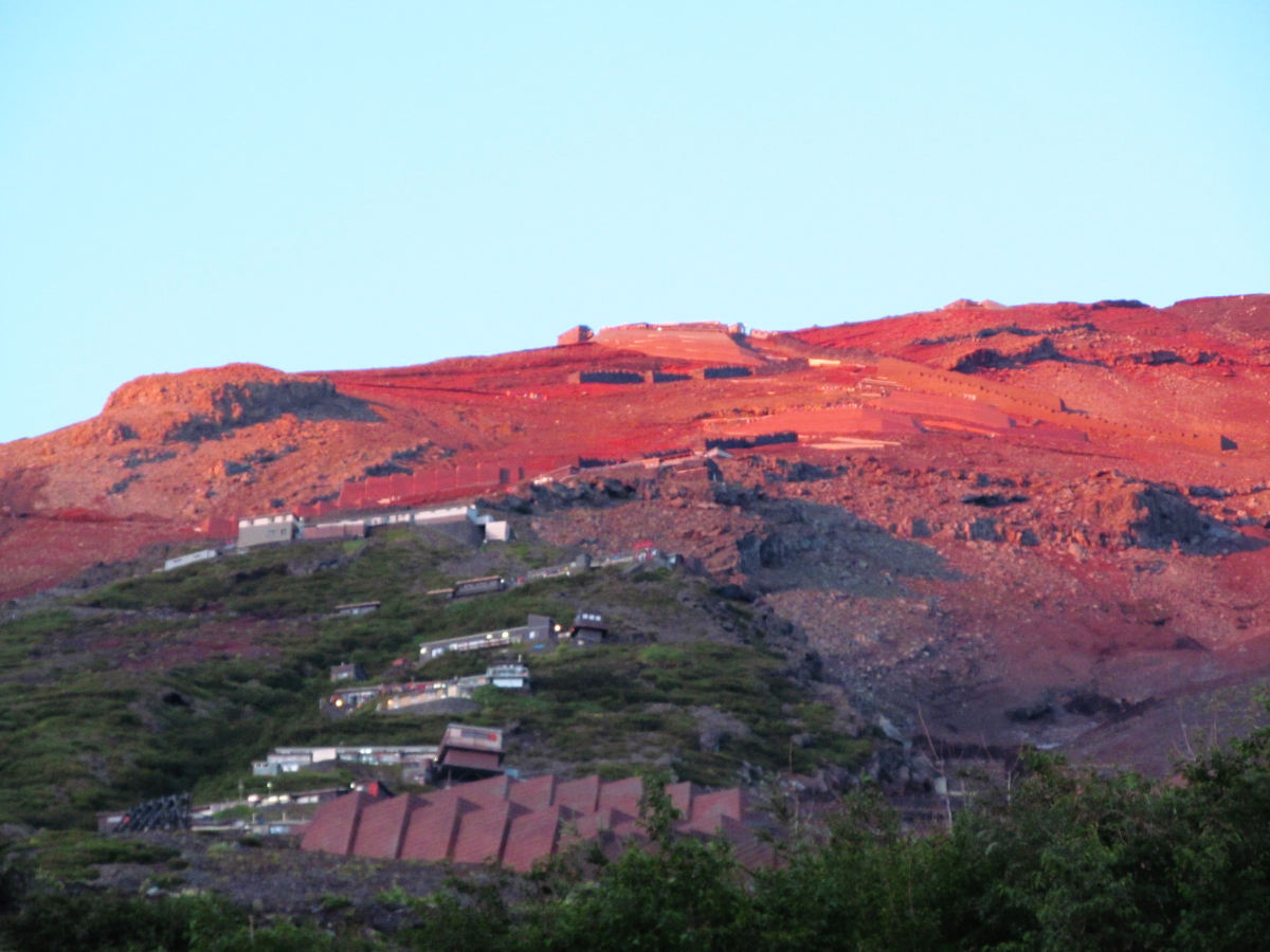
Mt. Fuji before dawn as seen from the end point of Fuji Subaru line who was working.

From the fifth consecutive eyes to the sixth eyes it is a flat road that is easy to walk on.
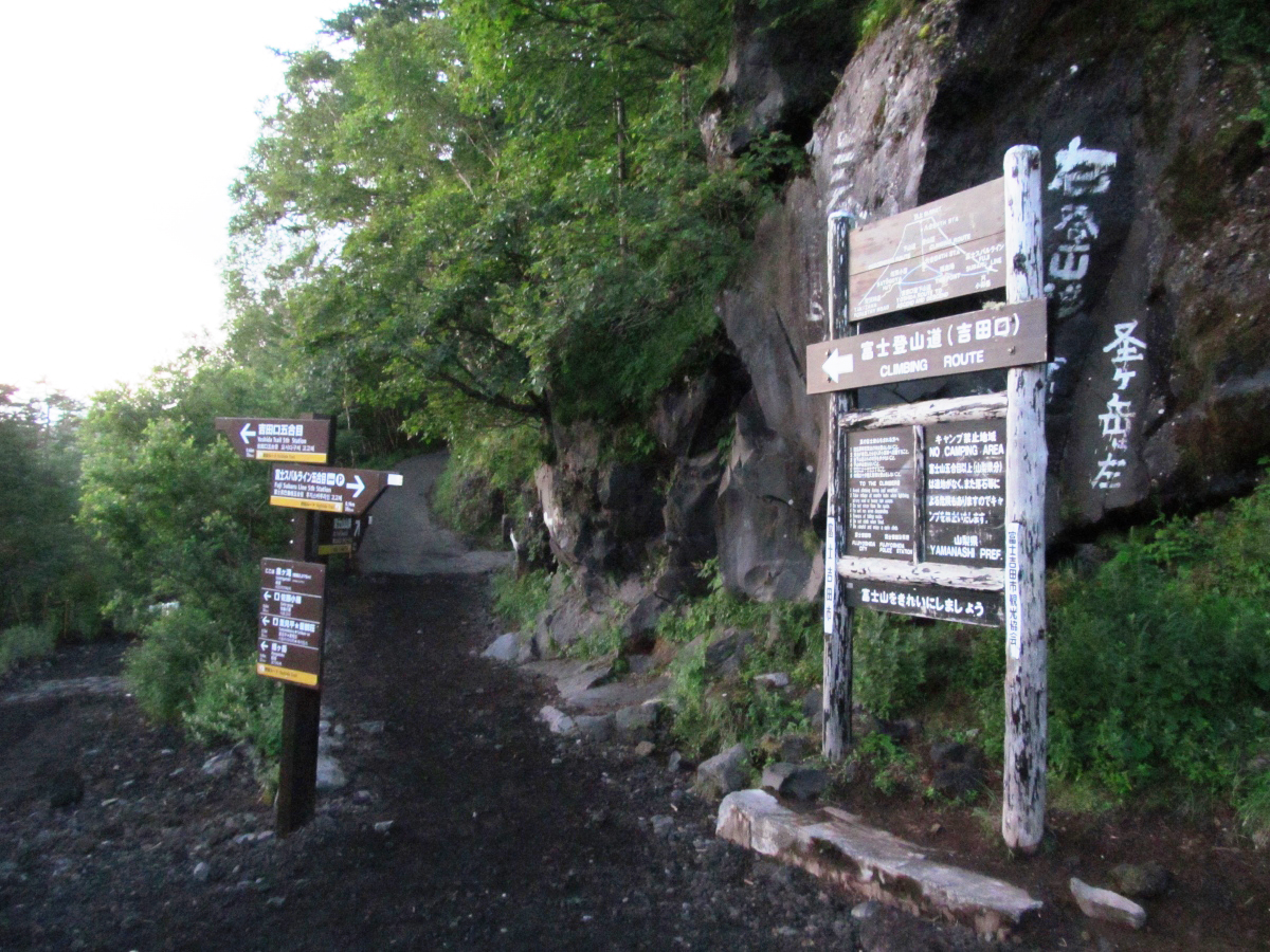
A branch point between Yoshidaguchi and the Subaru Line parking lot. Those who wish to climb Mount Fuji from the foot should climb Yoshidaguchi.
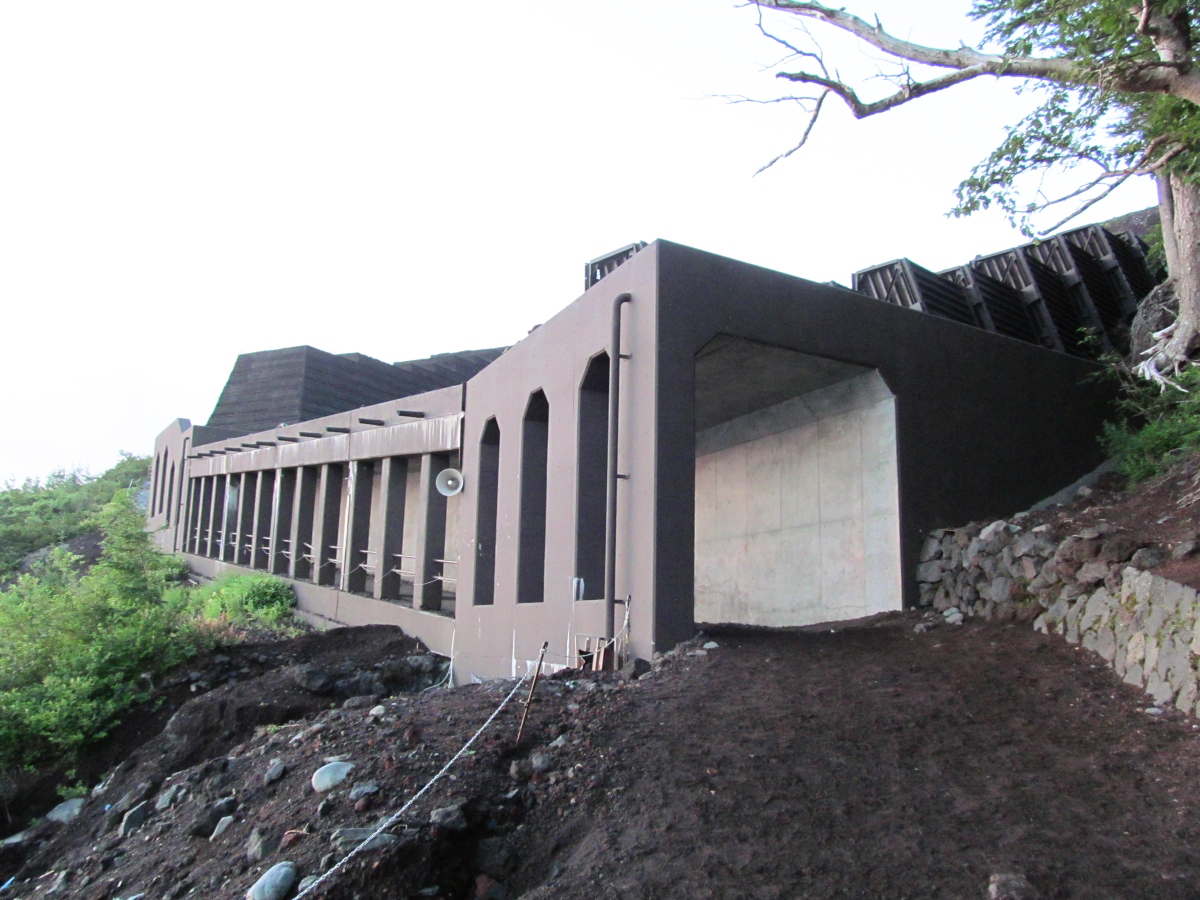
Go through the tunnel to avoid falling rocks and landslides.
Safety instruction center located in the Six Sai (altitude 2390 m).

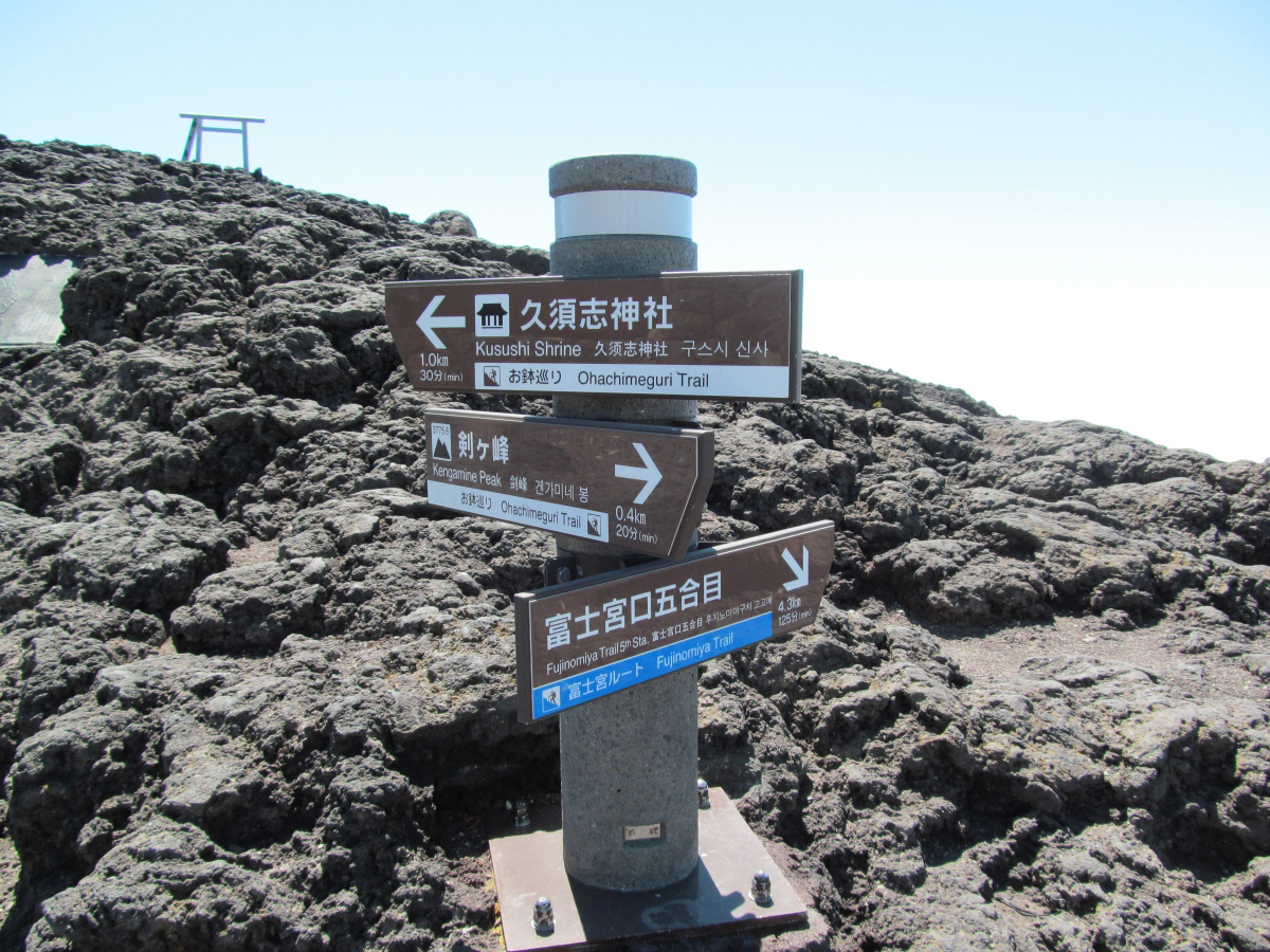
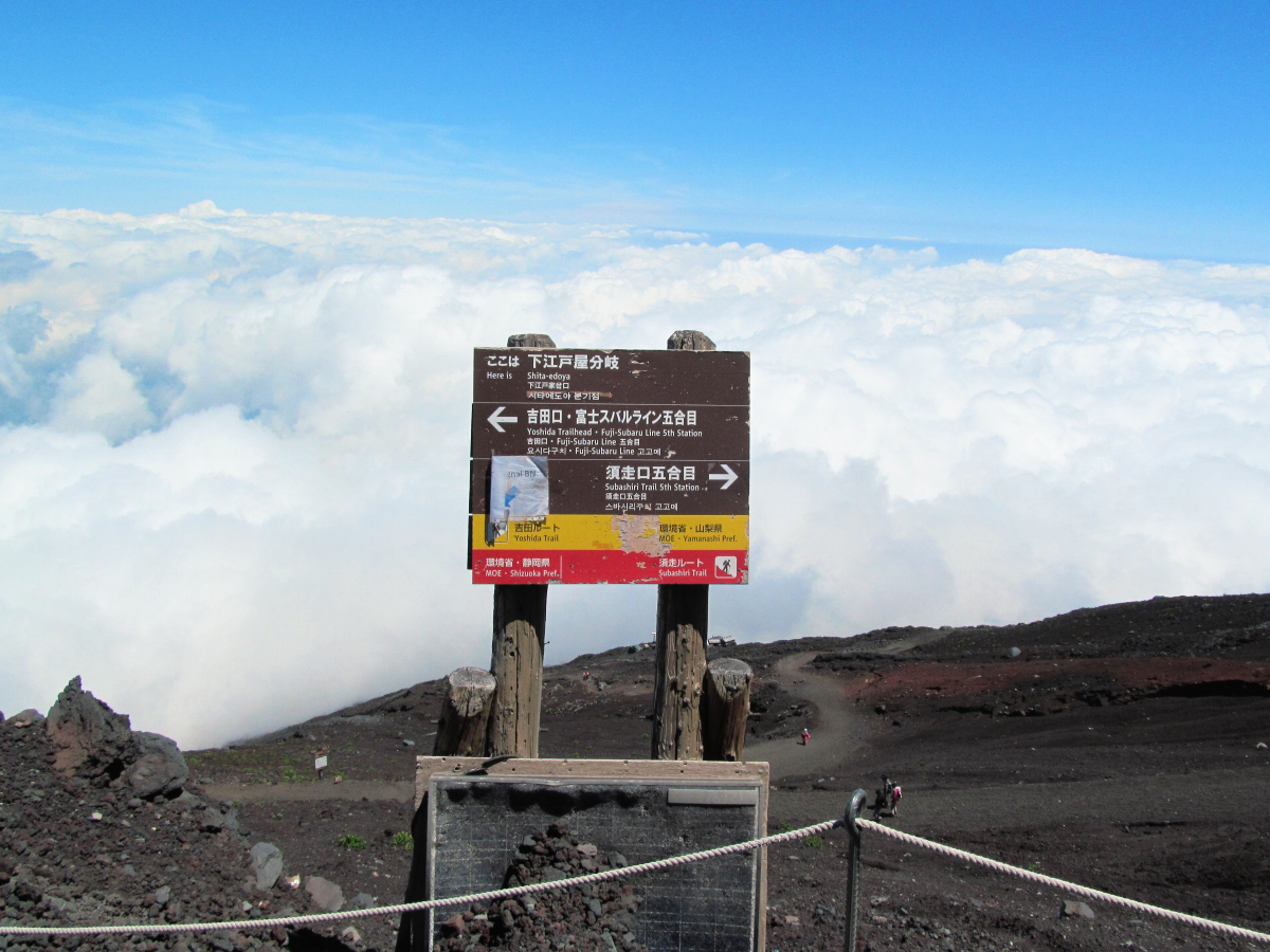
Branch signs.
The climbing road that I looked up from the bottom line is crowded like the stage of the action game.
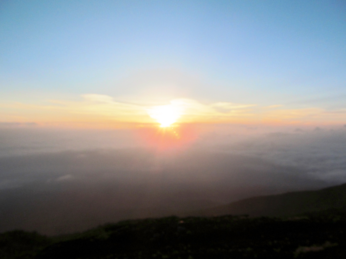
Happy light came at 5 o'clock.
A mountain trail that is well maintained and also a staircase.
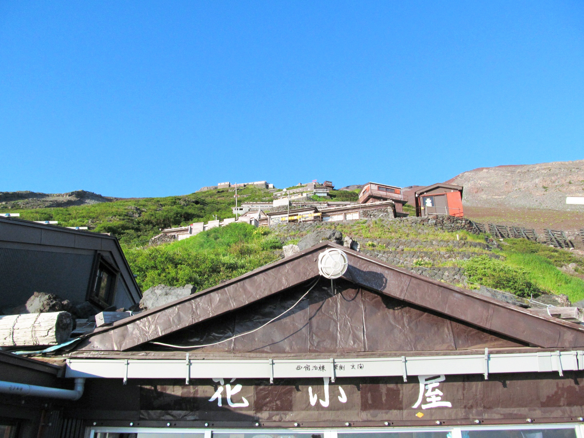
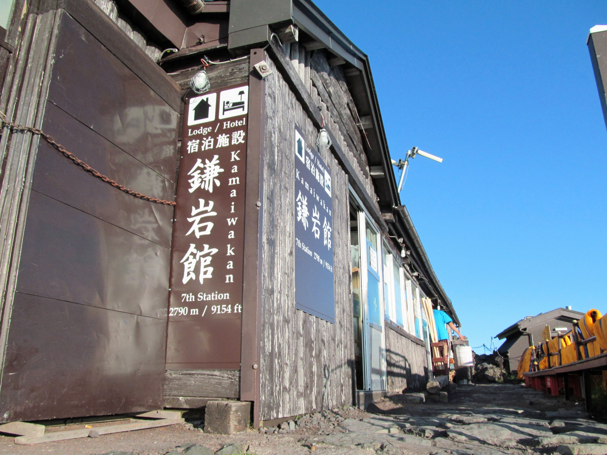
A mountain hut will follow so that it will continue from the "flower hut" at the seventh (2700 m above sea level).
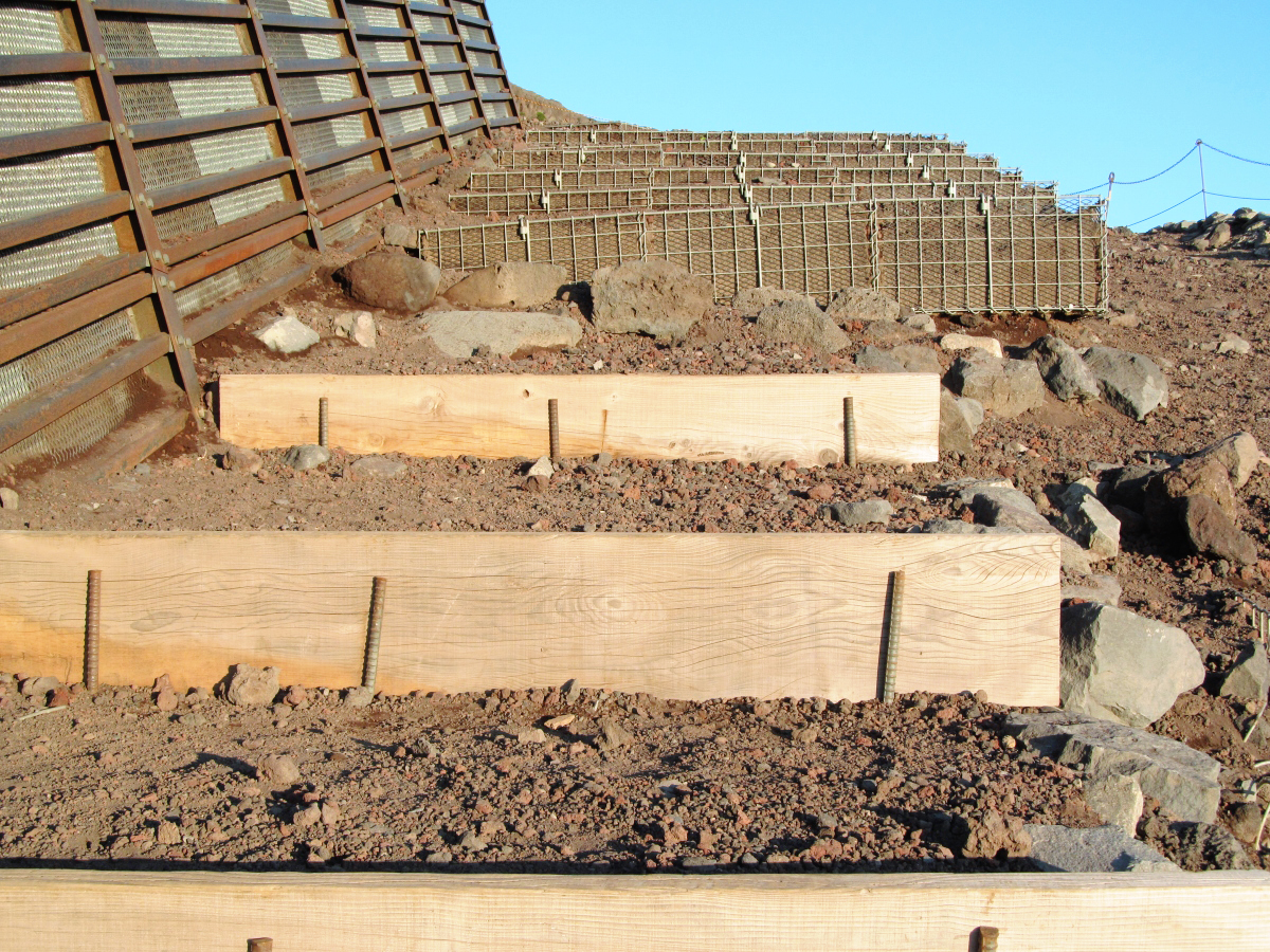
The climbing mountain road of ninety-nine was protected so as not to collapse.
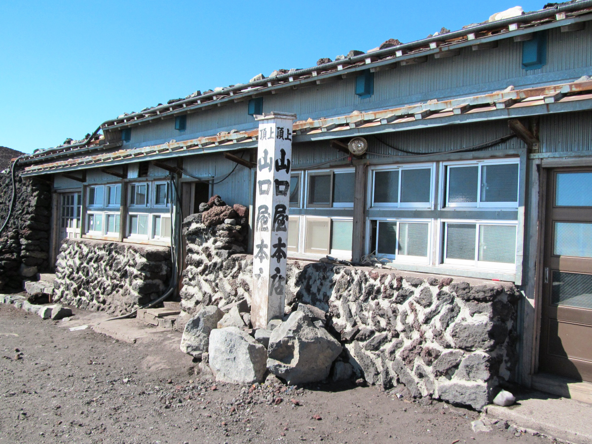
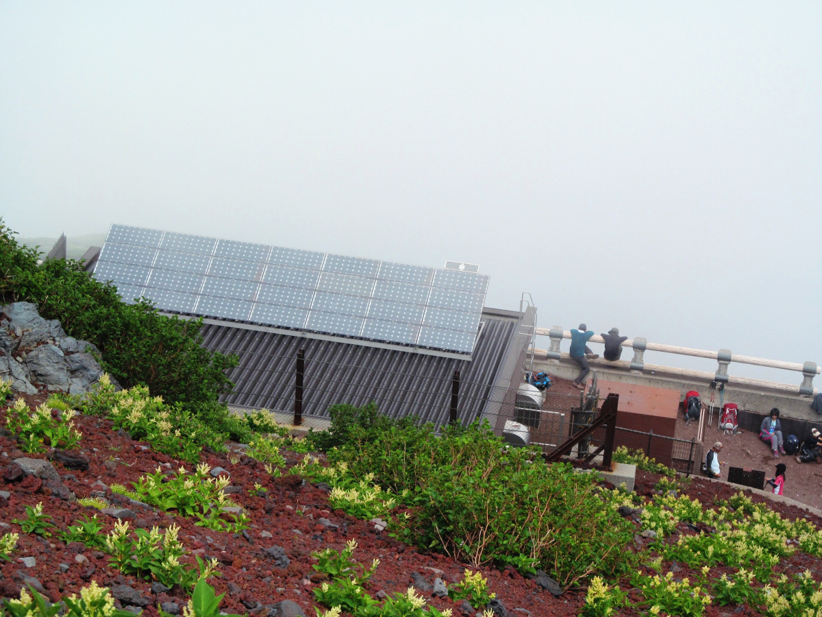
Mountain hut "Kamaikan"
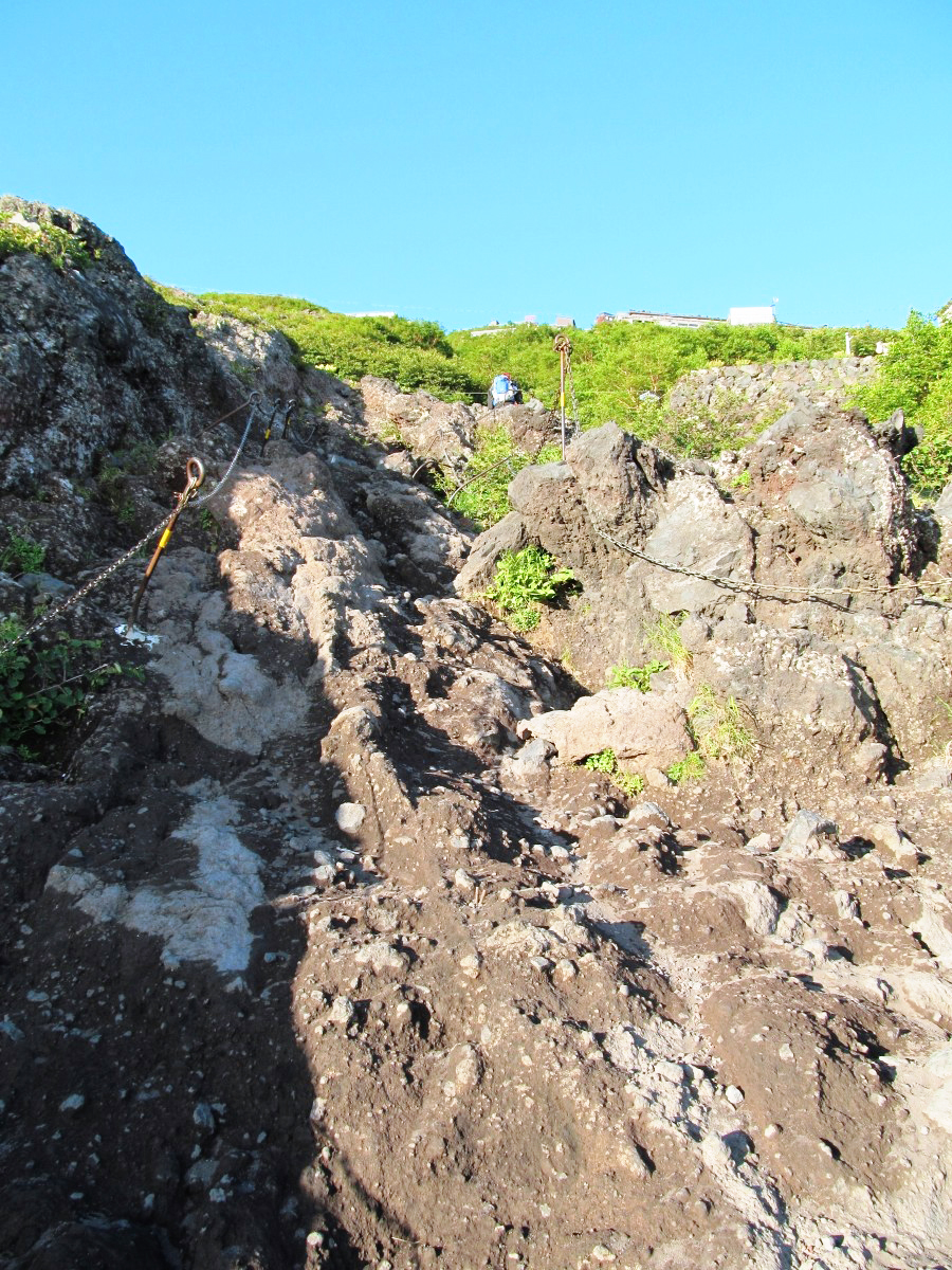
A rocky place hard to climb will come out after the seventh consecutive eyes so let's take care of your feet.
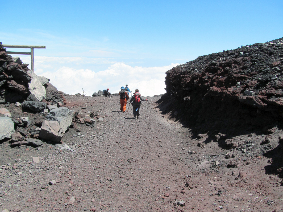
Looking back, a great view is spreading.

Encounter with group tour customers. This time was not the case, but when trying to reach Hikariko at the summit, the climbing path seems to be jammed with many tourists.

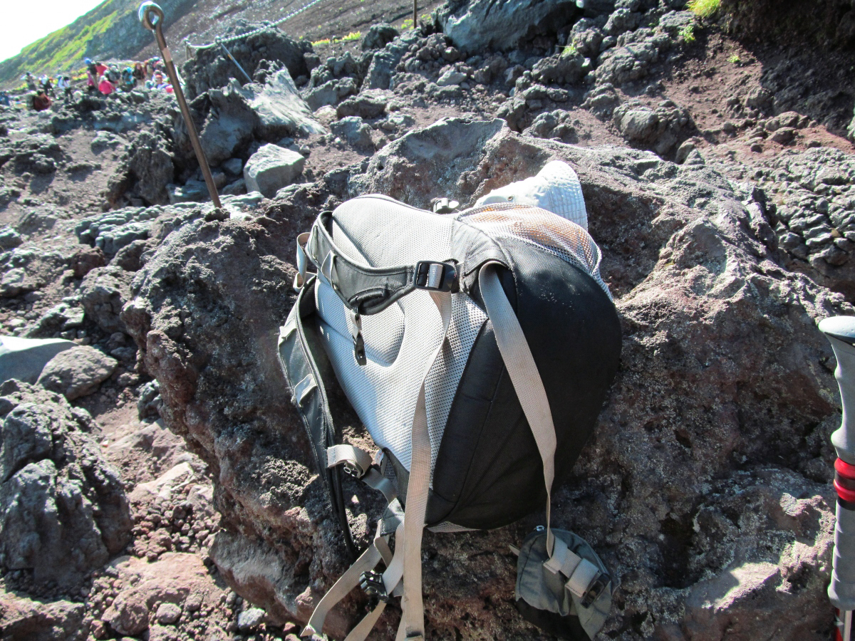
I left a Zac pack and took a break.
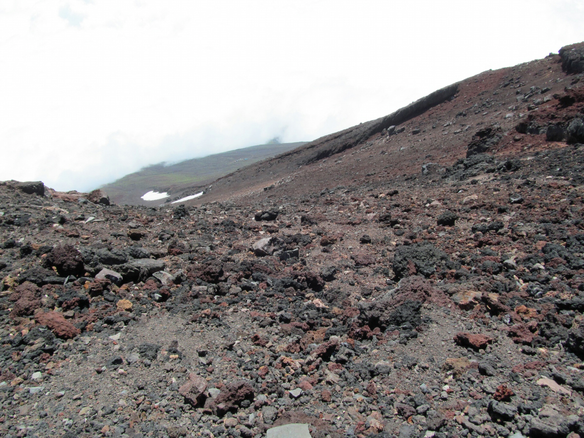
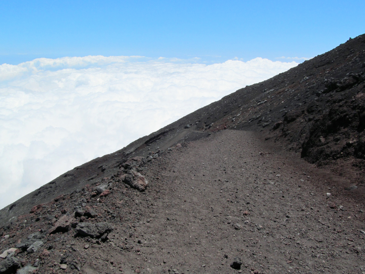
The slope near the summit where there is no green figure.
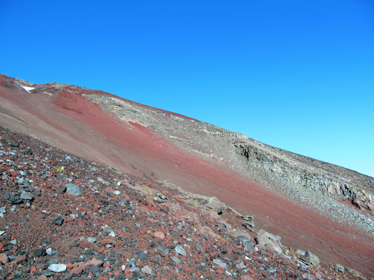
It keeps a constant inclination and continues to the lower bound.

After the rocky place to the pumice area.

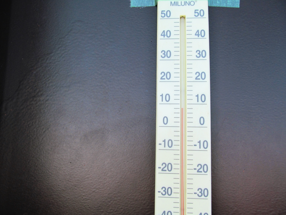
Temperature of this 8th altitude (altitude 3400 m) is 8 degrees.
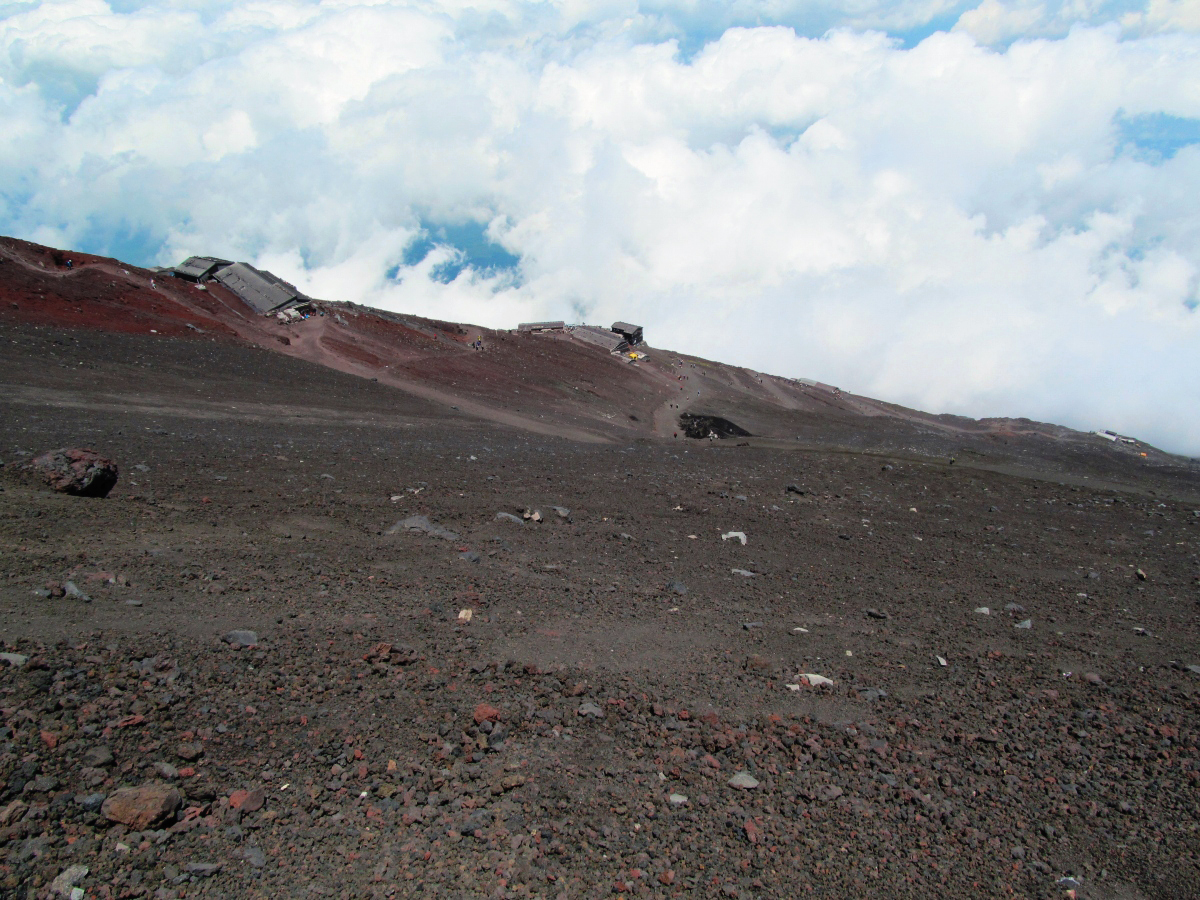
This area around the eighth line.

A little more to the top.
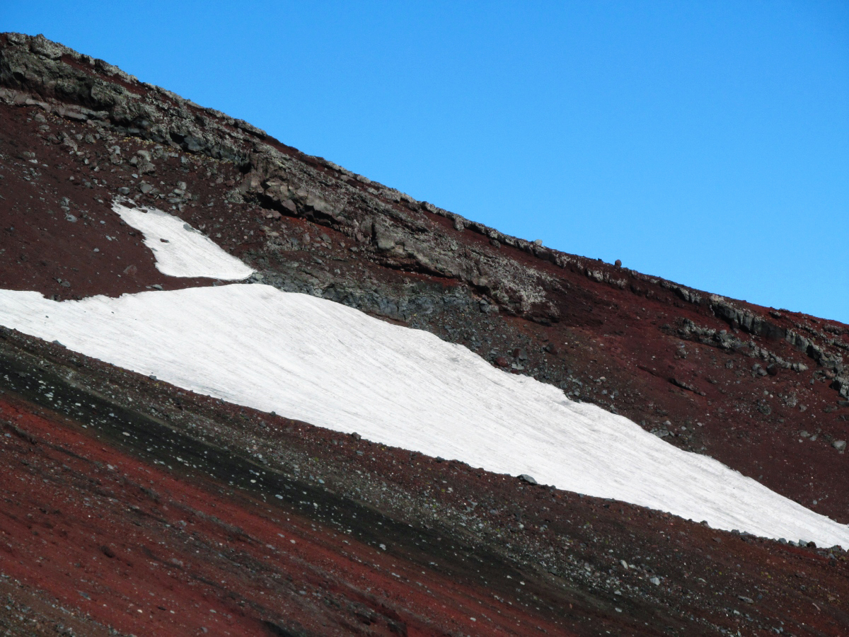
Snow was still left though August had passed.
Brittle rocky skin that is about to collapse.
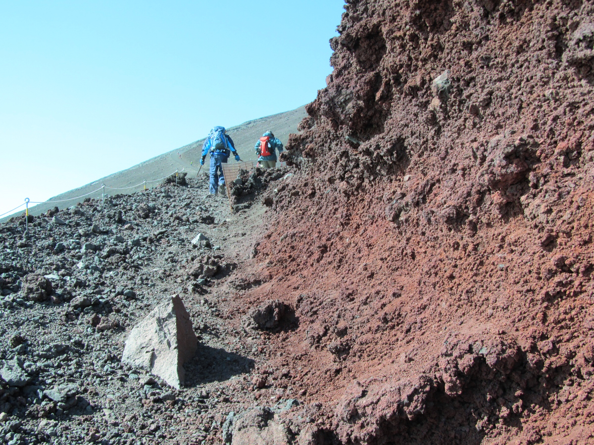
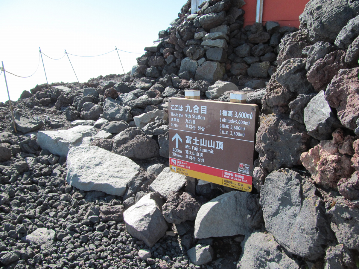
Nineteenth elevation (altitude 3,600 m)
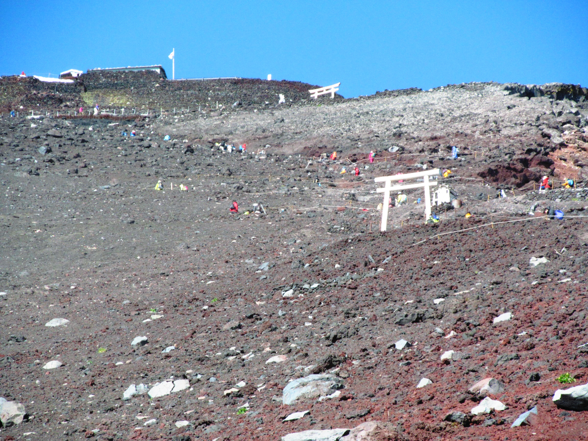
And when you pass through the torii protected by a lion dog,
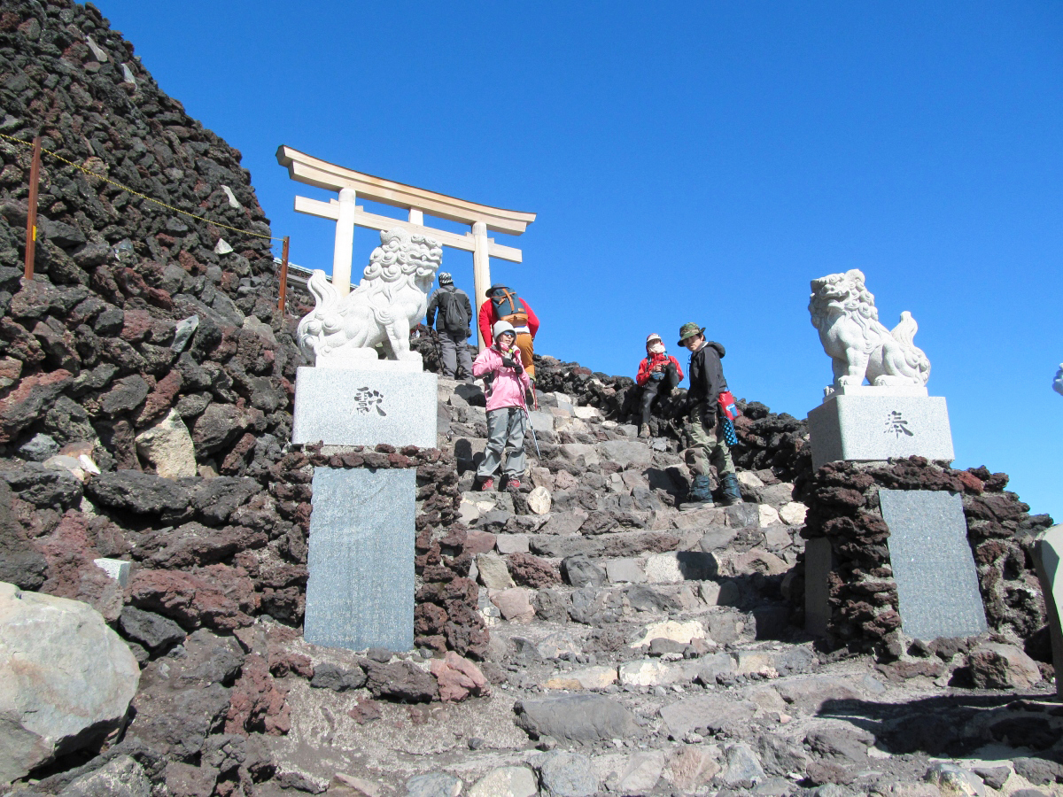
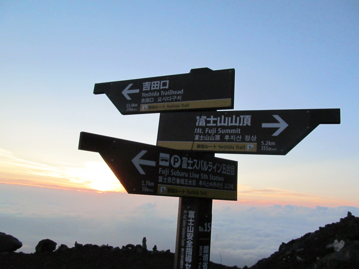
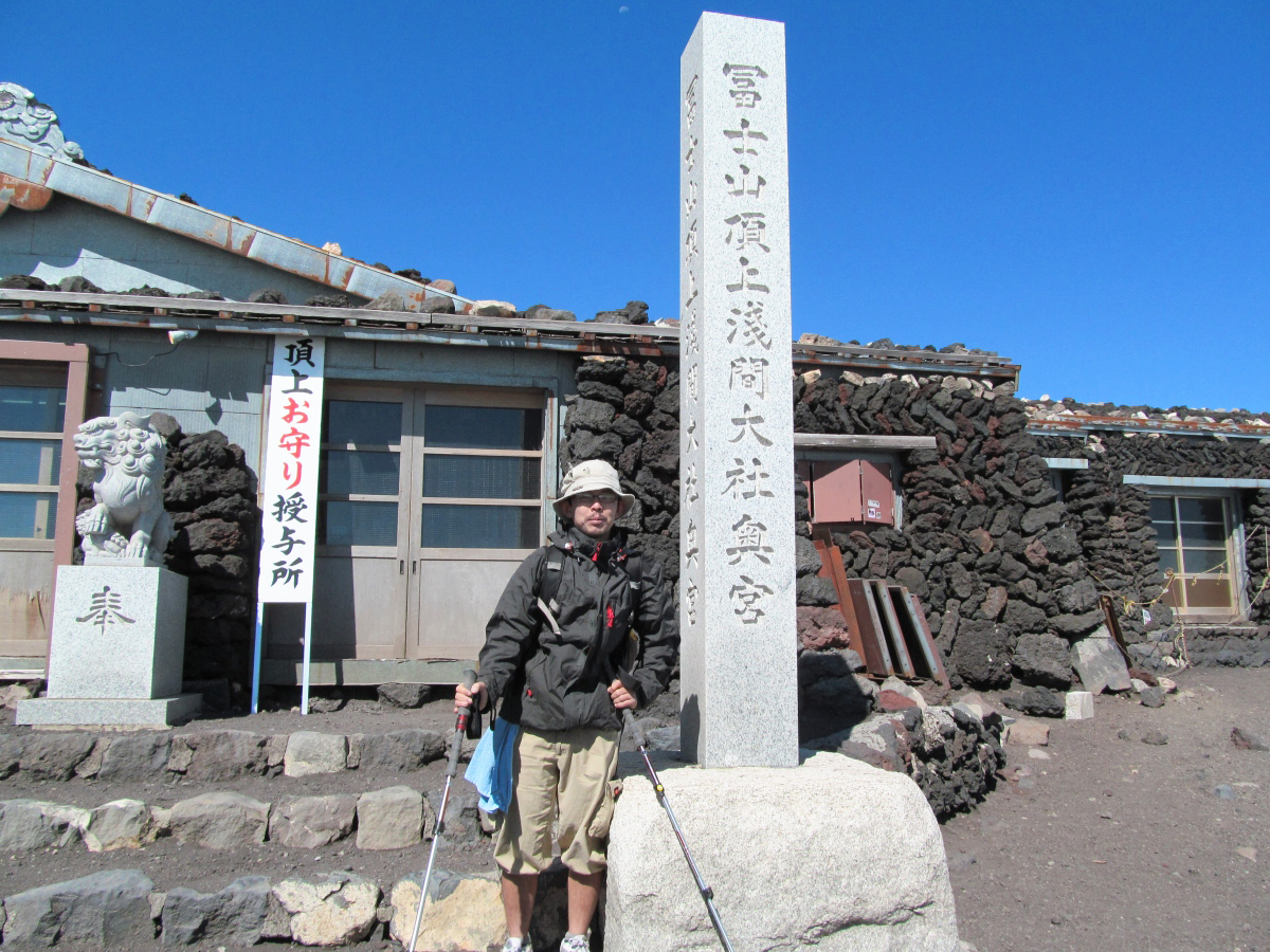
I reached the summit of Mt. Fuji. It is climbing from 4:30 and climbing at 4 hours.
Commemorative photo at the summit of the Yoshidaguchi side.
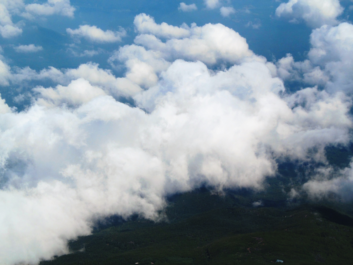
A white sea of clouds spread from the top of the mountain, so I could swim anywhere.
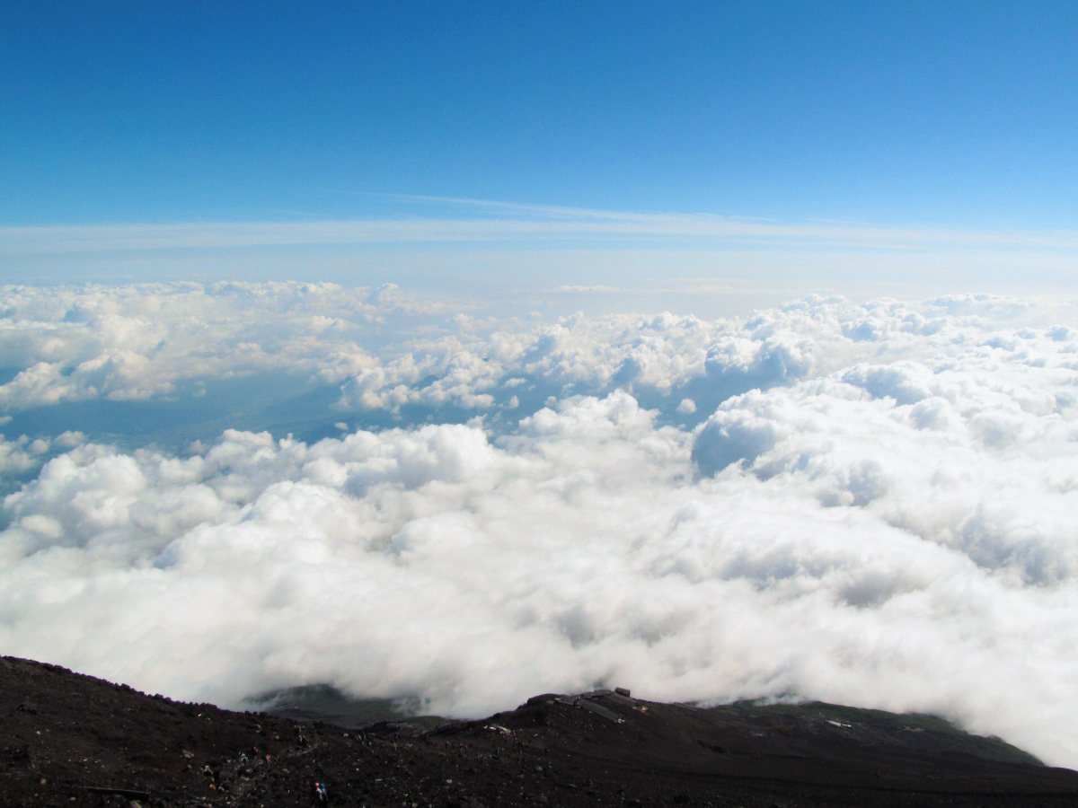
The tree sea spreading at the hem of Mt. Fuji.
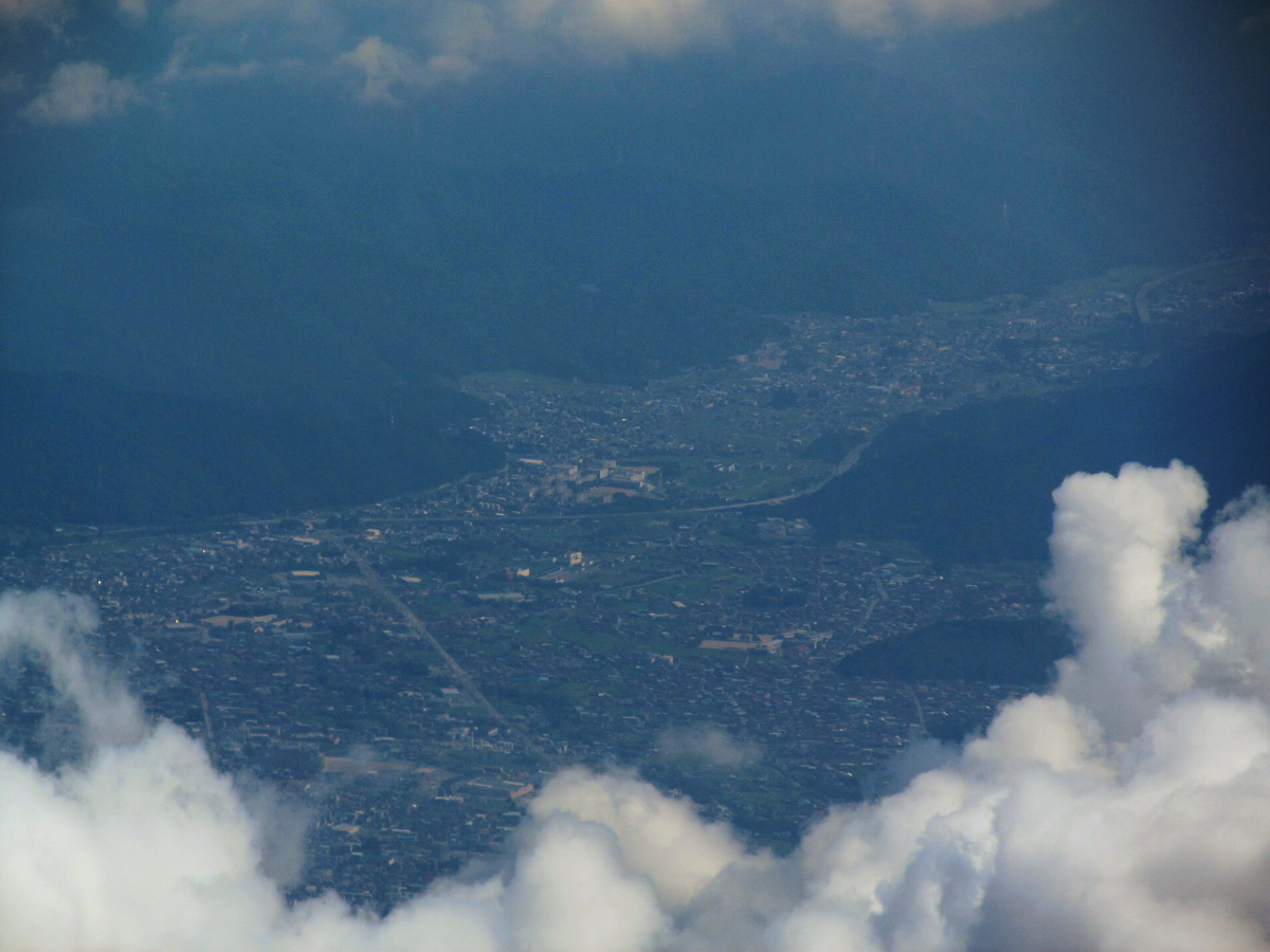
The street of Yamanashi spreading in the basin.
A somewhat famous mountain heading out over the clouds.

A clear sky with no clouds above it.
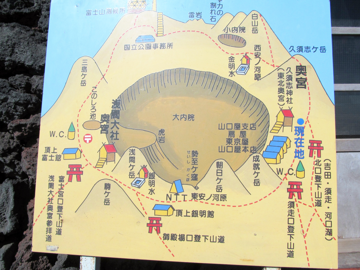
◆ Bowl tour
Although it arrived safely at the top of Mt. Fuji, it is not the highest point here. Walking the crater, the altitude of 3776 mKenzokuenI have to walk to it. To go around this crater is called "Cruising a bowlI call it. Fuji which is also a volcano has been realized by seeing the vivid crater at "Going around the bowl". A strong wind was blowing in "bowl tour", so I had to wear a jacket. I clothed sweat so it was okay for light clothes, but as the wind blows at the top of the mountain it will cool down at once.
A sign of "going around a pot".
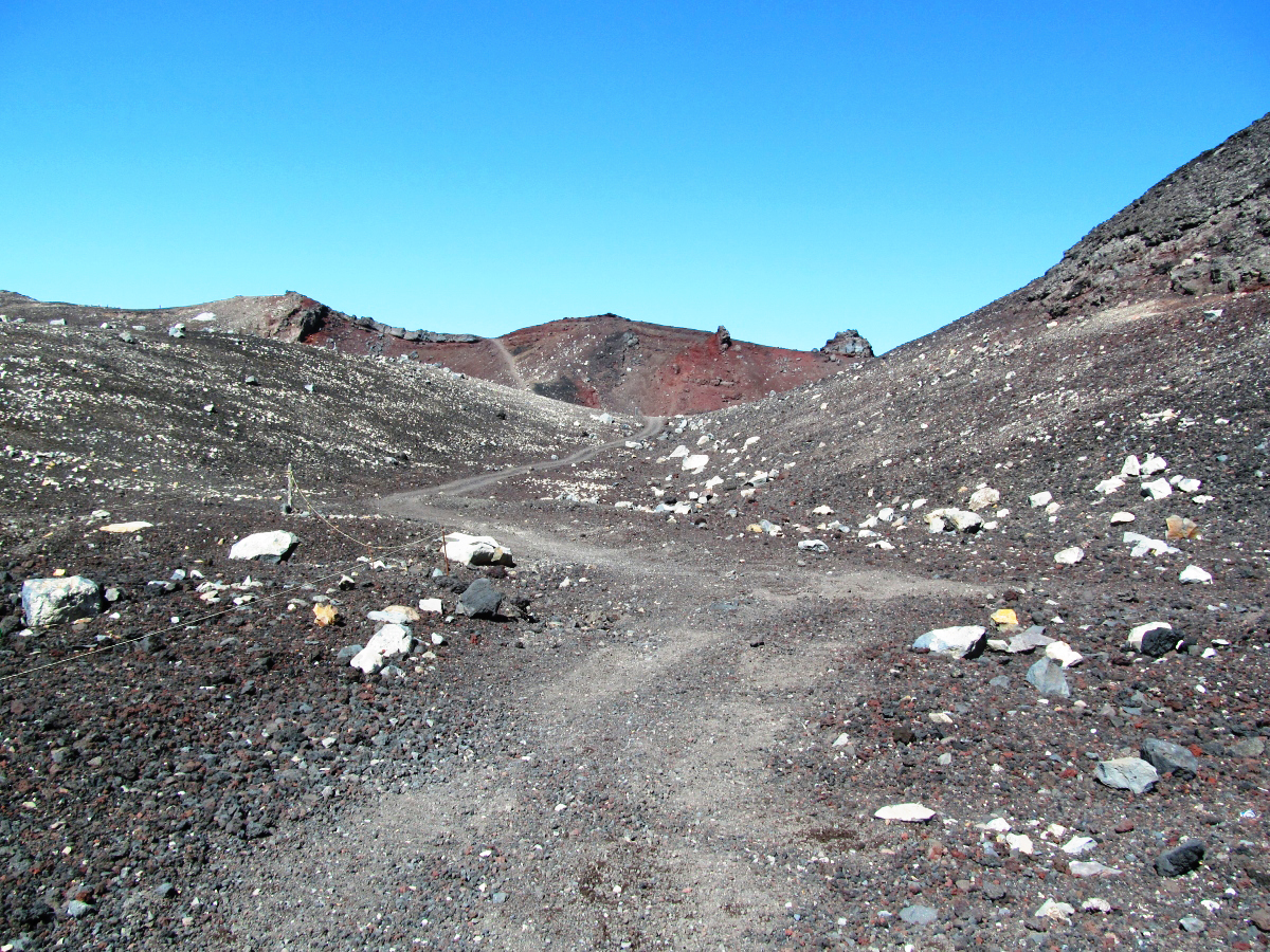
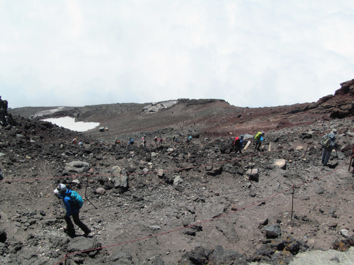
I went round the crater.
There are some ups and downs, but it is a much easier way compared to climbing from the fifth consecutive eyes.
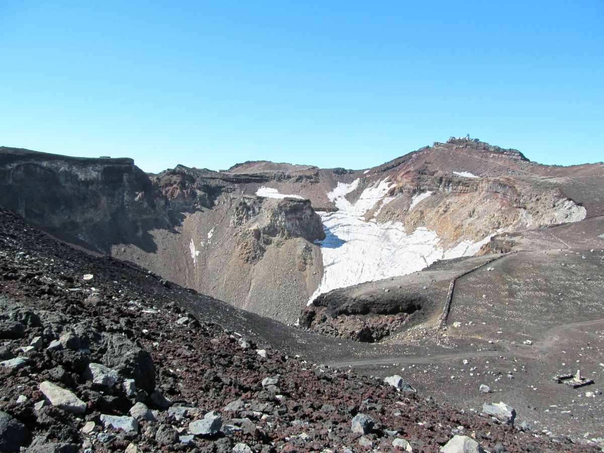
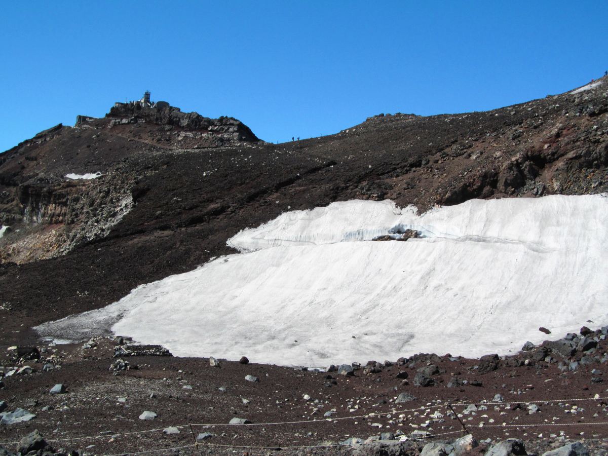
A lot of snow remaining in the crater.
Go up and down a little hill.
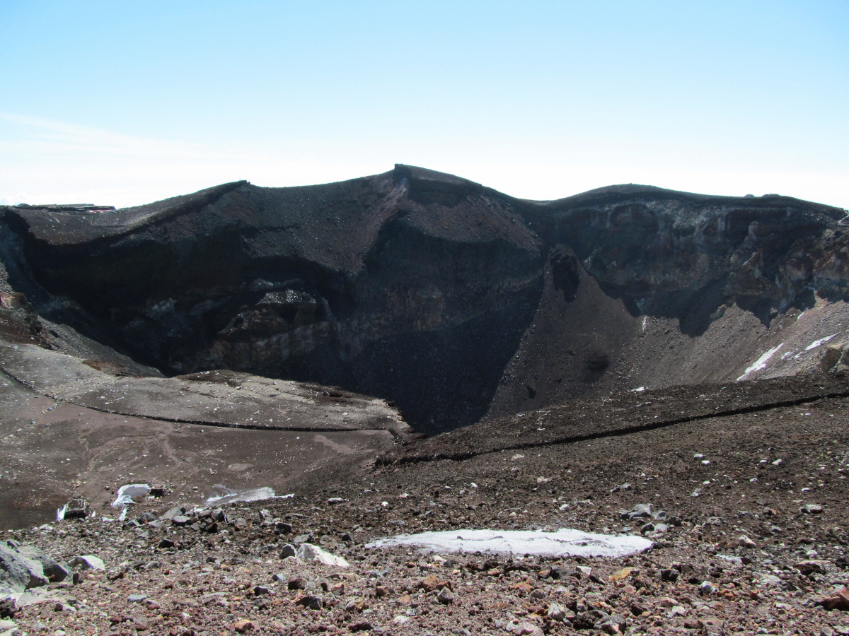
Mt. Fuji crater whose center is dented.
Mt. Fuji can only be seen from the top. Here you can see the fear of Mt. Fuji which is a volcano.

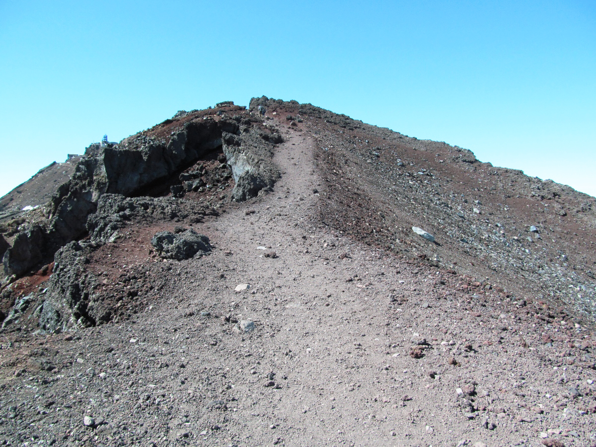
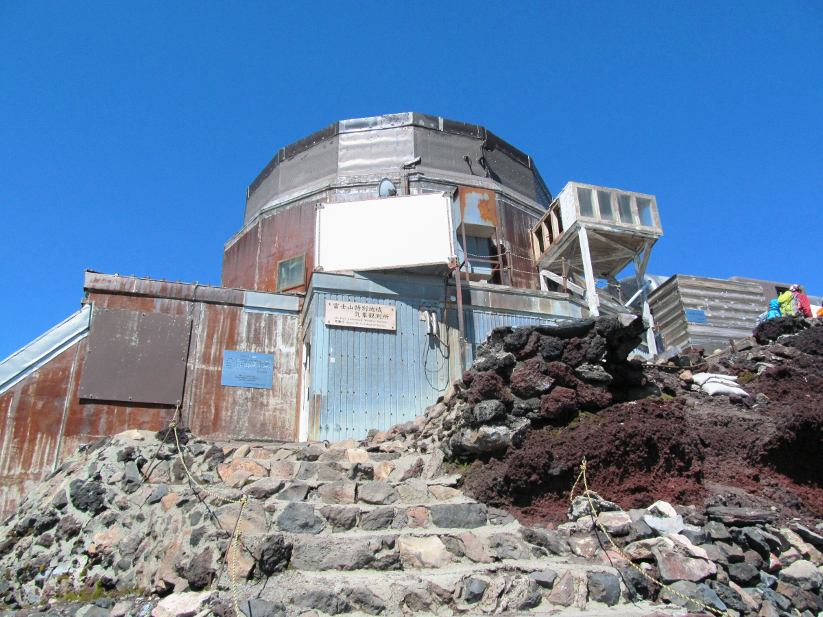
The highest point in Japan was near the Mt. Fuji special region weather station.
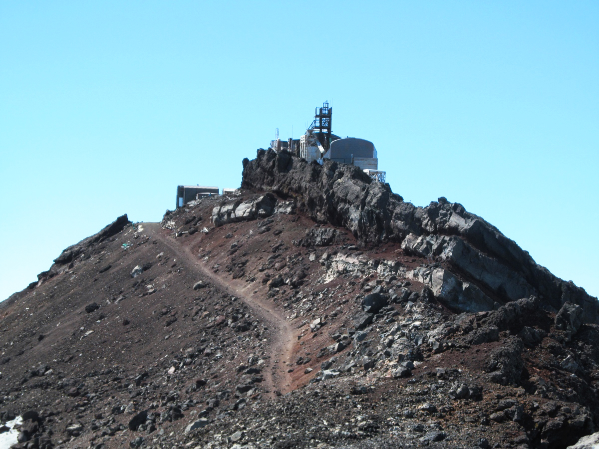
A meteorological observatory that is invisible to the adult 's secret base.
There was a monument of Kendoko with altitude of 3776 m here.
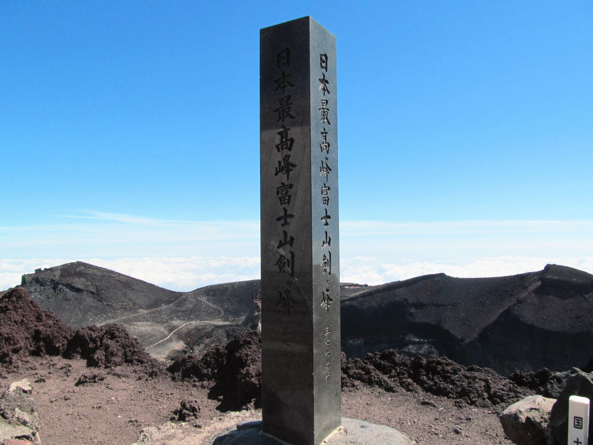
Altitude display of the clock. Since it is not adjusted, please forgive the error.

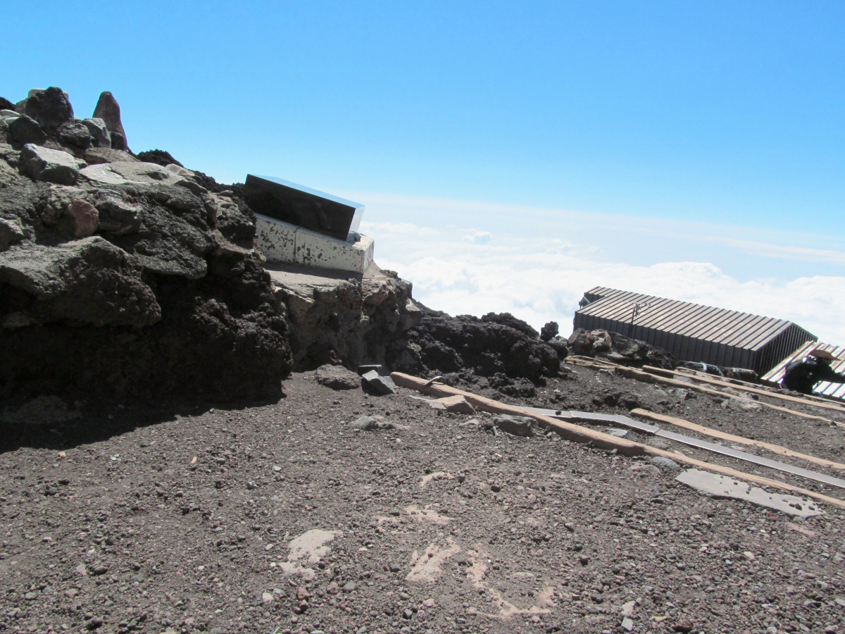
Scenery seen from the highest point in Japan.
This is the summit of Fujinomiya mouth.

hereFuji Mamiya Asama ShinshaThere is Okumiya of.
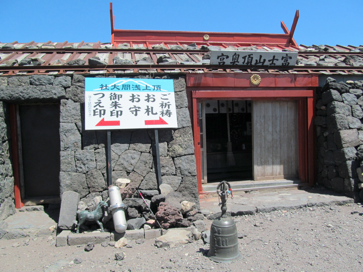
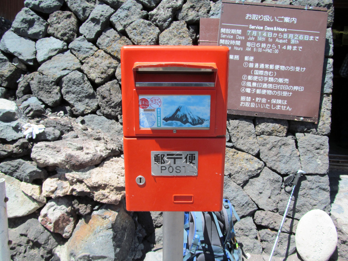
And also the post office.
Climbing mountain sign of Fujinomiya mouth.
People coming up from Shizuoka prefecture in Fujinomiya mouth, not Yamanashi Prefecture in Yoshidaguchi. A little wonder.
The appearance of the crater as seen from the top of Fujinomiya mouth.
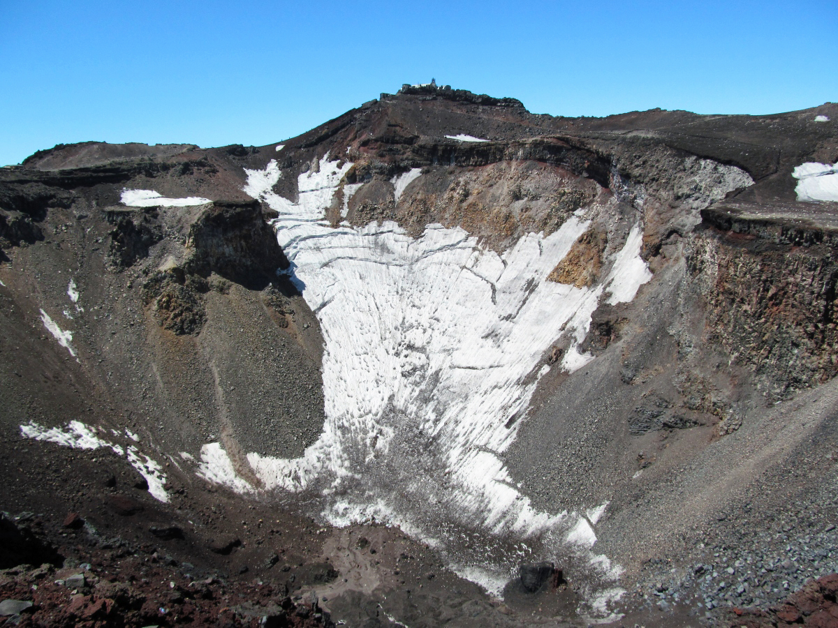
The crater also changes its expression depending on where you see it.
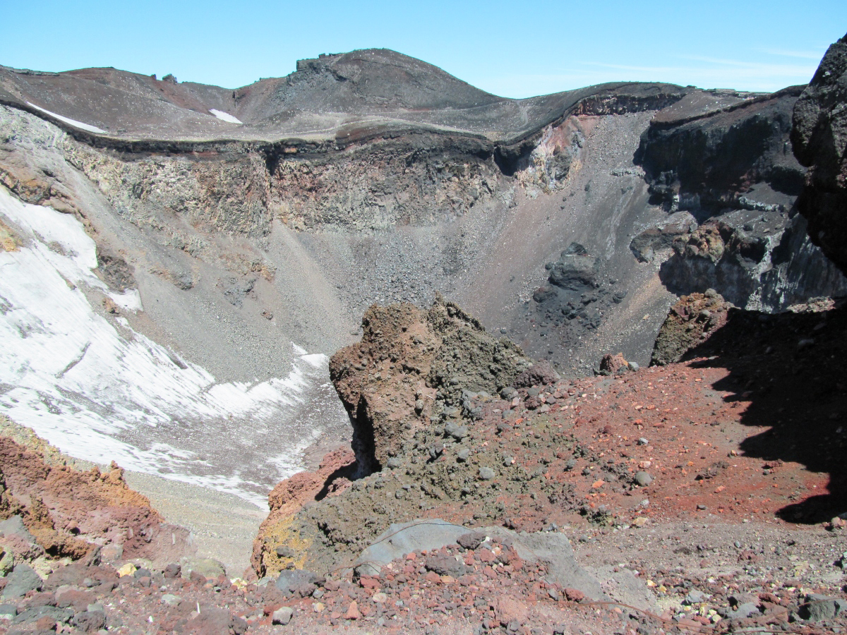
The sea of clouds on the right and the crater on the left.

A steep slope at the summit where you do not want to collapse.
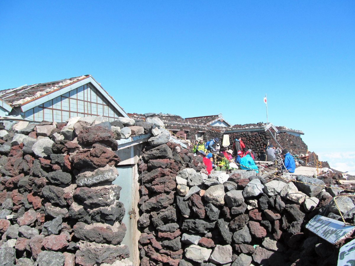
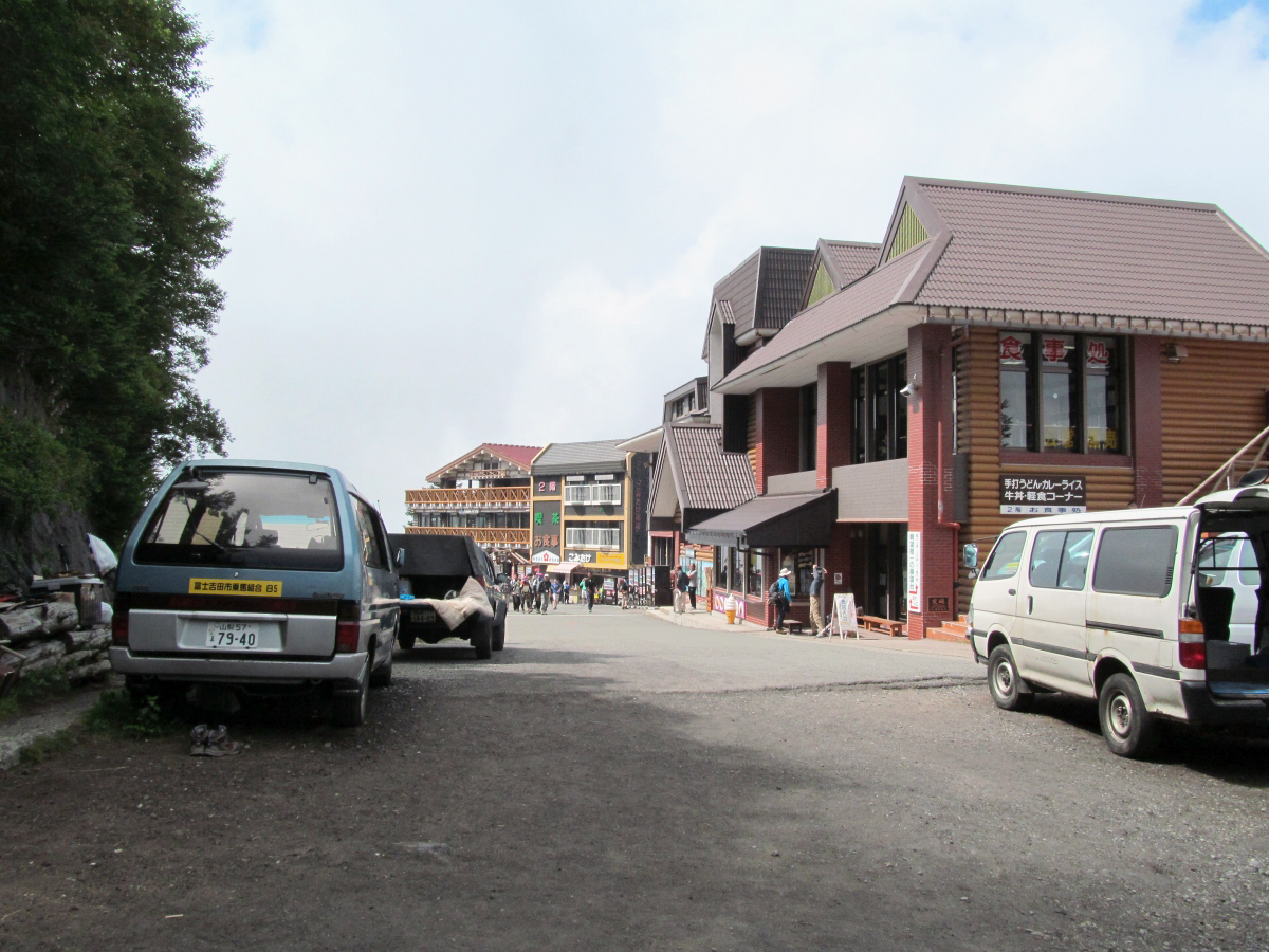
Complete the "go around the bowl" and return to the summit of Yoshidaguchi. It was like an andean highland village atmosphere.
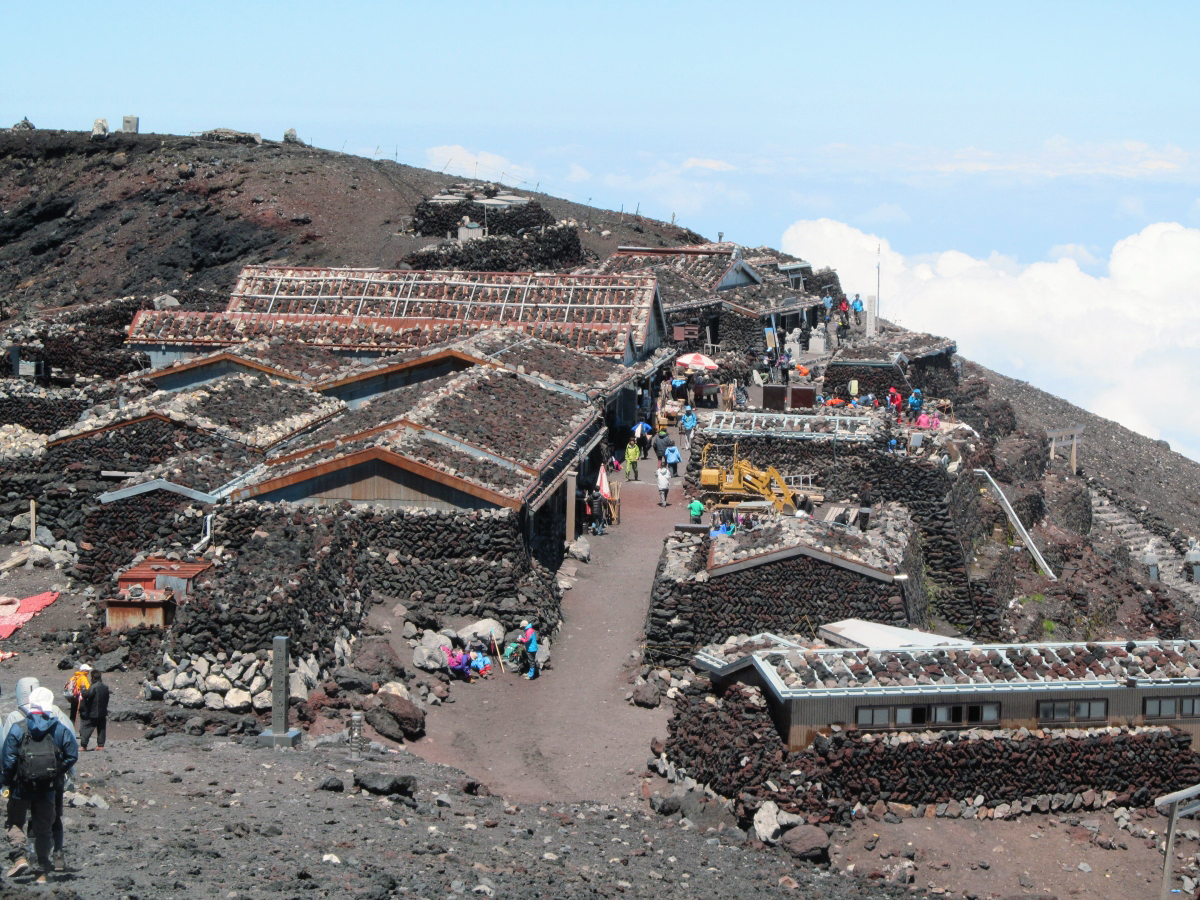
A shop at the top.
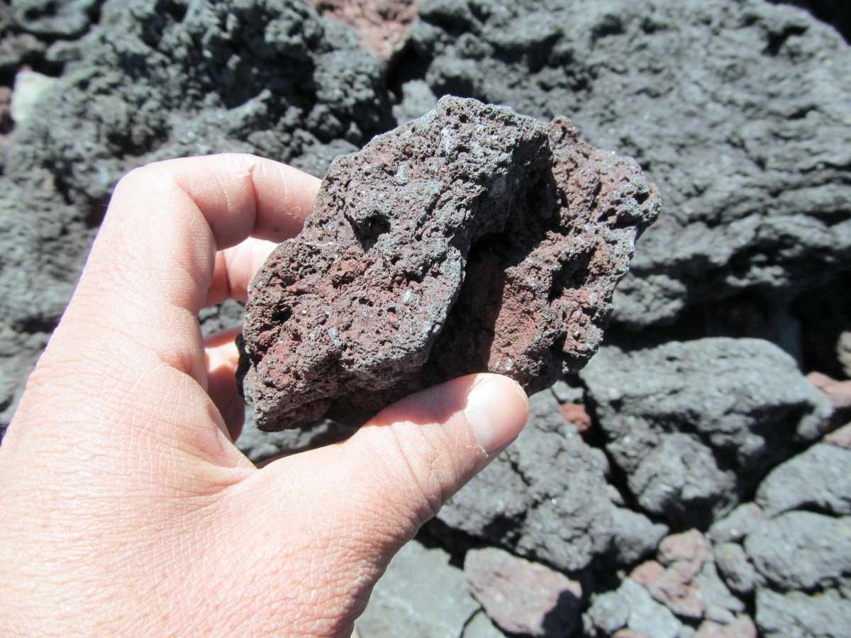
A wall made of rocks at the top of Mt. Fuji.
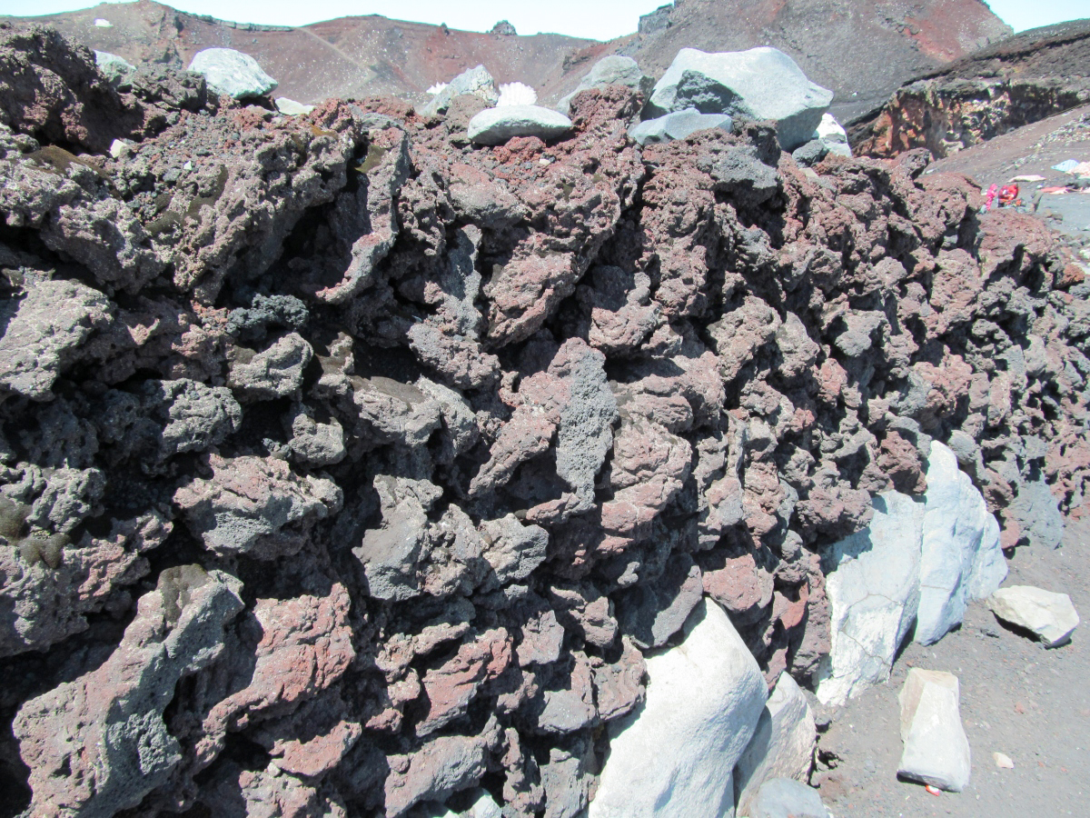
Even if you take it in your hand, it is not heavy as it is faint.
Lunch with canned rice balls and canned pine at work.
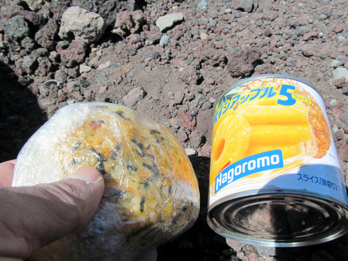
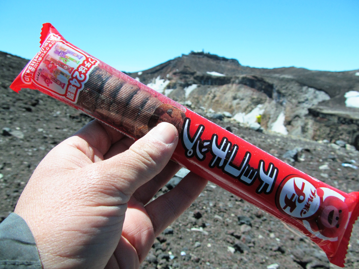
Because the pressure was low, the sweets bag was bad.
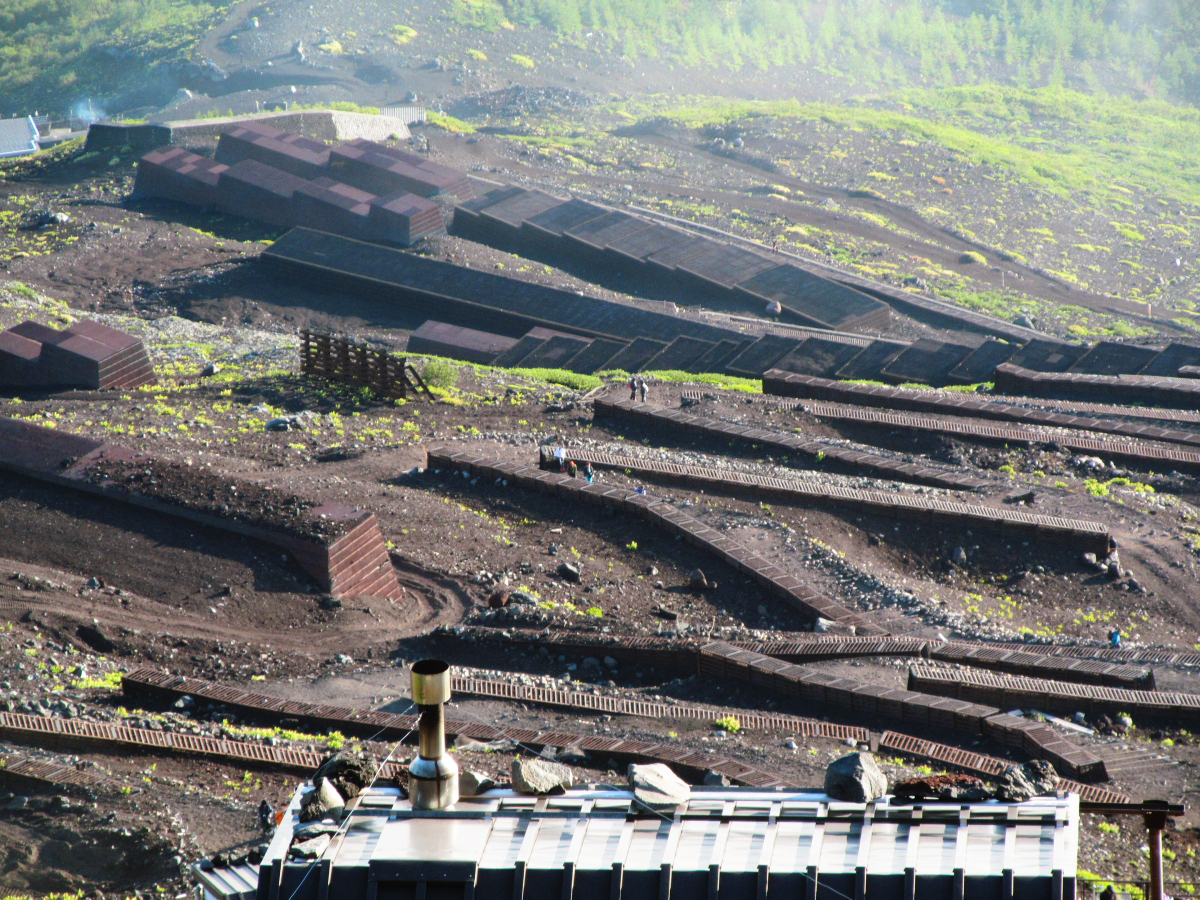
Shimoyama
Yamaguchi's climbing road and Shimoyama road are separate.
Shimoyama road is a road used by bulldozers for unloading.
I went down to slide.

Kujuku way which does not stop even if it goes down.
There is a branch point in this Shimo-yama. Be careful not to accidentally head for "Sukuguchi".
Public toilet in Shimoyama road.
I have to walk another breath if I come down.
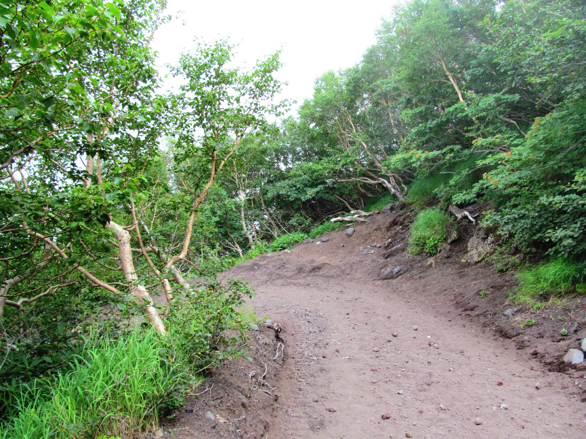
Then I came back to the parking lot at the end of the Fuji Subaru line. Shimoyama took two hours.
The climbing path was well maintained, climbers and mountain huts were also large, making it easy to climb.
Just climbing it is OK. Warm clothes are necessary at the summit. If it rains, rain gear at the time is OK. Please bring the light if it is midnight. I was worried by those who climb up in a light clothing when I am working, but as soon as I get up something, it is my responsibility, so please prepare firmly and prepare.
Then you will surely enjoy Mt. Fuji.
(Sentence / photo: Takuya S. Narou Charriderman
Cycling around the world for a bicyclehttp://shuutak.com)
Related Posts:

in Coverage, Posted by logc_nt