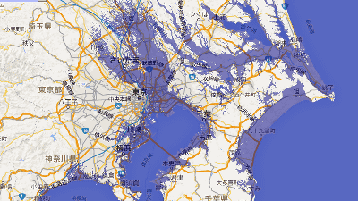
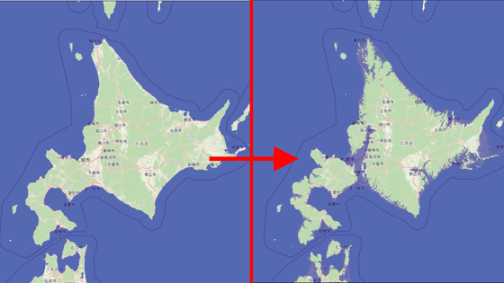
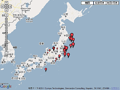
"Flood Maps" to show what happens when the sea level rises
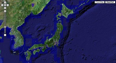
As a result of global warming, you can see how many meters above the place where you live will submerge as the sea level rises. Since we are using Google Maps, we can consider two patterns of photos from satellite orbit and normal map display.
Flood Maps
http://flood.firetree.net/
Easy to use, just specify the rate to rise from "Sea level rise" in the upper left. I can understand the threat of sea level rise due to global warming that I only understood vaguely.
...... As we go along this, the land value of zero meters above sea level will fall in the future ....
Related Posts:

in Web Service, Posted by darkhorse_log