'Trails of Wind', a world map that proves that 'when you look at the airport runway, you can see the movement of the wind on the earth well'
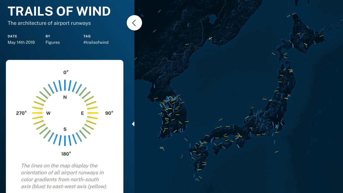
At many airports, runways are constructed to match the average wind direction of the location to prevent crosswinds. Also, where the wind direction is irregular, the runway may be designed in multiple directions to enable smooth takeoff and landing. Looking at the Trails of Wind , which maps the airport runway location and direction on a world map, it is possible to grasp at a glance not only the airport but also the entire atmosphere.
Trails of Wind
Making-of: Trails of Wind-Towards Data Science
https://towardsdatascience.com/trails-of-wind-39967f07a67f
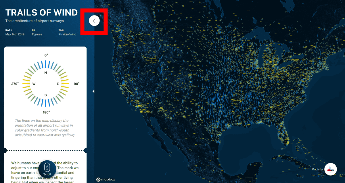
It is like this when you access Trails of Wind. Click the “[” icon in the upper left to close the explanation field displayed on the left.
The map can be enlarged or reduced with the mouse wheel. The straight line on the map is the runway, the runway running from north to south is blue, the runway running from east to west is yellow, and it is colored according to the direction of the runway.

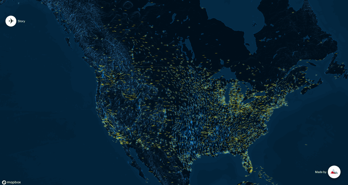
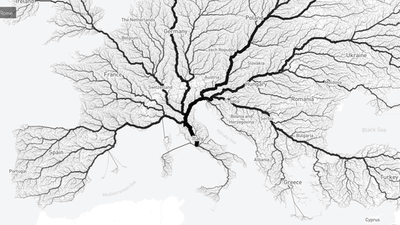
Looking at the map of the North American continent displayed by default, it is impressive that the northwestern United States has many runways on the north and south along the Rocky Mountains, and the west where the plain spreads has many runways on the east and west.
Drag the map to see runways outside the United States. When Japan is displayed, it looks like this.

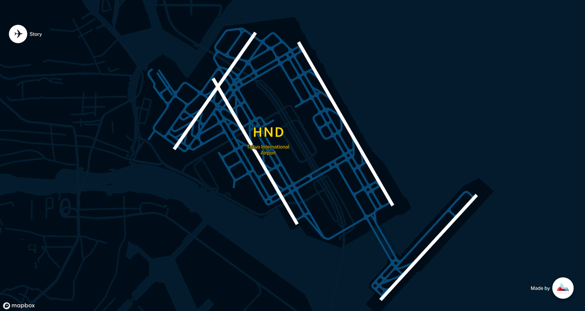
The following is zoomed around Tokyo Bay.
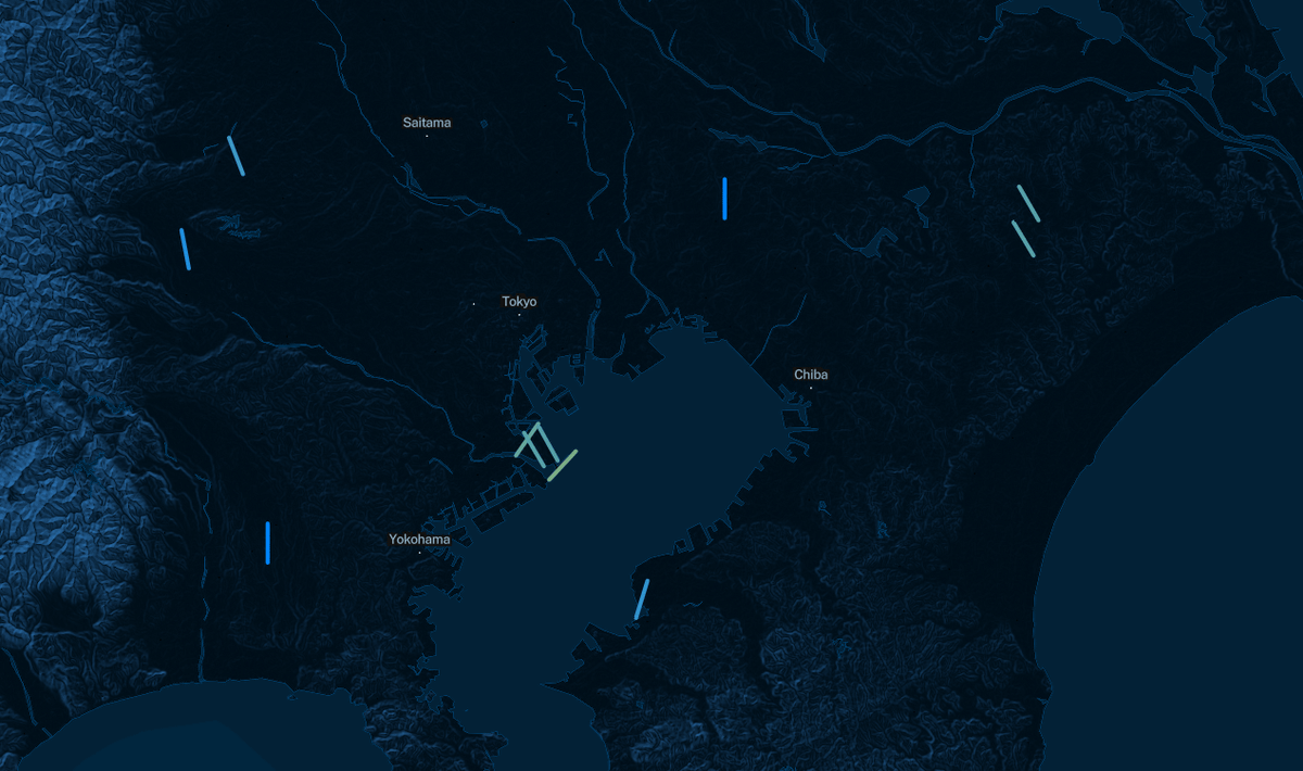
When I zoomed in and went to Tokyo International Airport (HND), the airport structure and airport code were displayed. Of the four runways at Tokyo International Airport, runways A and C run northeast and runways B and D run northwest are used according to the direction of the wind.
The development staff of Trails of Wind discovers our open source database `
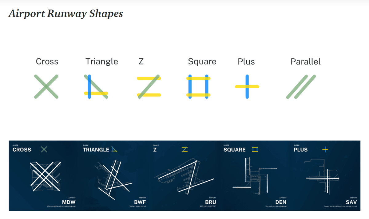
It seems that the runway is basically designed according to the wind direction, but in areas where the wind direction is not constant, the runway can run in multiple directions, as shown in the airport runway shape example shown in the image below. There are also patterns to design the road. Tokyo International Airport is one example. In addition, some runways, mainly in South America, Africa, and Oceania, do not have clear geographic information, and there seems to be a lack of data.
The development staff said, “The wind circulates on the earth, forms a huge 'probability pattern', becomes part of human culture and is reflected in architecture. The airport runway is designed to depict the complexity of the earth. Is hidden and we have visualized it, because the airport is built along the direction of the wind, so the invisible Earth's wind is expressed in steel and stone and becomes visible. While interpreting humans as the creators of their living world, they continue to rely on the laws of physics and nature, as humans are inevitably as airport runways depict wind movements. 'The world is depicted in culture, and the beauty of the earth and the existence that dominates the earth are vast beyond human imagination.'
Related Posts:


in Review, Web Service, Ride, Posted by log1i_yk