Unicorn and mermaid · centaurs are drawn on the largest world map created at the time in the 16th century
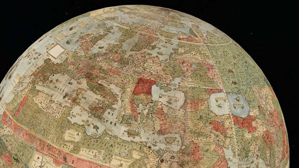
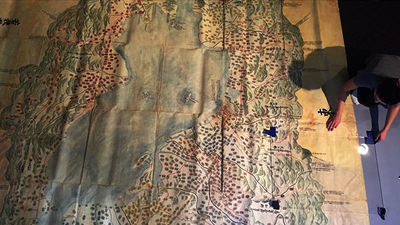
It consists of 60 pieces and the world map which becomes the largest size at that time was newly released when joining together.Bird's eye viewMaps created with centaurs, mermaids, monsters and so on are from Stanford UniversityDavid Rumsey Map CenterAlthough it is made into a 3D globe by digital processing, it is surprisingly precise.
Newly Unveiled 16th-Century Map Shows a World Filled with Centaurs and Unicorns
https://www.livescience.com/61297-renaissance-map-goes-on-display.html
David Rumsey Historical Map Collection | Largest Early World Map - Monte's 10 ft. Planisphere of 1587
https://www.davidrumsey.com/blog/2017/11/26/largest-early-world-map-monte-s-10-ft-planisphere-of-1587
It was in September 2017 that David Rumsey Map Center got a map drawn in 1587. This map was created by aristocrat Urbano Monte who lived in Milan during the Renaissance era. Monte, who was married at the age of 35 and was blessed with four sons and one daughter, did not need to work because of being a wealthy family, collecting books in his library for lots of time, He said he was devoted to pursuing interests.
At the age of 41, Monte is interested in creating maps. In 1585, the first European embassy in Europe was opened in Milan, Monte who visited the site said that he was interested in Japanese geography. And we started on a map creation project as a way to integrate geographical knowledge.
The map created by Monte is extremely accurate and quirky finish compared to the map that was created at the time.
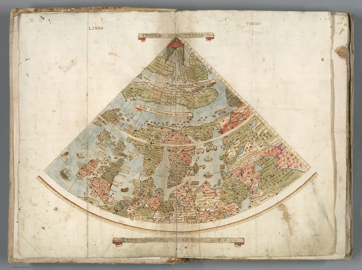
The map created consists of 60 hand-drawn manuscripts, which are ten feet (about 3 meters) square in size and are the largest in the world as a map made in the 16th century.Azimuthal azimuthal projectionIt is said that distortion is occurring in Antarctica because it is drawn in.

Each piece is like this.
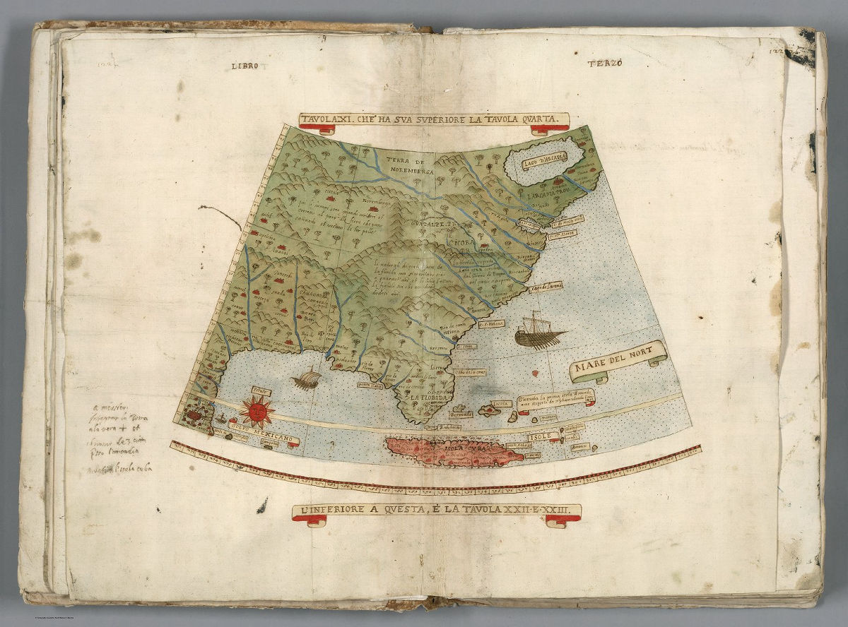
The following piece depicts Florida and Cuba in eastern United States.
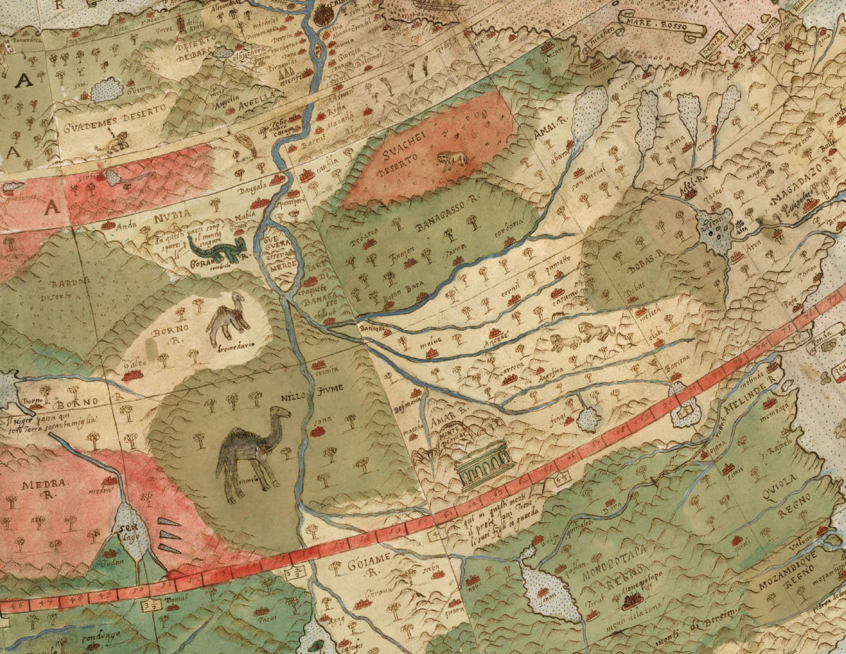
The decoration is also fine, science, history and art are united, and the overall level of the map is evaluated as very high.
"GIAPONE ISOLA" is written in Japan. It is very different from Japan which is drawn on the current map.

There are unicorns in the map ......

A monster attacking a ship
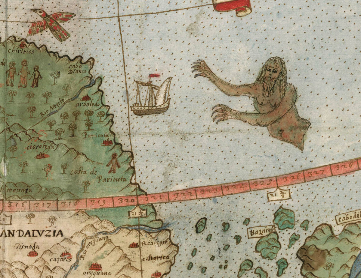
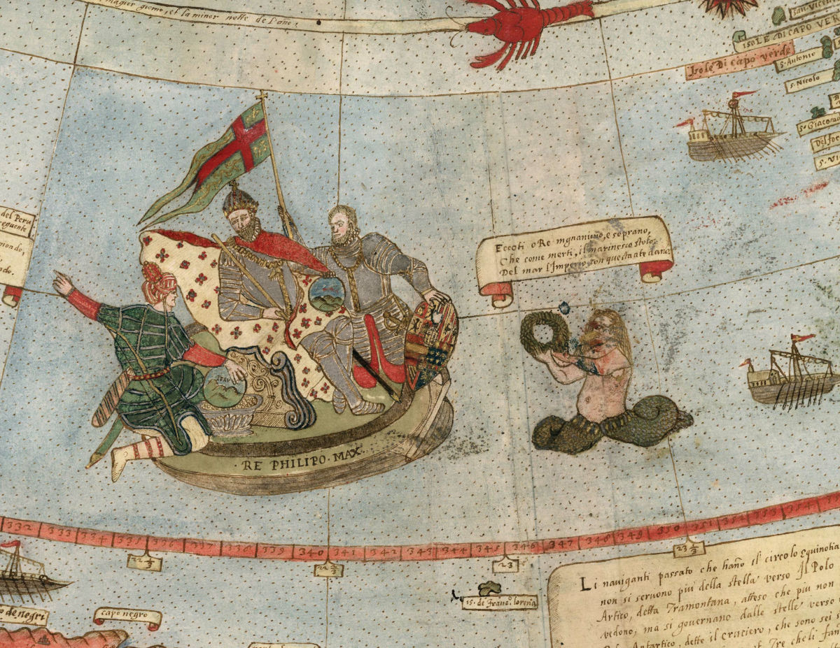
With mermaid etc.Felipe II of FranceThe figure of the politician is drawn as well.
There also existed drawings depicting the state of the solar eclipse.

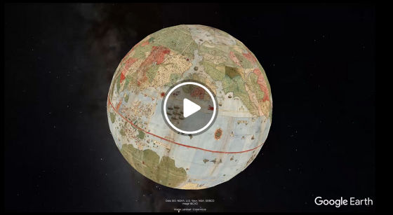
In addition, from the link below it is possible to watch a movie of the world map of Monte drawn digitally and made into the globe.
Composite: Tavola 1-60. (Map of the World) (In Google Earth) - David Rumsey Historical Map Collection
Related Posts:

in Note, Posted by darkhorse_log