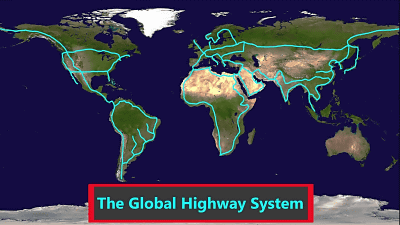
Is the "global highway network" covering the continent of the world ants?
Even when saying "the world has become smaller" thanks to the net, the size of the Earth itself is unchanged and the physical distance of each city in the world has not shrunk. The realistic means by which humans can move fastest at present is hard to think other than using aircraft, but conversely it is possible to connect all continents with highways on the road, and that is realized It is summed up in the movie about whether it is worth.
What If We Built a Road Around the World? - YouTube
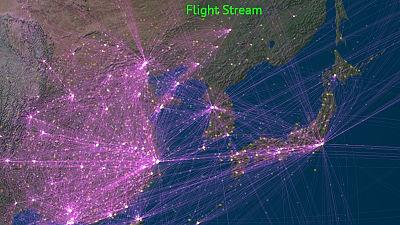
With the spread of the Internet, it became possible to communicate almost anywhere on Earth in near real time. Also, with the invention of the aircraft, human beings can move on the earth at an unprecedented speed, but still the distances to actually move things and people are not shortened.

One thing that mankind has not yet achieved is "to go all over the world with one car".

Is it possible to build a "global highway system" to realize that?

First, let's look at the development status of the highway network and "degree of connection" for each of the four continents where society is substantially formed.

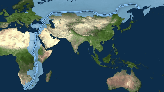
First of all, I will look at the largest "Afro-Eurasian Continent" of the Earth. Looking at the map, it seems that all the places are connected by land ... ...

Strictly speaking, it is actually a mistake.

It lies between the African continent and the Eurasian continentSuez CanalBecause of the existence. The Suez Canal, opened in 1869, is an artificial canal connecting the Mediterranean Sea and the Red Sea built in the Suez Strait, and literally separates the Eurasian and African ground.

However, since there are actually several bridges, there is no need to forcibly say "land continuation".

Therefore, it is possible to think that the Eurasian Continent and the African continent are "a continuation".

The Australian continent also has its own highway network, but the "degree of connection" with other continents is zero as described later.

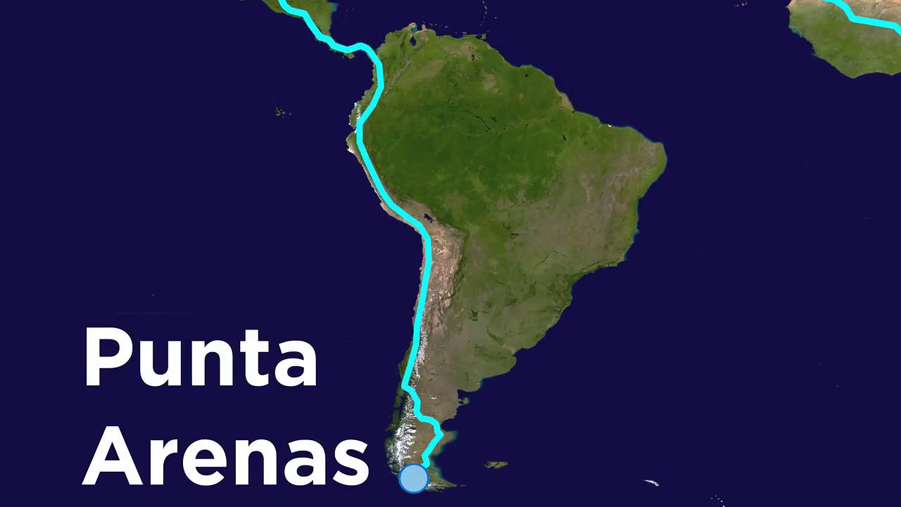
Next, I will look at North American continent and South American continent. Although this seems to be a continuation of the land, ... ....

Connect the Pacific Ocean, the Caribbean Sea, and the Atlantic Ocean by waterwaysPanama CanalThanks to the existence of the land, the land is divided. However, as there are three large bridges bridging, this situation can be called "land continuation" in some way.

However, the real problem lies at the border between Panama and Colombia "Darien GapA wetland belt called.

This area is dominated by militia and narcotics organization, and the road which goes through this is not maintained. For this reason, the North American continent and the South American continent are also not "connected" by road.

In other words, all these continents are said to be "not connected".

Take Cape Town in South Africa as a starting point,Punta ArenasConsider the route which goes up. It is the capital city of Republic of Congo, Kinshasa that can reach from Cape Town by expressway. It only takes 51 hours to go to here.

The road is interrupted at Kinshasa because there is no bridge crossing the Congo River. At present it is necessary to cross the river using a ferry.

If we were to build a bridge here, it would cost as much as $ 444 million (about 48 billion yen).

As this bridge is connected, the most distant place to be reached next is the city called Edalia of the Republic of Morocco. It takes 7 days and 6 hours by land from Cape Town.

And the next obstacle is the Mediterranean.

Edalia is a city facing Spain across the Gibraltar Channel. Because the Strait of Gibraltar has only 14 km in distance, it seems that it is not too difficult to bridge ... ...

In fact, due to the depth of 900 meters, the construction of bridges and submarine tunnels is very difficult.

Therefore, when roughly estimating the cost of linking Algeciras on the other side from Edalya by land, the amount is estimated to be tremendous, that is $ 24 billion (about 2.6 trillion yen).

Conversely, if you cross over to Algeciras, then the town is in the eastern part of Russia ·MagadanIt is possible to cross the Eurasian Continent with Subaru on existing highways. However, the time required for crossing is 7 days and 11 hours.

Forcibly, the route from Cape Town to Magadan was 14 days and 17 hours, assuming that a land route crossed the Gibraltar Strait. It has become a great thing.

People who live in the UK have a cart rain running through the English Channel tunnel that goes through the Dover StraitsEurotunnel shuttleIt is possible to connect to the global highway system while riding in the car by using the "

Meanwhile, it seems difficult to connect Australia and Southeast Asia including Japan.

The reason is that it is too divided at the ocean and its distance is so large that it can not be dealt with by modern technology.

Well, I came up to Magadan, the furthest in Russia, but in reality the Russian ground is still going on.

According to the highway network map of Russia, the highway network is not developed at all in the area from Magadan.

Therefore, it is necessary to newly construct a 2000 km highway to the nearest point in America and Siberia. It is thought that a lot of difficulties are awaiting construction and maintenance of this place because it becomes an extremely cold land in winter this winter.

A 2000 km highway, Russia's farthest land ·WellenReach. By the way, there are only helicopters as means of transportation to Wellen at present. There is a distance of 82 km to Alaska at the other end of the Bering Strait from Wellen.

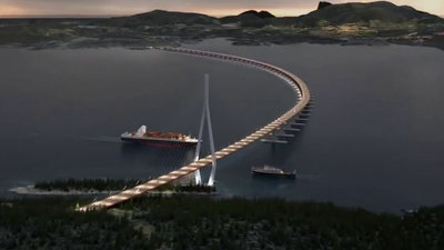
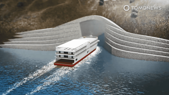
In fact, however, Diomede Island is present in the middle of the strait, so you can simply build a 36 km and 37 km bridge and a 4 km land road. Because the water depth is about 55 meters, it seems that it is not so difficult construction.

But the real problem is that it is in a difficult climate. The cost of building this bridge is seen as $ 150 billion (about 11.4 trillion yen). Is there such an economic effect so far ...?

The problem will continue. The nearest town from the landing site of the bridgeNomeThere are 160 km to 160 km, so it is necessary to build a new highway again.

Furthermore, it is also necessary to construct a highway to Fairbanks, which has the existing highway closest to Nome.

However, once you have come so far you can cross the North American continent to the city of Panama / Yabiza.

And the last challenge is the Darien Gap mentioned earlier.

But if you managed to make a highway in this way too, it will eventually penetrate the route to reach the Punta Arenas in the South American Continent.
To summarize, clearing the obstacles shown on the map somehow and completing the highway network connecting the continents of the world ... ...

A tremendous highway network of 52,000 km connecting Cape Town to Punta Arenas will be completed. It takes 28 days to travel.

And a tremendous budget of 233 billion dollars (about 25.5 trillion yen) is needed.

Nonetheless, this amount is just over 1% of the GDP of the United States, which is just enough to cover 38% of the annual cost of the US military.

Those who thought, "Those who thought that" There is not much in terms of cost "should remember a certain fact. When you fly from Cape Town to Punta Arenas, the cost is just 2000 dollars (about 210,000 yen) ......

This time is also "only" 27 hours.

On the other hand, trying to move the same spot on the Global Highway System takes 675 hours.

In this way, it is a global highway system that seems to be just meaningless if it arranges only numbers, but why the feeling of thinking "I want to run ... ..." from the bottom of my heart rises up is what the hell Is it ...
Related Posts: