"Zenrin Virtual Museum" which allows you to see precious old maps from the time before Edo Period Futures to the end of Showa era using a browser
The largest map production company in JapanZenrinHas digitized old and new domestic and overseas maps that we have so far released and has published "ZENRIN Virtual Museum"is. Since about 220 kinds of maps of various kinds created before Edo Open Fure by the late Showa era are published, I tried to see the old map actually.
Zenrin Virtual Museum
http://www.zenrin.co.jp/zvm/
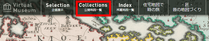
After opening the above URL, click "Collections public map list".
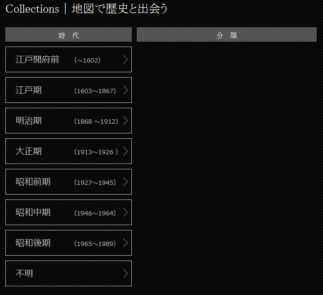
In the page of the public map list, it is possible to search the map published from "era" and "classification". The era of open maps ranges from "Edo Opening Front" to "Showa Late".
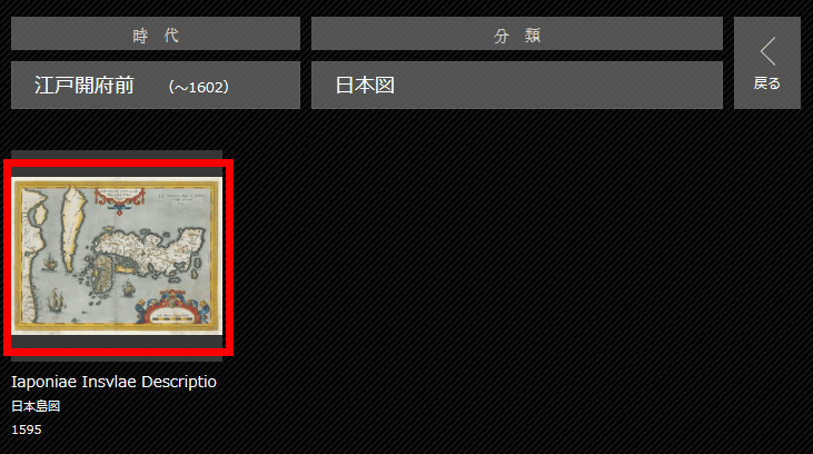
For example, if you click "Edo-opening prefecture (1602)" and click "Japan map" ...
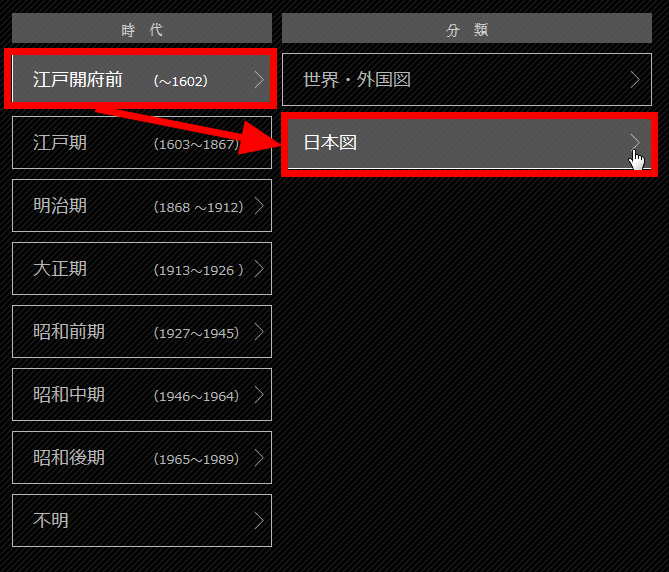
A Japanese map created in front of Edo-ku is displayed. Click on the thumbnail ......
The selected map is displayed. This map was created by Mr. Teisera of the Portuguese who was the cartoonist of the Spanish royal family, and the 1595 edition of Abraham Ortelius "World stageIt is what was put on.
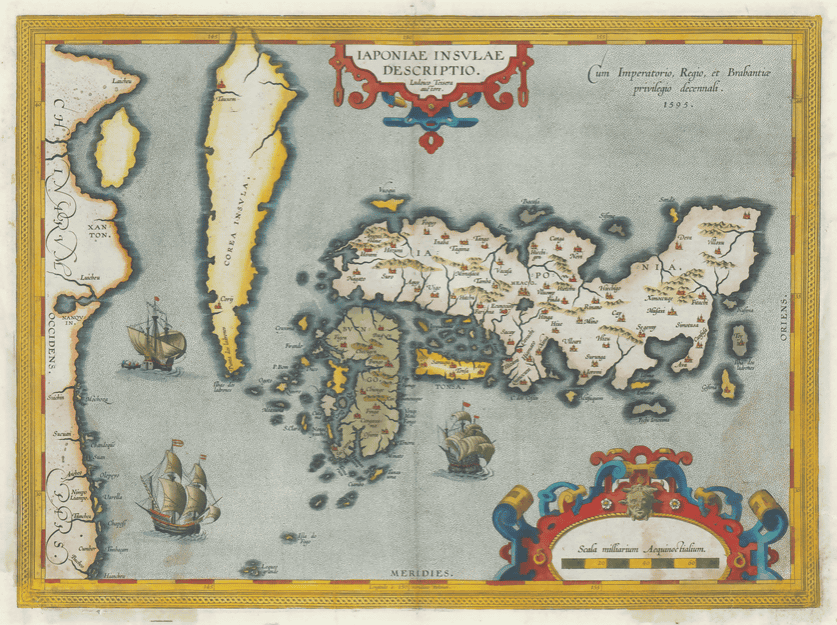
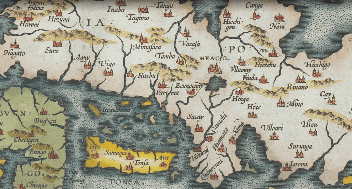
You can zoom in and out by double clicking on the map. Sakai is displayed as "Sacay", and it is also appreciated where you can see the letters clearly.
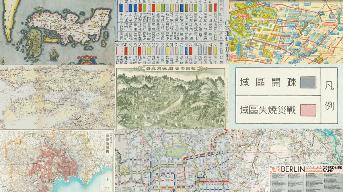
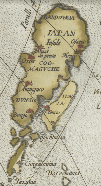
So I tried picking up some maps released at Zenrin Virtual Museum. This map is based on "the world stage" that appeared earlier "Asia New Figure"is. Japan is drawn on the top right of the map.
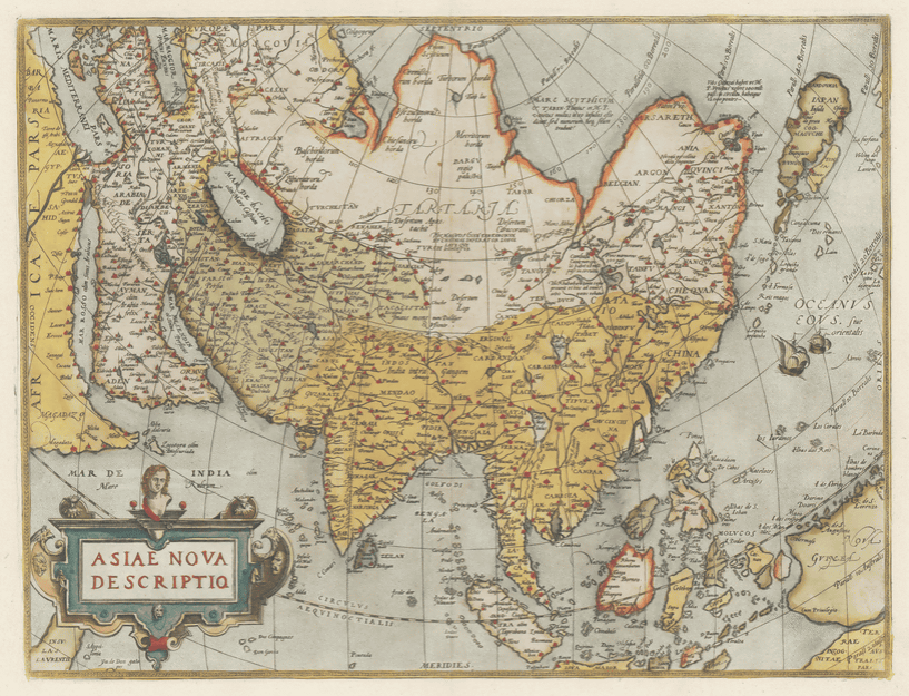
"BVNGO (Bungo)" is in Honshu, "Cangaxuma (Kagoshima)" is an island, it is far from the modern map.
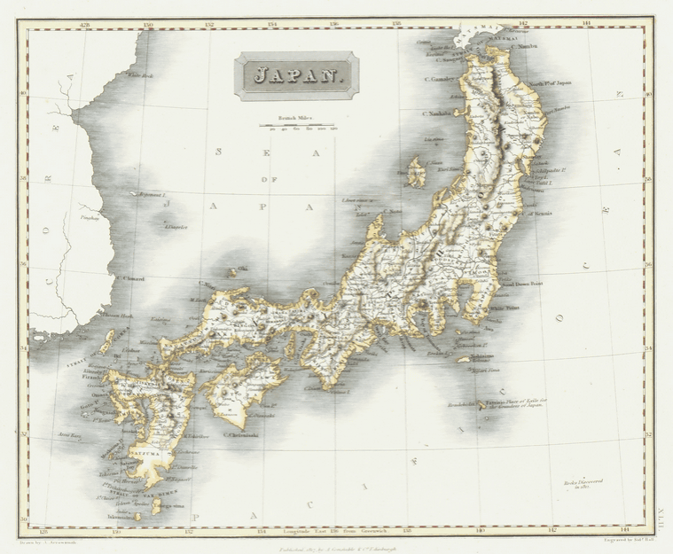
Japan diagram created by Aaron Ariomenin in the Edo Period of 1817. It is quite close to the current one, but Yamaguchi prefecture is getting thinner, and there are still more subtle differences.
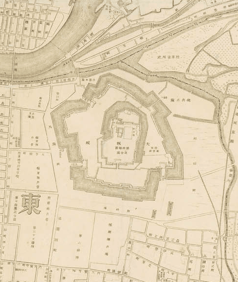
Osaka city map made in the 1901 Meiji era.
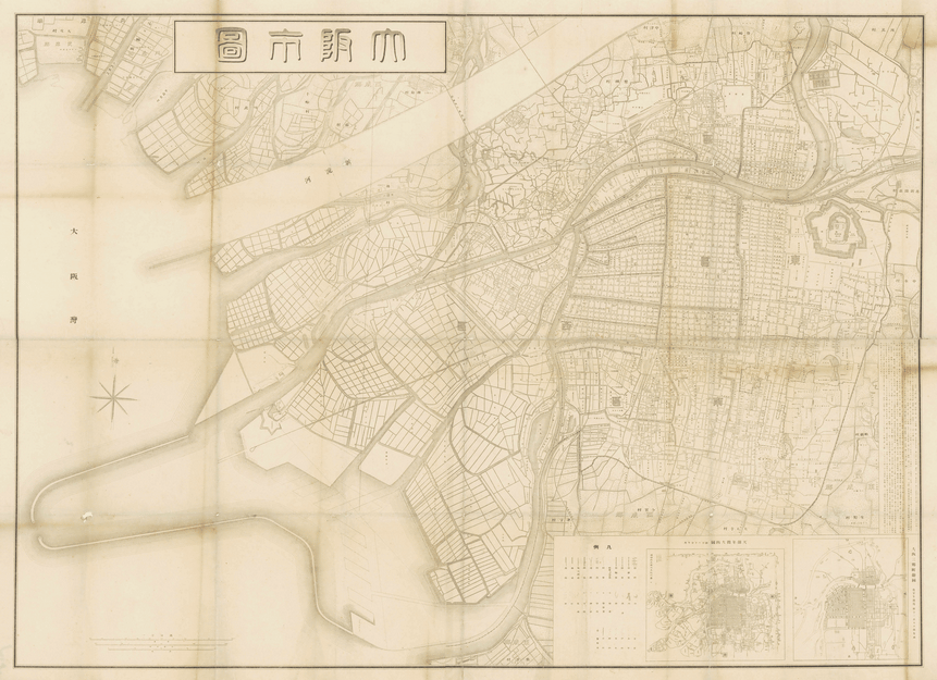
I zoomed in and found Osaka Castle when I saw it.
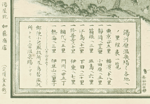
From the Meiji era, the category "road map, travel guide map, tourist information map" was added to the classification, and the following is the map for souvenir of "Aizu Yugawara Onsen".
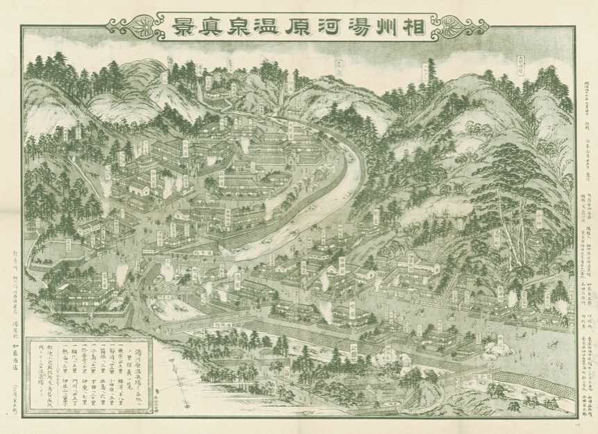
In the lower left of the map the price is written as "5 sen".
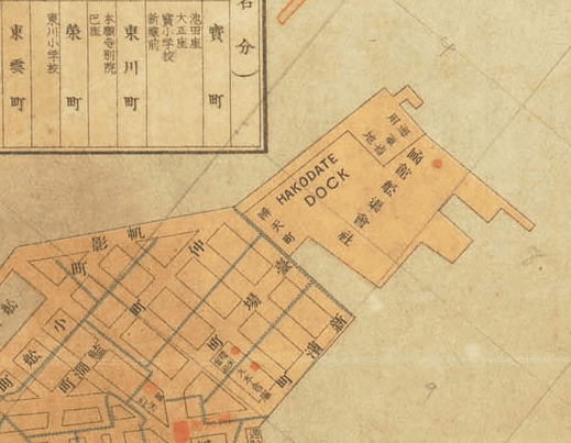
The whole map of Hakodate city which was created in 1913.
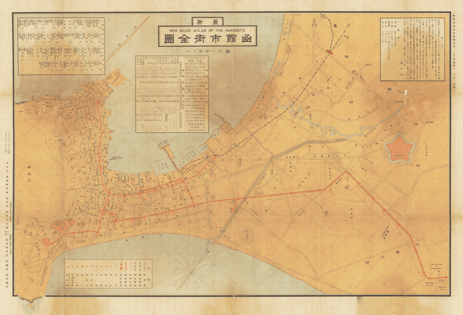
Since 1854 when the Treaty of Japan-US and United States of America was signed, Hakodate of that time has developed as an international city, and the map shows the Romanization notation "HAKODATE DOCK" on the map.
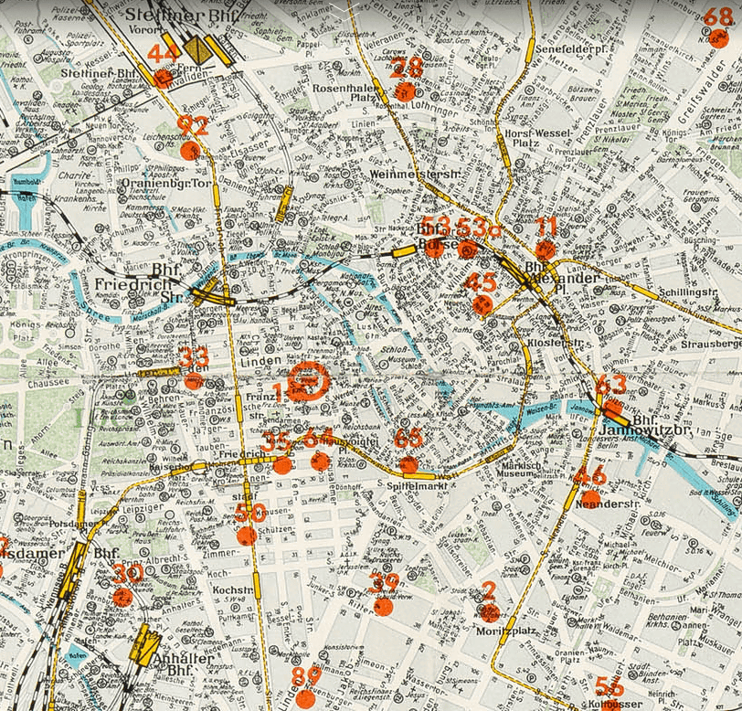
A map of the Berlin Olympic Games held in Berlin, Germany in 1936.
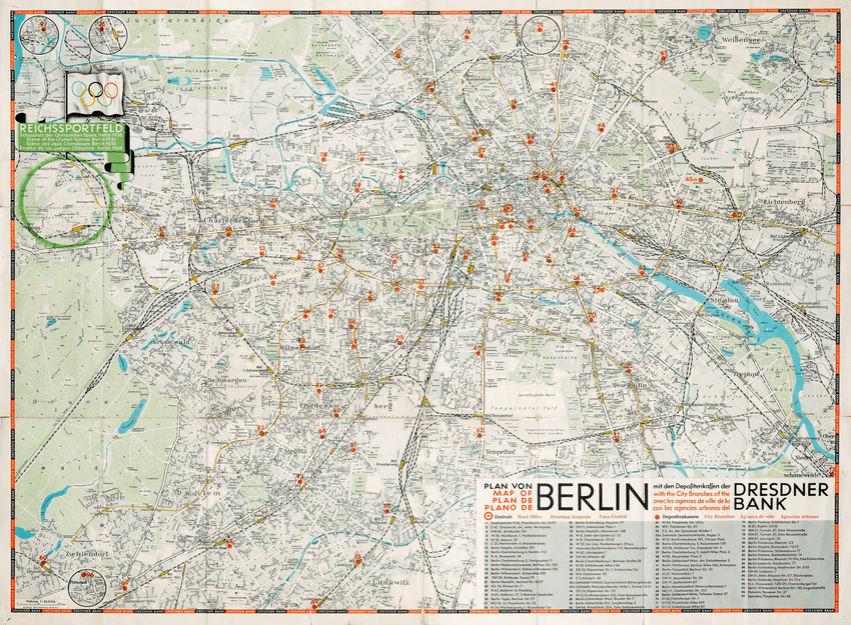
Orange points numbered are considered to indicate stadiums and facilities.
"From the first half of the Showa period to the middle period," war related chart "showing war, war situation, war damage, etc. was added to the classification.
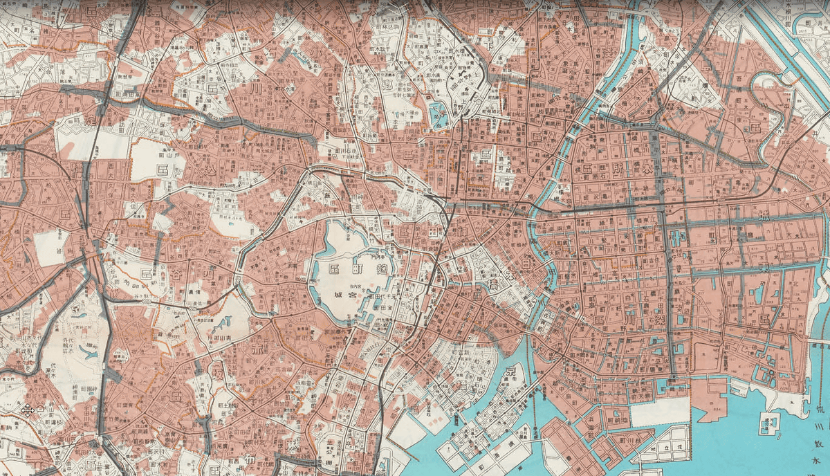
"War damage burning area display Neighborhood map of the imperial capital (35 ward system)" represents the area burned out by the war damage on the map, and the present situation of Tokyo at that time is transmitted.
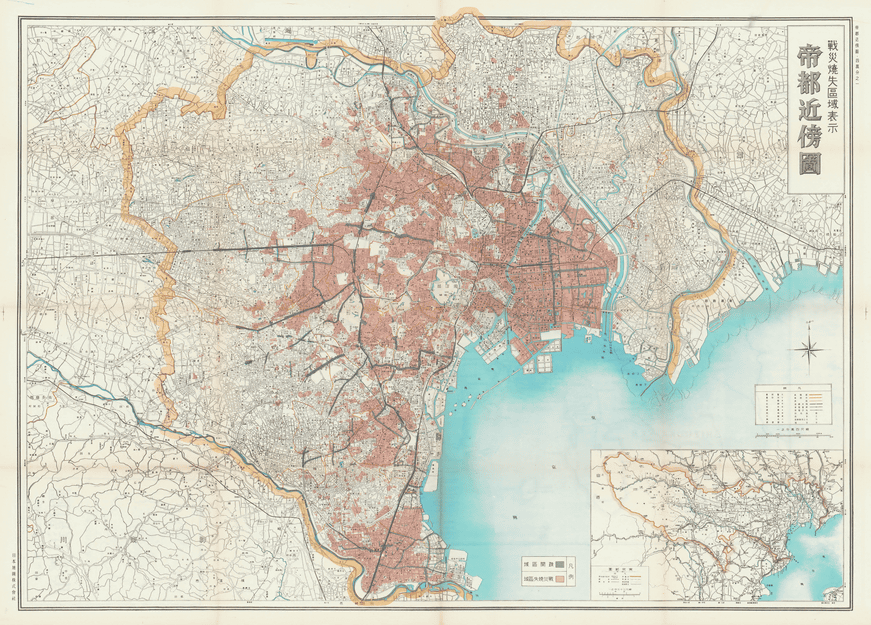
It is said that gray represents "evacuation area" and red represents "war-burned-down area".
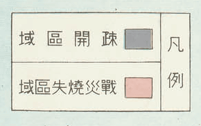
Most of the east of the Arakawa is a burned area.
"Tokyo Metropolitan Information Guidance (Incorporated in Tokyo Traffic Planning)" made in 1955
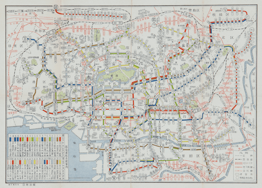
On the lower left of the map, driving system information such as the starting station and the terminal station is displayed.
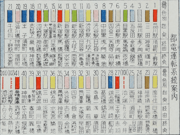
The biggest terminal of the time at the time was Suda Town in Kanda where 10 routes were on the way.

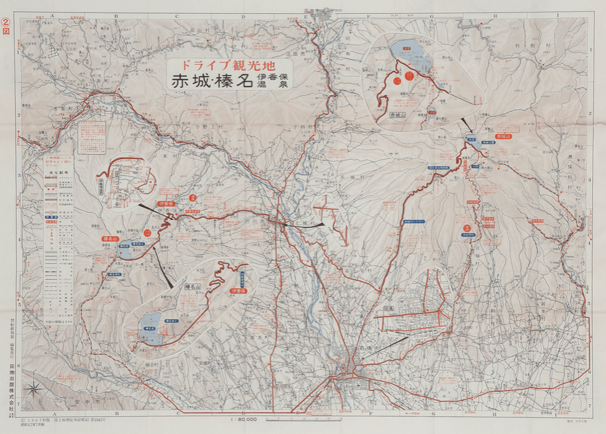
"Niche Drive Guide ⑨ Akagi · Haruna" was created in 1967 when the Kanetsu Expressway and Route 353 were not open, is a drive map that introduced six courses including Akagi Yama, Ikaho Hot Spring / Haruna Lake Route.
This is a map for foreign tourists "GUIDE OF TOKYO" made in 1970

In the sightseeing spot there is a speech balloon in which an explanation is written.

If you look at the map published at the Zenrin Virtual Museum, you will be able to visit and learn about the old Japan, and there is no doubt that time has passed while you do not know. People who want to see more maps are located in Kitakyushu City, Fukuoka Prefecture "Zenrin map drawing facilityIt might be good to visit.
Related Posts:


in Review, Web Service, Posted by darkhorse_log