About 50% of the vast country of the United States map which you can see well that nobody lives
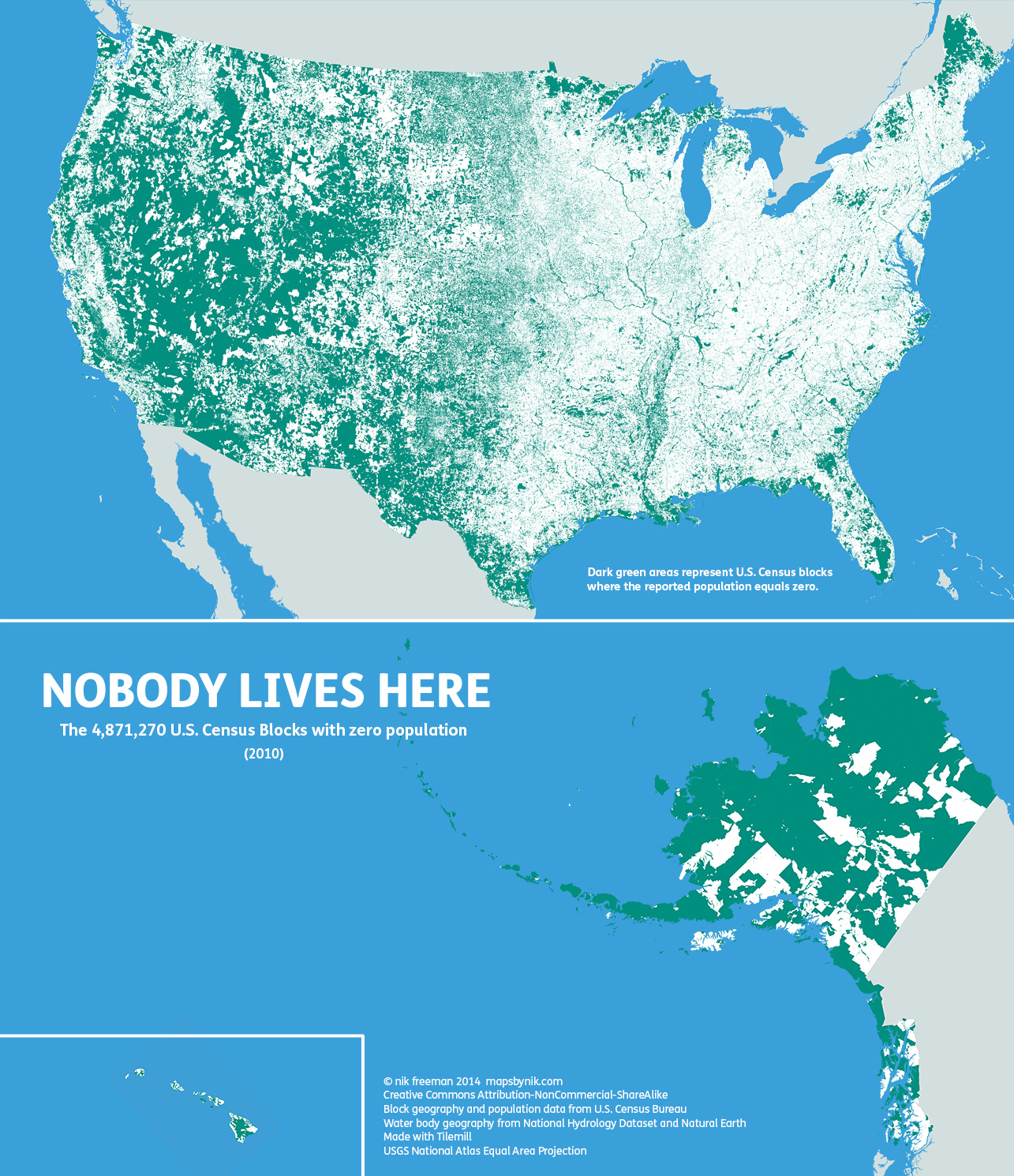
America has a population ofApproximately 317 million people are the world's No. 3, The area of the country except the territorial waters is about 9.16 million square kilometers, and this is also the third largest country in the world. Investigate a vast country landUnited States Census BureauA geographical unit used for creating statistics "Census subdivisionThere is a thing called a map that distinguishes between the area where the residents are confirmed and the area with the zero population among them, and a map that shows at a glance where the person does not live in the United States is released.
Mapsbynik: Nobody lives here: The nearly 5 million Census ...
http://mapsbynik.tumblr.com/post/82791188950/nobody-lives-here-the-nearly-5-million-census
The following map shows the presence or absence of the population in the census subdivision of the mainland of the United States. White corresponds to the category where people live in somewhat, green corresponds to the category with zero population. Clearly understood from the map that the western half of the mainland of the United States occupies most of the population with no population, and the opposite phenomenon occurs in the eastern half. Also, it is known by the creator of the map that only 47% of the country except the US territorial waters lives there.
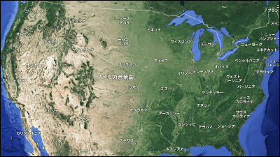
As you can see from the mainland of the map on Google Maps, the western half of the mainland is mostly inhabited by people, such as deserts, wilderness, and mountain ranges, whereas the eastern half are green and areas where people live are more prevalent .
Focusing on the west half of the mainland, many people live in California and on the coast of the west coast, but the central inland is mostly green.
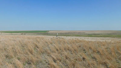
When looking at Google map, you can see that deserts and desolate areas are dominated around Nevada State and Utah State with few population. In addition, there are many national parks where people are not permitted to live, in addition to a strict natural area in the western half, so it is said that the population is extremely low.
The eastern half of the mainland is filled with white which the population is confirmed. The main province in the upper right of the map below is a place with zero population.
The east coast where New York, Philadelphia, Washington D.C. gathers seems to be particularly dense is like this.
It is connected near the border of the United States and CanadaGreat LakesI tried close-up to ... ...
It is the westmost sideLake SuperiorAlthough there are many areas with zero population in the surroundings, it seems that people are gathering around the Great Lakes.
It is in the northernmost tip of the United StatesAlaskaThere are not so many people living as it is imagined or what they say with that severe cold weather. The population density of Alaska state is the smallest among all the provinces of the state.
The Hawaiian islands, consisting of eight islands and over 100 small islands, excluding Midway Atoll, belong to the state of Hawaii, USA. One of the most popular travel destinations in Japan.
There are active volcanoes such as Mauna Loa and Kilauea on the lower right of the image, and the area with zero population is quite large, but the other islands are about half of the population with no population.
On the mapAuthorI want you to create a map reflecting Japanese statistics, because I divide various data by color and form rather than statistics, and I am creating an easy-to-understand map.
Related Posts:


in Note, Posted by darkhorse_log