I got off at the trail in the valley of the Grand Canyon and looked up at the rocky mountain
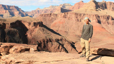
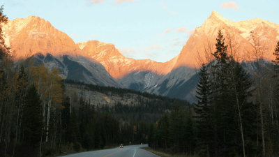
It was Grand Canyon that the Colorado River scraped over a long time. It is also registered as a World Heritage Site, and I am attracting many tourists visiting from all over the world. There are numerous observation stands along the valley extending to the east and west, and it was overwhelmed by the scenery spread far from there. It is pulled in. That is why I was curious about the scenery that I could see from the valley and tried walking on the trail. You can see the flow of the Colorado River, which can not be seen from afar, come close. I ran from Monument Valley loved as the stage of Western play to the Grand Canyon which is a highlight of American tourism.
Hello,Takuya Sudo @ circle around the world bicycle @ Charridermanis. The sightseeing of the Grand Circle which followed Zion, Bryce Canyon, Archie and also ended at Monument Valley and Grand Canyon. It was a fun place to feel the earth rather than nature.
Grand Canyon National Park is here.
View Larger Map
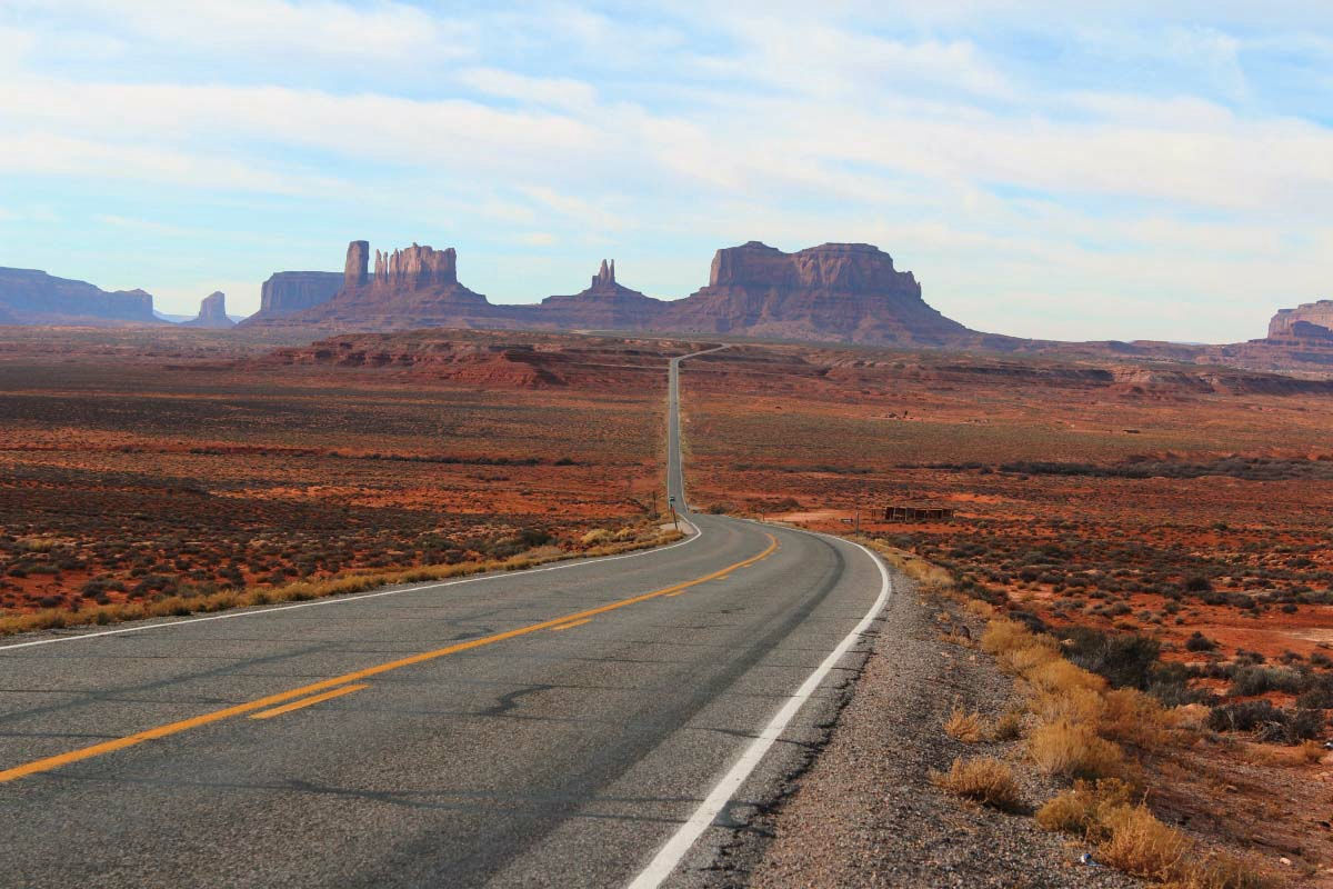
Arches National ParkFrom the city of Moab which is the base point of sightseeingMonument ValleyI will aim for. Beyond the big pass where there was a lot of greenery, the neighborhood became dry and lonesome scenery. The end of the earth. A rocky mountainous rocky mountain near Monument Valley, the scenery which is not painting is different from the image. But when I got inside from the main road and arrived at the visitor center I lost my words. I did not think that it was different depending on the viewing angle, but the scenery of the monument volley which I was holding was there.
The way to the monument volleyball.
It is disappointing though it is coming soon. I'm impatient with "I'm sorry if this is over."
Tentatively, a photograph that looks like that.
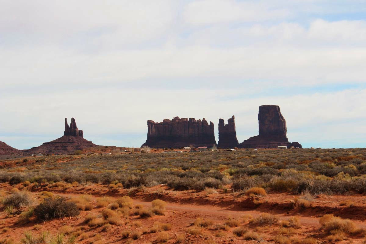
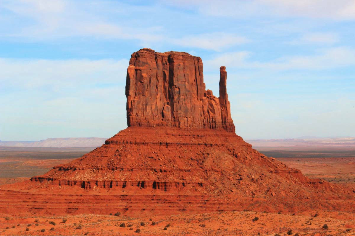
I reached the visitor center, finally understood. Depending on where you look, the scenery will change so far.
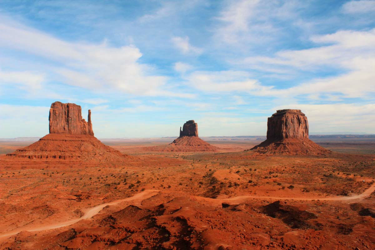
It is called Monument Valley because a rocky mountain like this was found in this plain like a monument.
A monument volleyball where numerous movies were filmed as a stage of Western play.
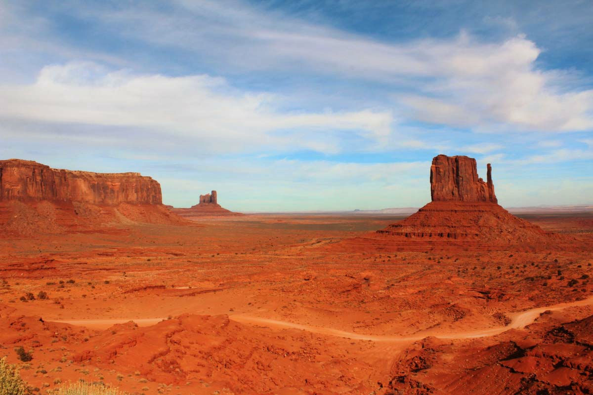
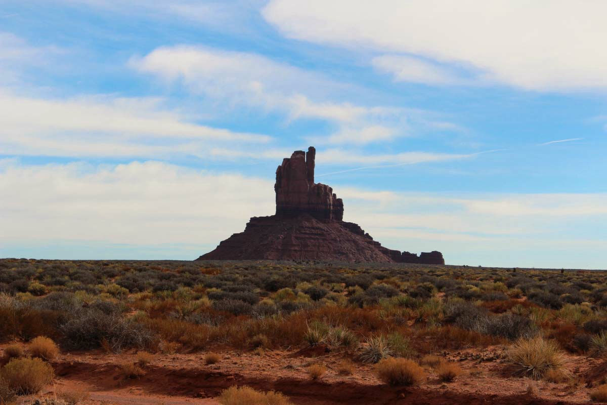
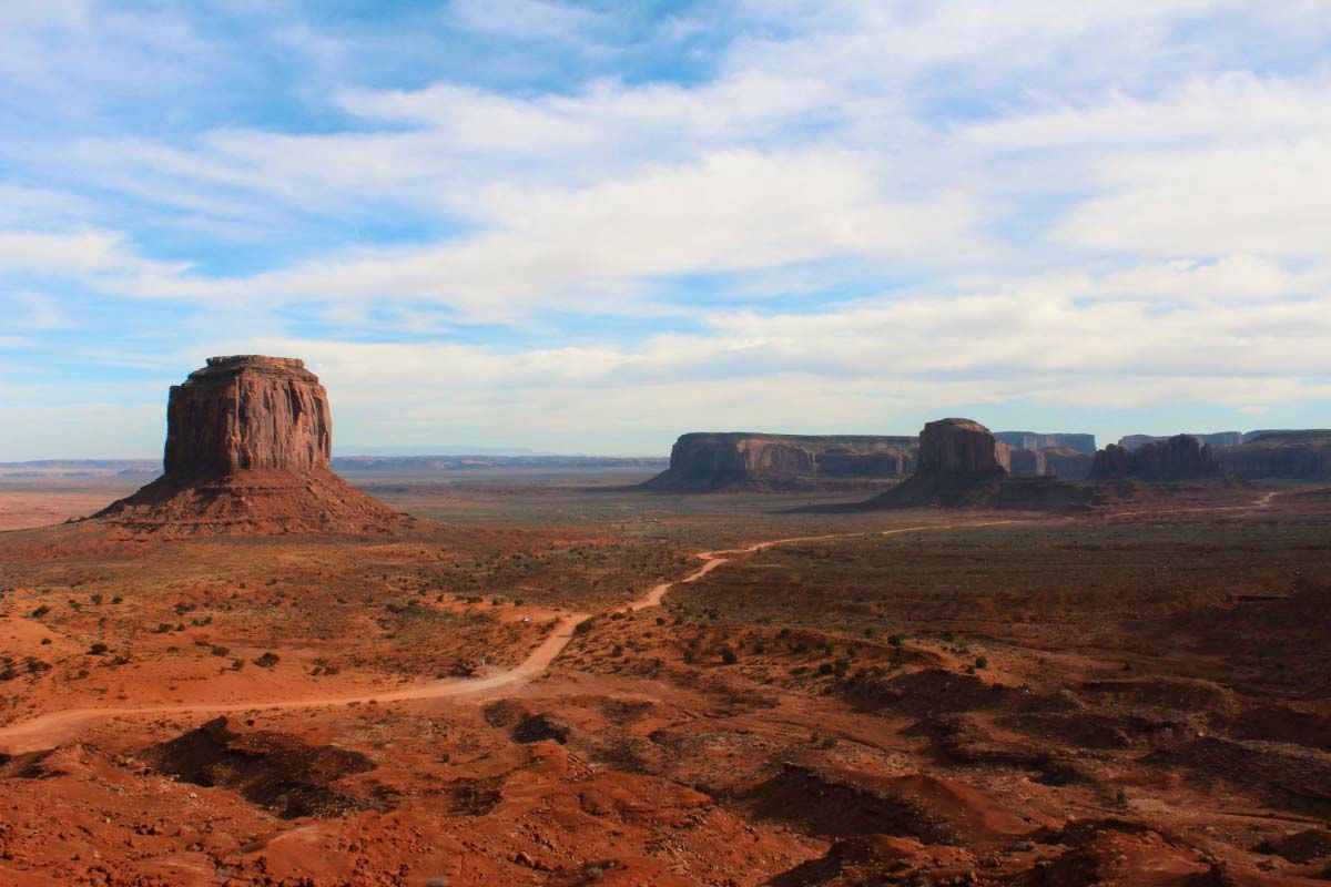
Dirt road extending to the deep part of Monument Valley.
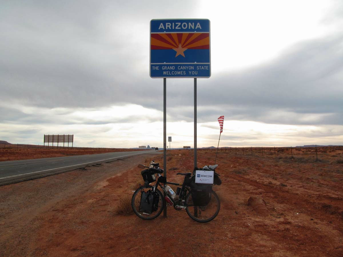
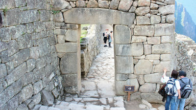
When I leave Monument Valley, I enter Northern Arizona and at the same time it is Native AmericanNavajoThe country of the begins. People of Navajo like brown and black hair Oriental people lived with a certain autonomy right. Just a living standard is low, house and city are slightly rough. To the entrance of a certain shop, a list of people who are not allowed to leave. However, most people live normally, and the bustle of supermarkets and McDonald's has not changed from that of the United States.
From Utah to Arizona State.
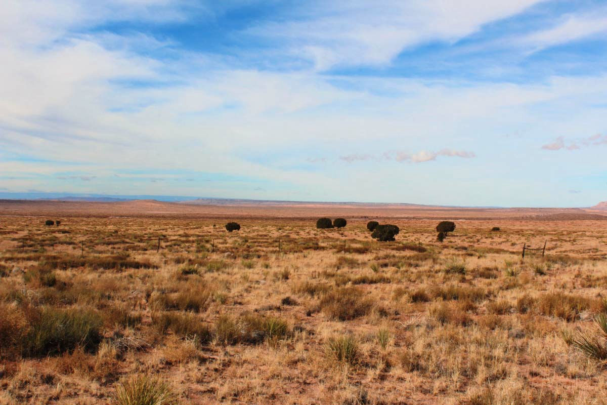
Prairie zone.
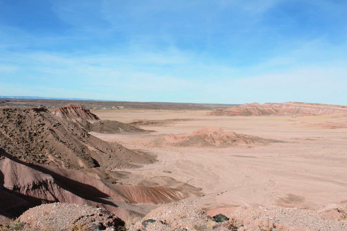
It turns around, there is only sand.
Does the valley created by the Little Colorado River also call Little Grand Canyon?
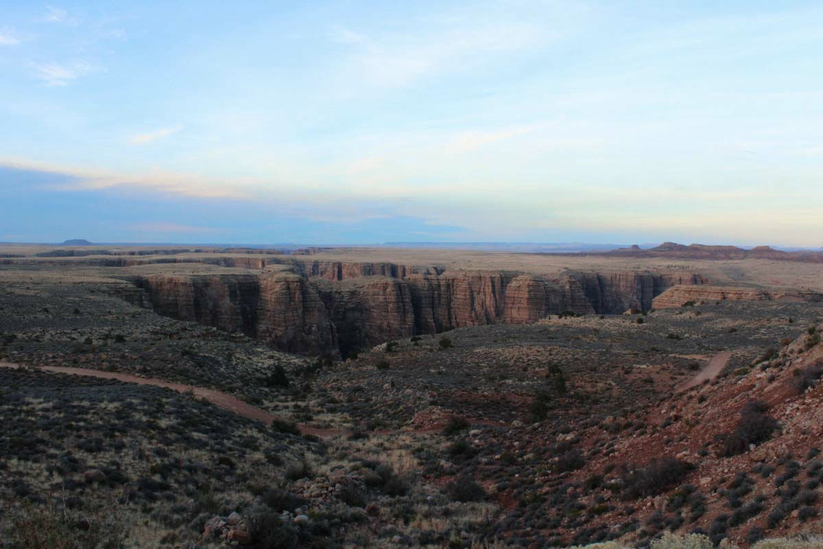
It seems that the ground surface is flowing and being swallowed.
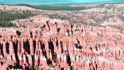
According to WikipediaGrand CanyonIs
About 40 million years ago erosion by the Colorado River starts. The canyon almost revealed its full potential five million years ago and it became a canyon as seen now, about two million years ago. Even today, erosion continues, eroding the earliest, about 2 billion years ago primordial life birth formation. Cliffs of the Grand Canyon range from an average depth of about 1200 m, length of 446 km, width of 6 km to 29 km. The deepest point is 1,800 m.
It has become. 2 million years, 2 billion years, How to use time is incomparable and I can not seem to feel it.
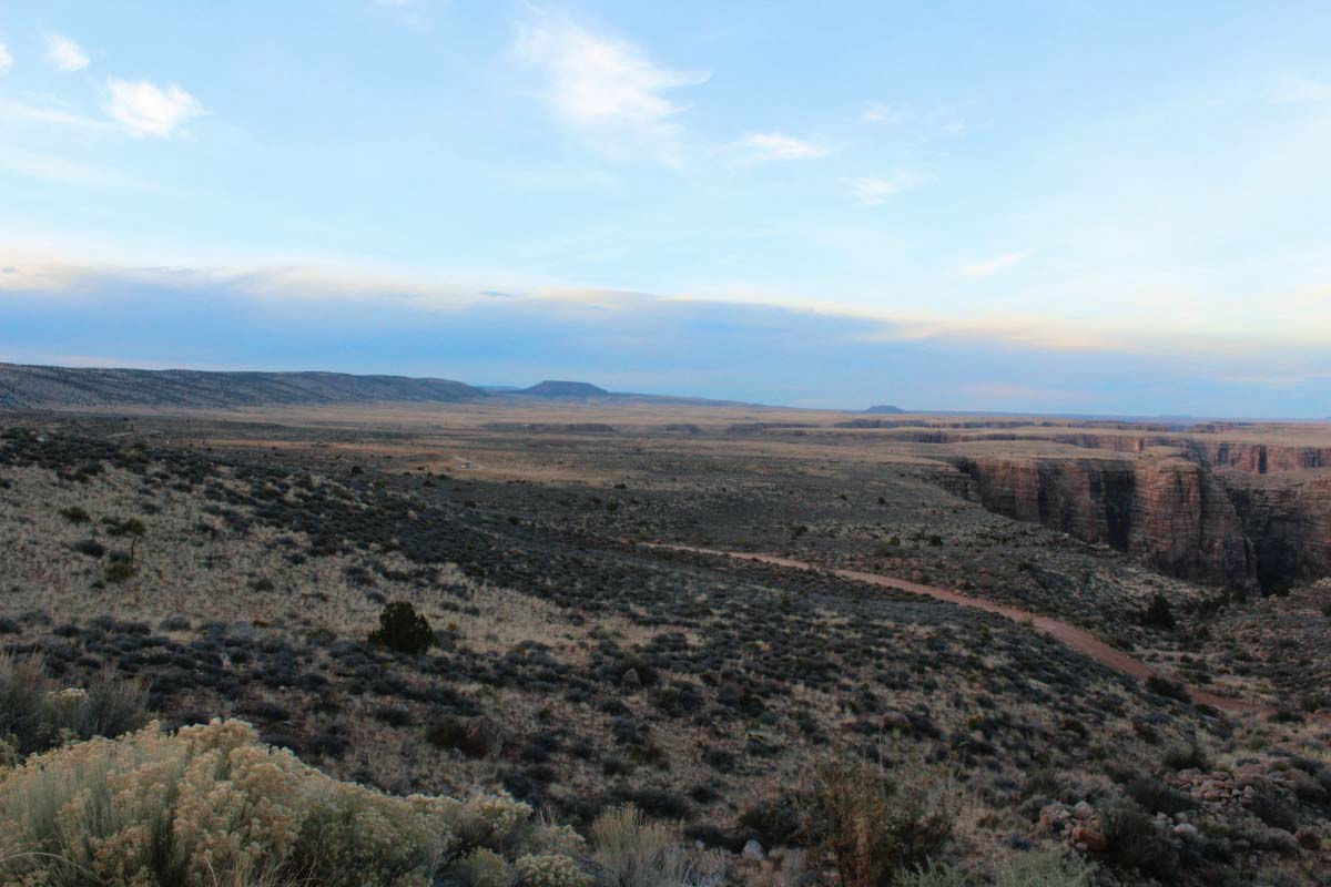
Grand CanyonYou can observe from two places, north rim (north side) and south rim (south side), across a valley. The center of tourism is the South Rim and I also reached the Grand Canyon from here. From Monument Valley you enter from the east gate. About 40 km to the village with the campground and the visitor center, I stopped by several observation platforms and ran. Any observation platform is around 2,200 m above sea level.
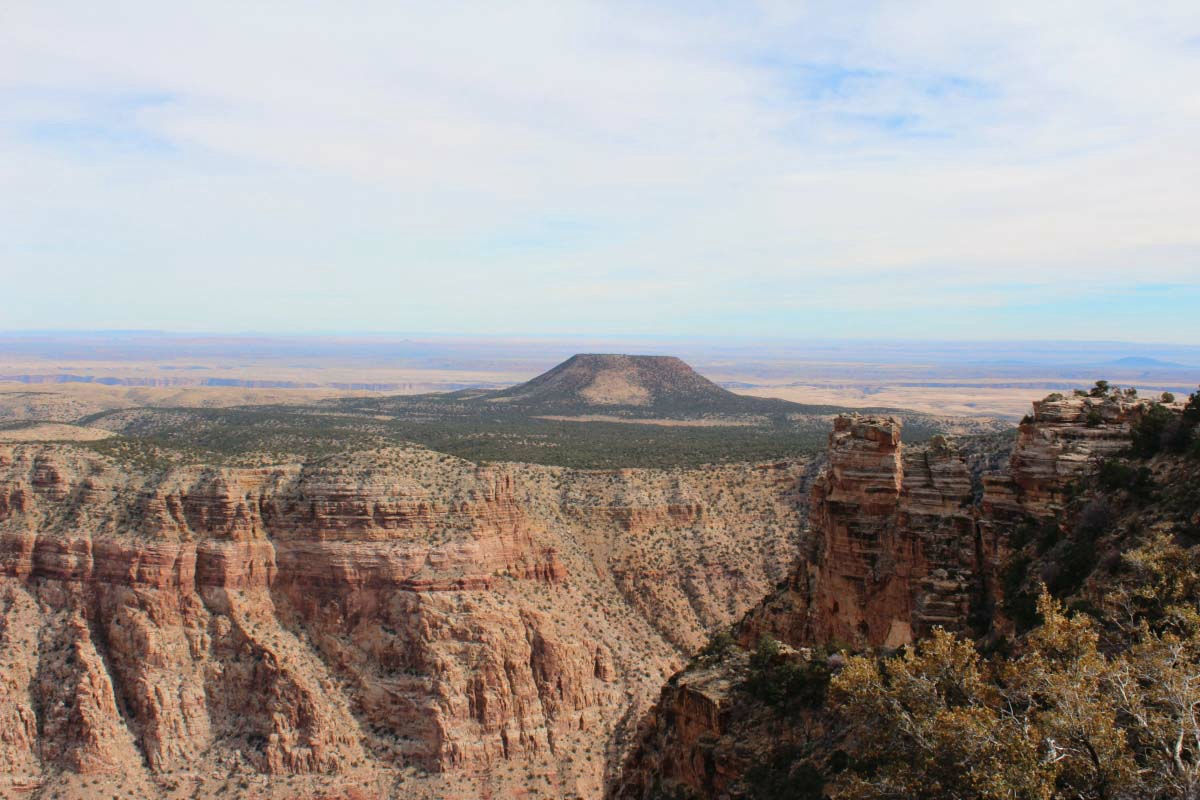
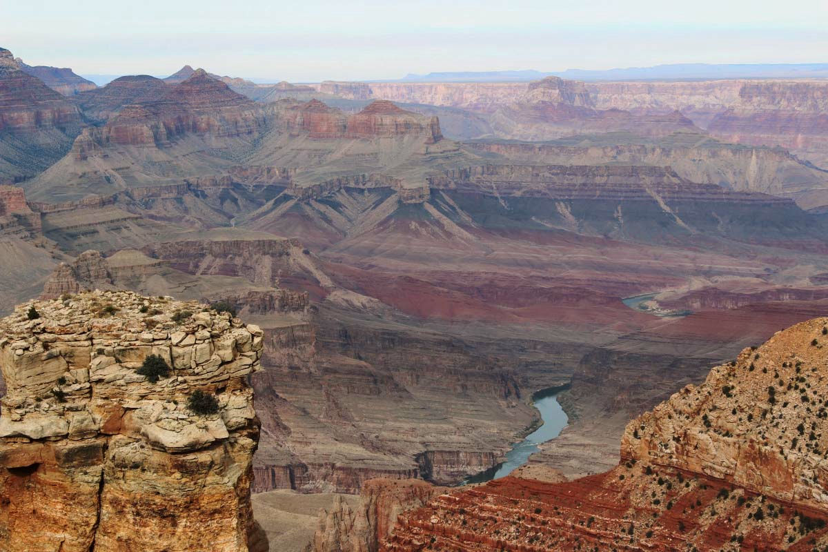
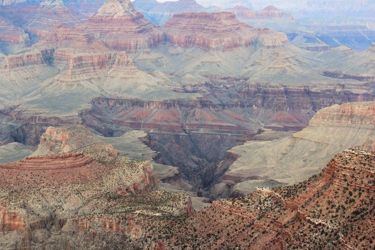
The observation stand immediately after passing through the gate is Desert View, the end of the east of the Grand Canyon. This scenery was my first meeting with the Grand Canyon.
The Colorado River making the Grand Canyon.
The direction of the village. A deeply carved large canyon.
The upper part than the Grand Canyon is a plain.
Grand Canyon seen from Desert View - YouTube
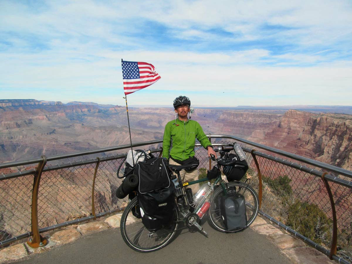
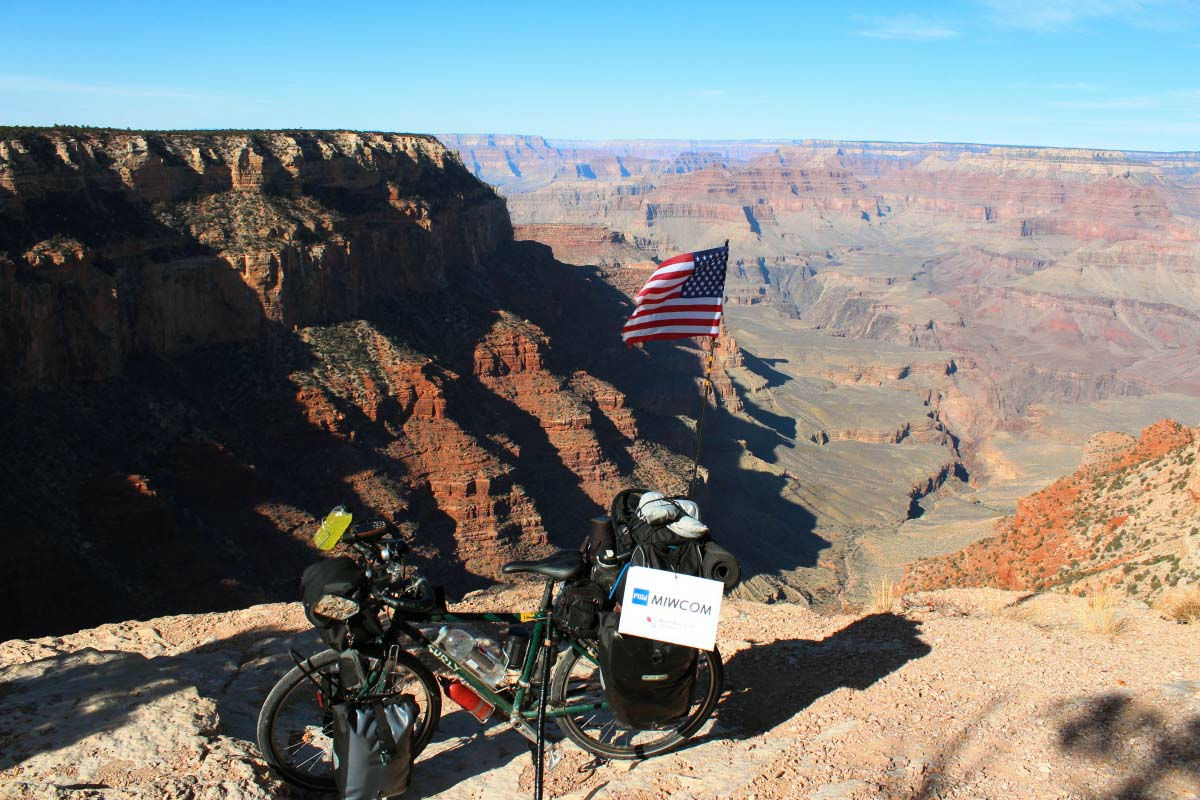
I reached the place I was longing by bike.
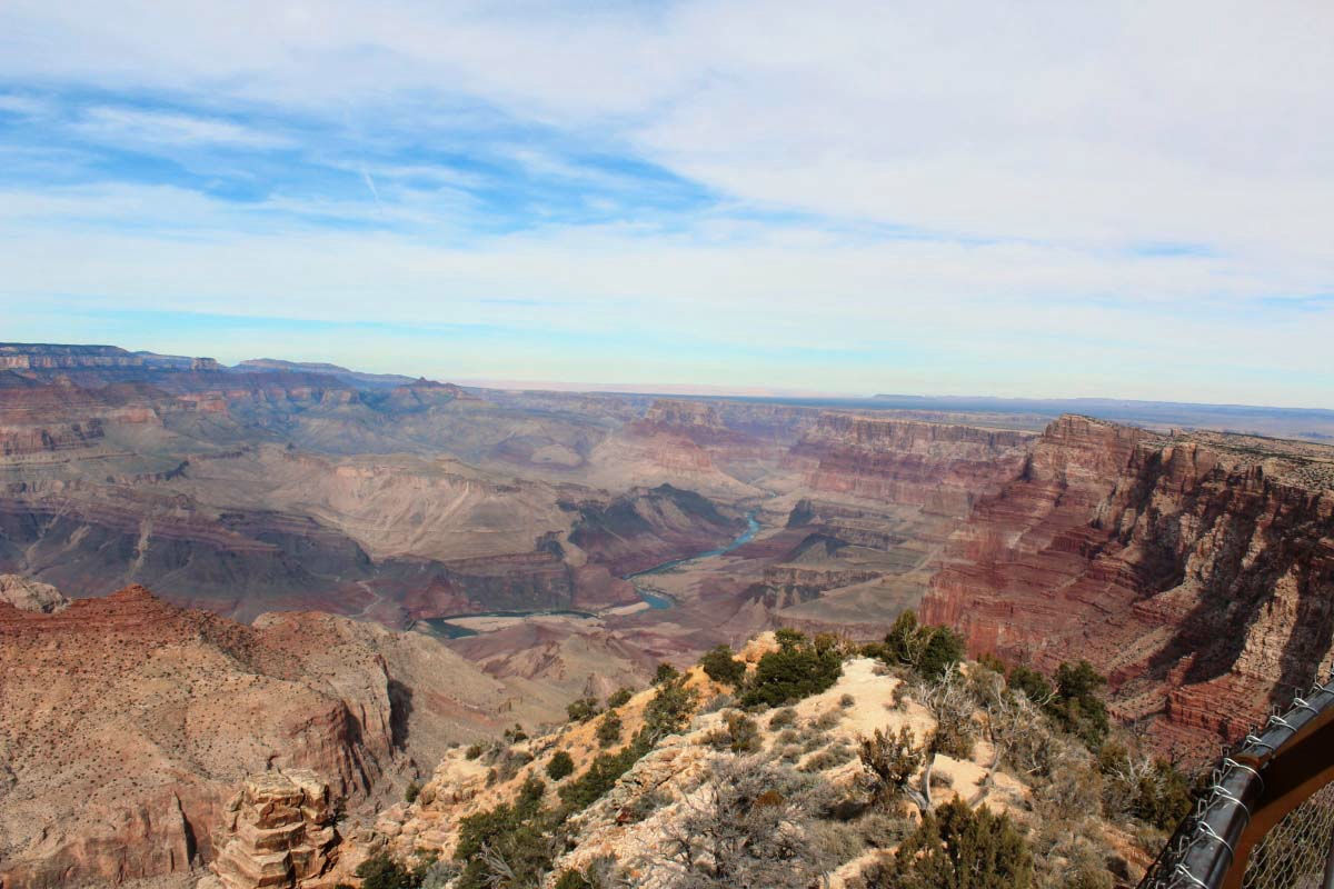
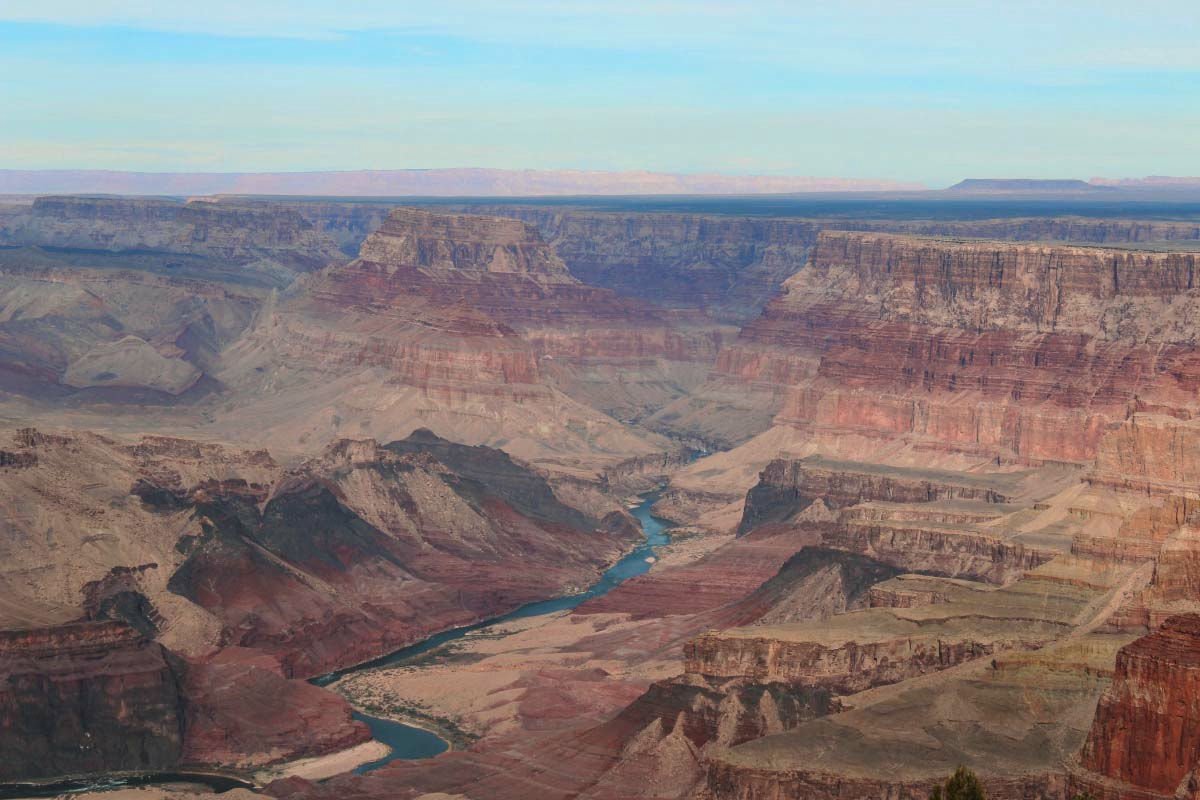
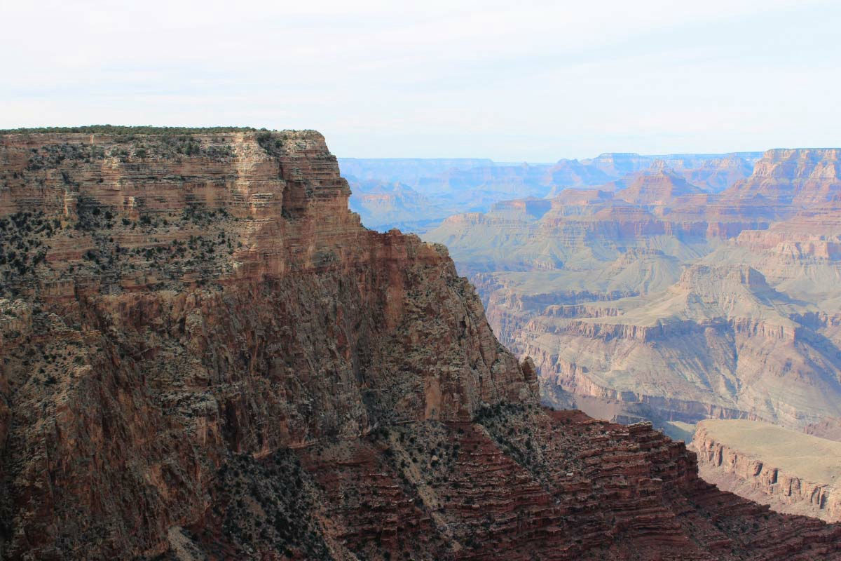
Navajo Point (Navajo Point)
Lipan Point (Lipan Point)
Cliffs and valleys.
Moran Point (Moran Point)
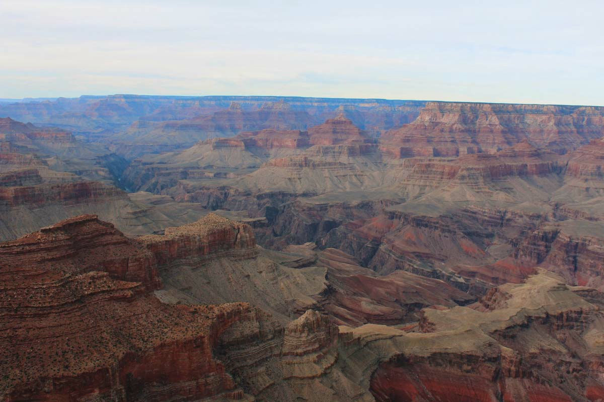
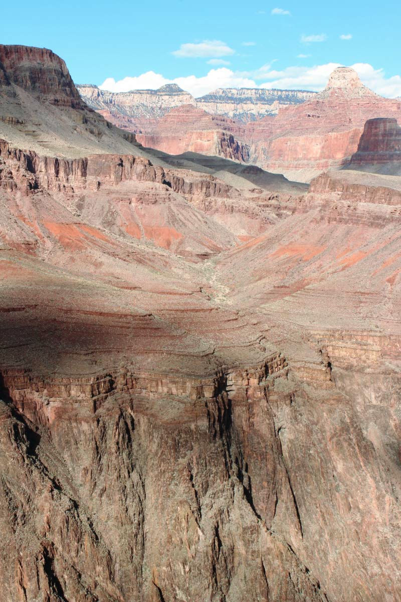
The color is different for each stratum.
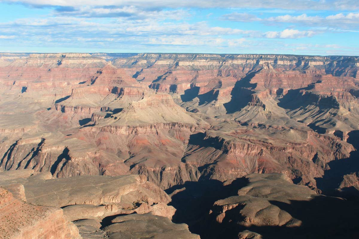
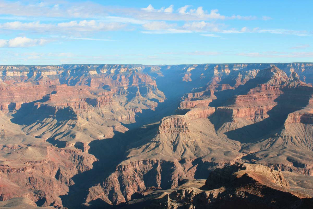
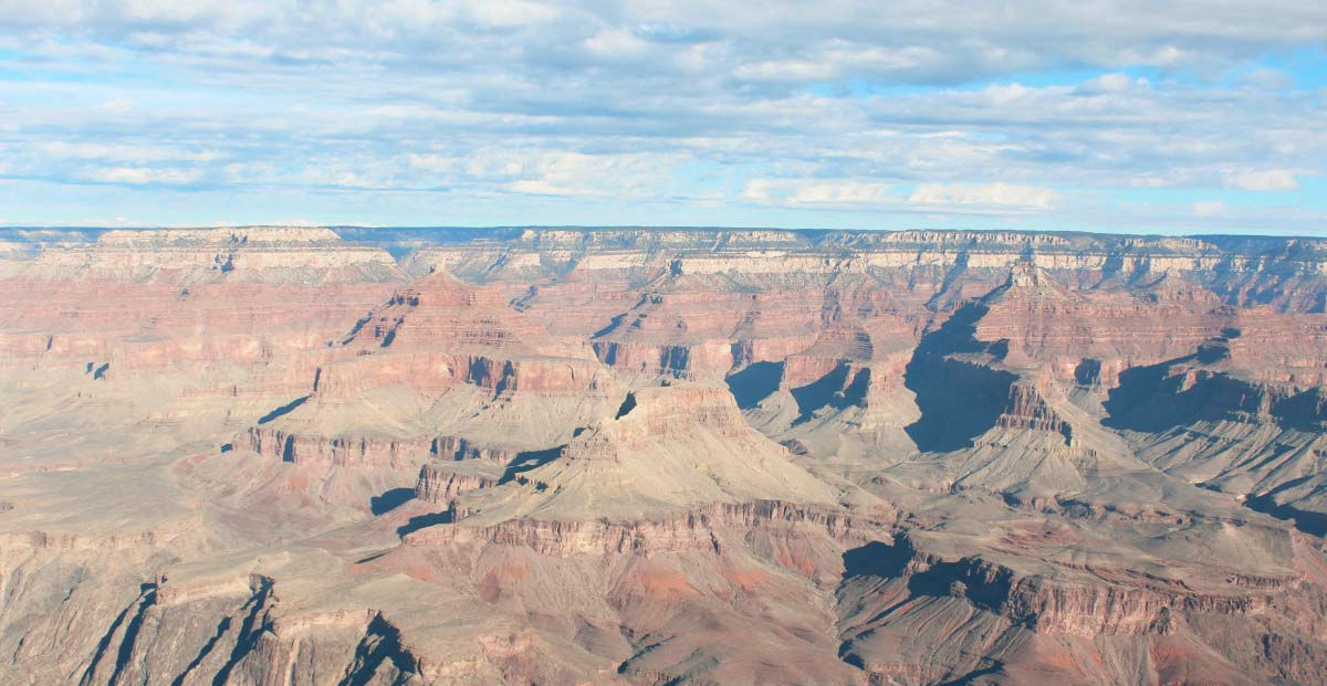
Grand View Point (Grandview Point)
Valley that seems to have broken up with bang.
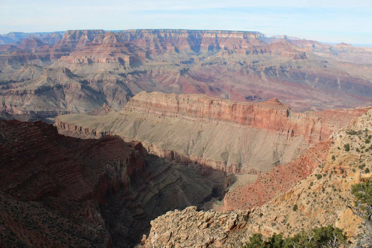
There were views that could be seen by the number of the observatory's places.
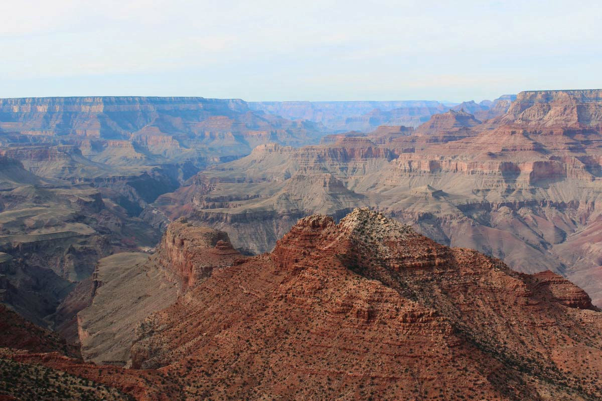
I stayed at the campground in the village for 2 nights. Accommodations, supermarkets and visitor centers are gathering in this village, and it is the base of sightseeing in the South Rim. The shuttle bus to the observation deck is also based on the village. Since there is an observation table around this village, I went around the next morning after arriving.
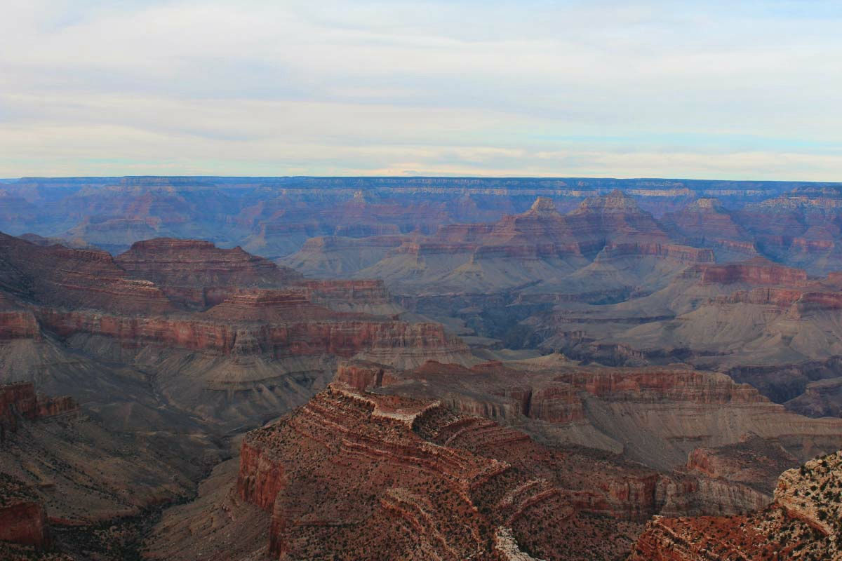
Mather Point (Mather Point) is an observatory which is famous for being used for brochures as well.
The morning Grand Canyon is refreshing.
The squirrel was also moved by the Grand Canyon! Is it?
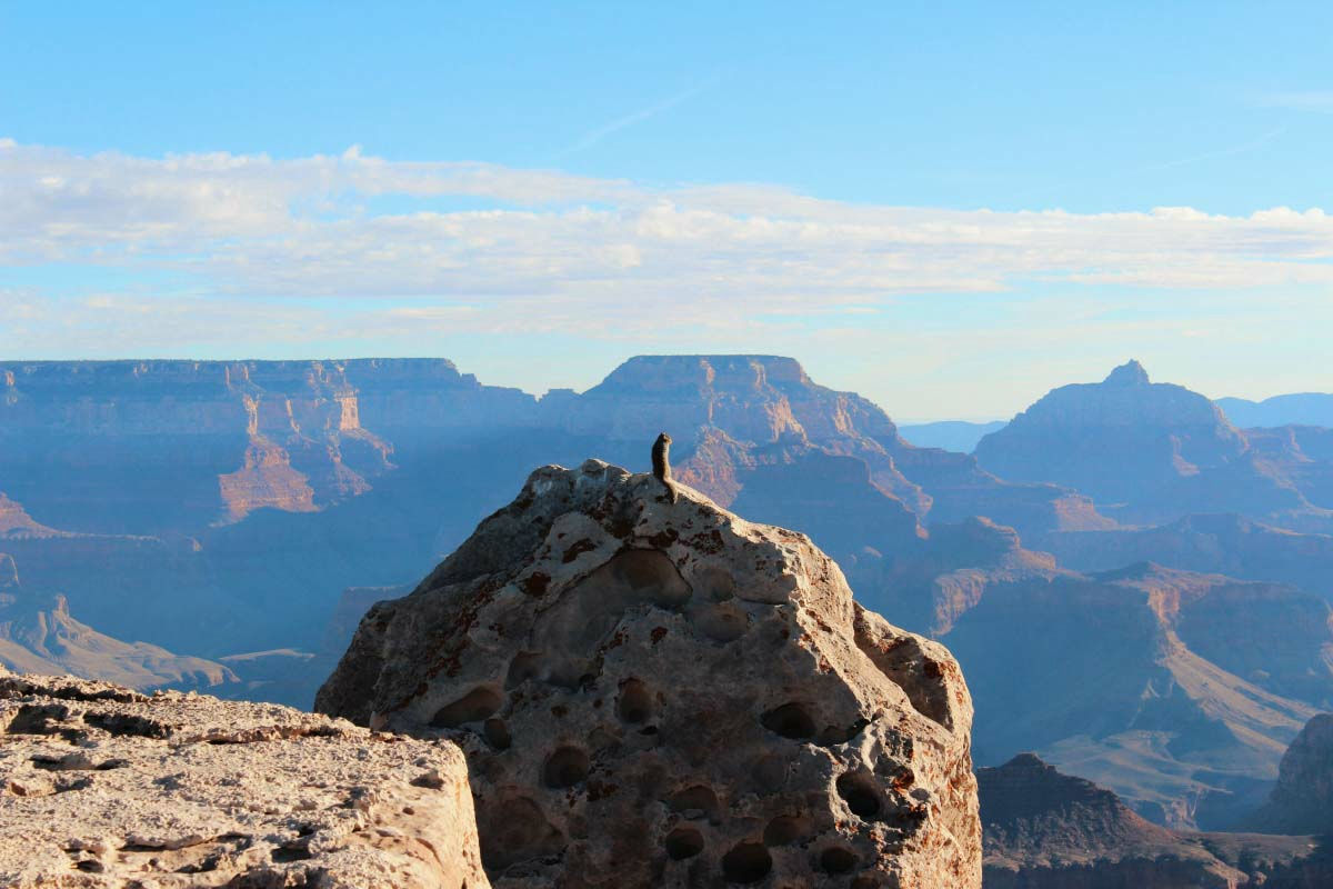
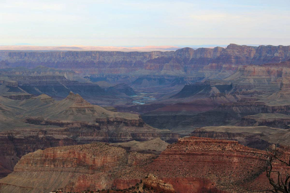
Yavapai Point near Maser Point
It is obvious that the earth is cracked.
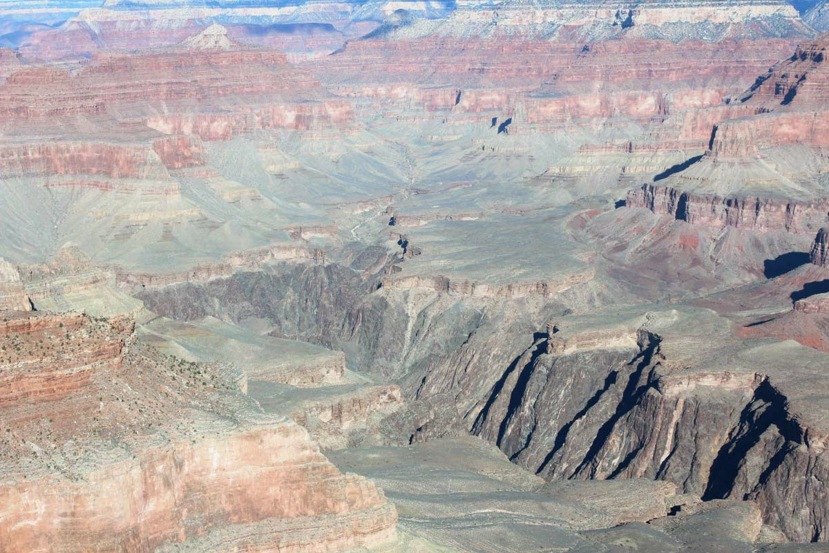
Grand Canyon seen from Yaba Pipe Point - YouTube
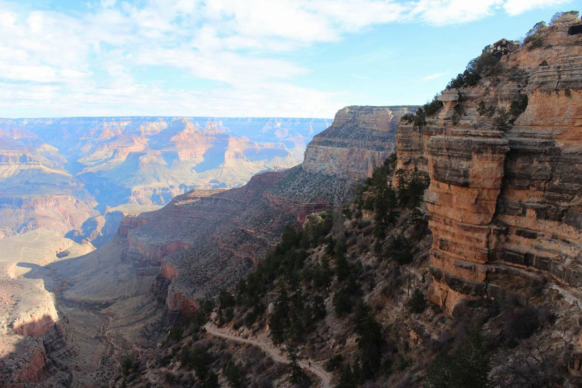
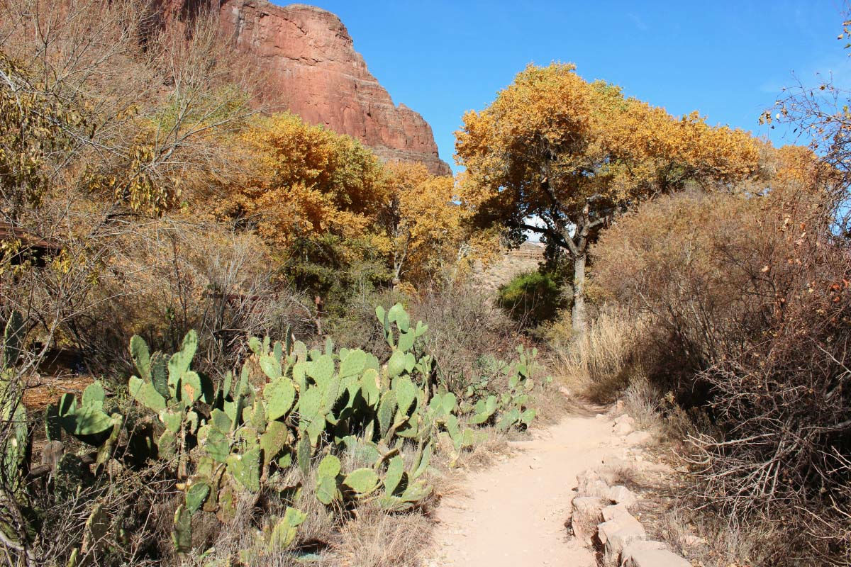
From the morning I finished a sightseeing tour and I walked on the main event, Bright Angel Trail. It is a trail which continues to the valley of the Grand Canyon. If you start off with getting down, you will have to think about pacing as return will be climbing. It was December, so it was not very hot. However, it seems to be tough if you walk in this summer over 40 degrees.
"Can you finish the Boston marathon?" The poster's concluding that question started, "She finished the Boston Marathon passed away lost in this trail" and was shocked. In this OctoberOld Japanese men who are missingThere are also posters on it. If you are walking on the trail, you should prepare firmly and try to avoid any possible problems. There are many places without fences in the trail of the observation platform as well as the trails, so please pay attention to your feet in the sightseeing.
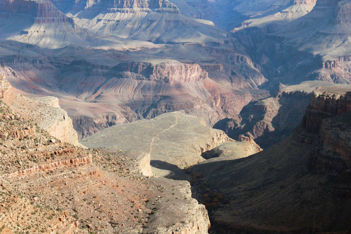
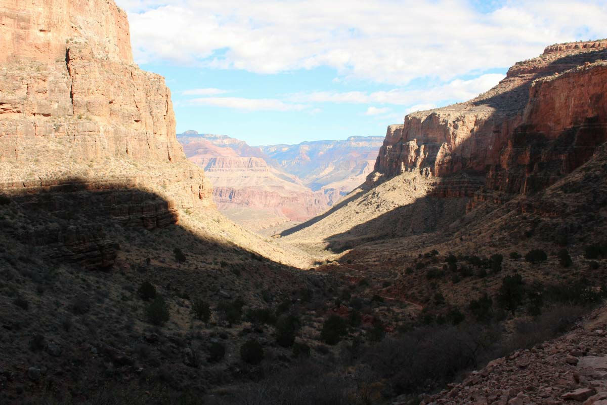
I descend down the mountain, descend in the valley, and walk to the grassland at the left end.
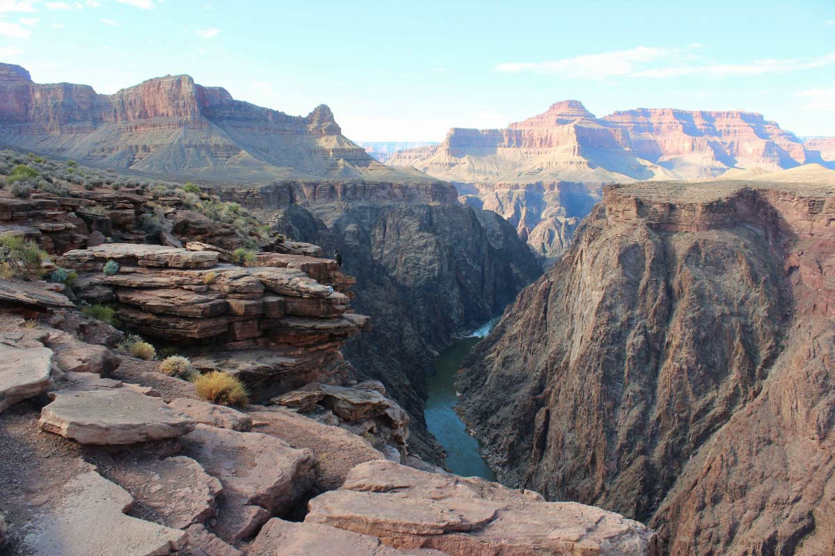
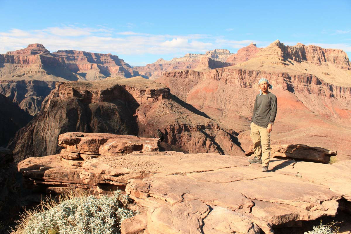
Here is the Observatory Plateau Point of the Colorado River, which is the destination of this trekking.
I am going down the cliff.
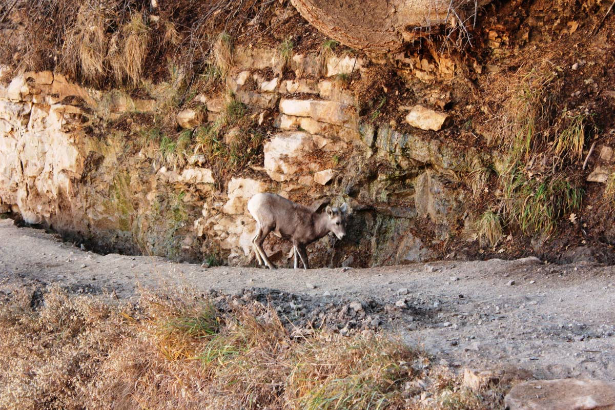
Wild Elk.
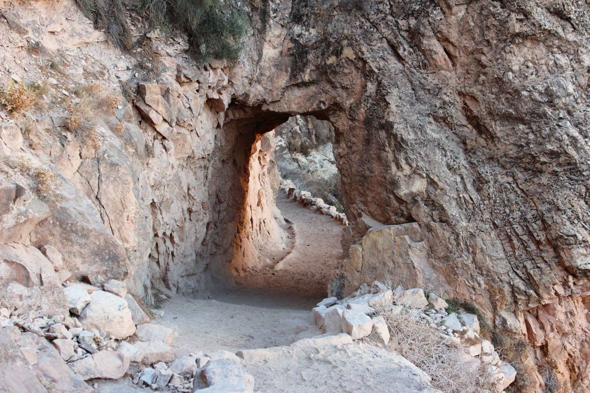
A natural tunnel on the trail.
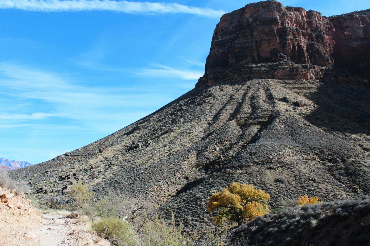
I will gradually lower the altitude.
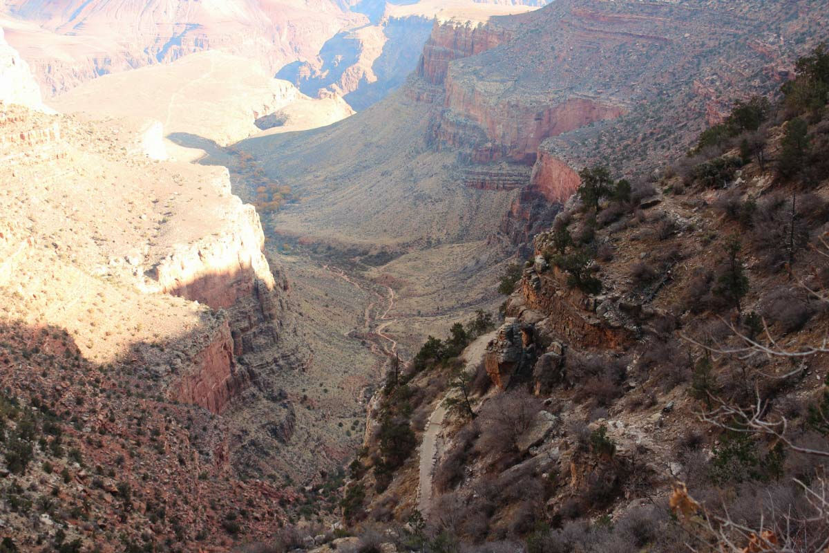
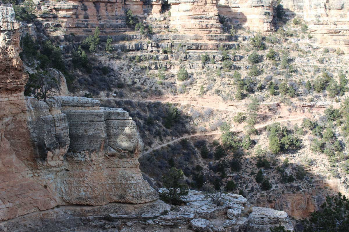
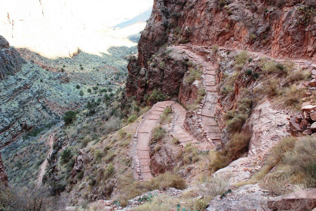
A trail that extends towards the bottom of the valley.
Repeat recurring Kujuku way.
It gradually approached the bottom of the valley.
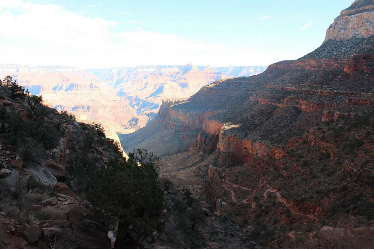
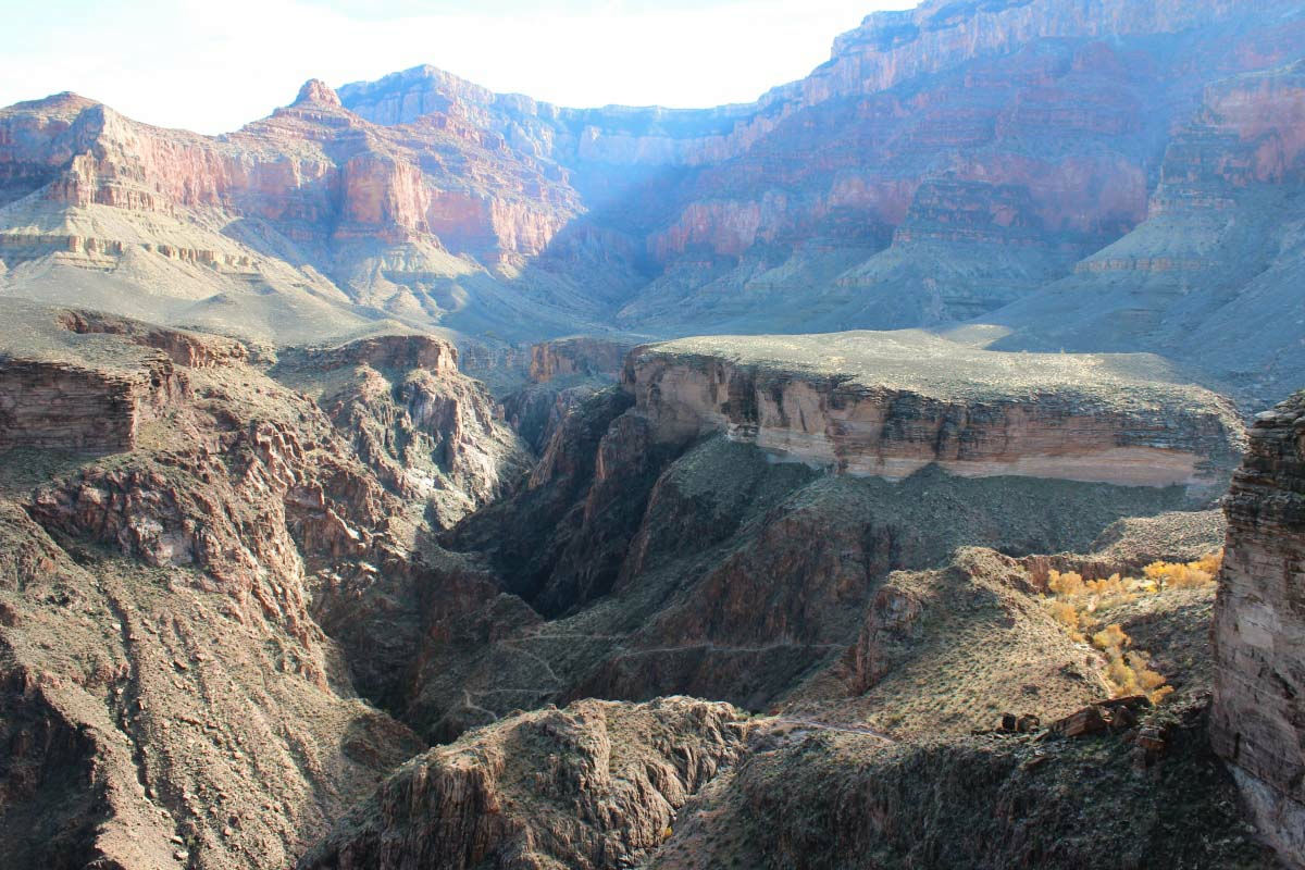
This is the Indian Garden where the campground is located, where native American people once lived. Even the dry Grand Canyon is an oasis of clear flow and green.
Even in December the trees shining in the sun.
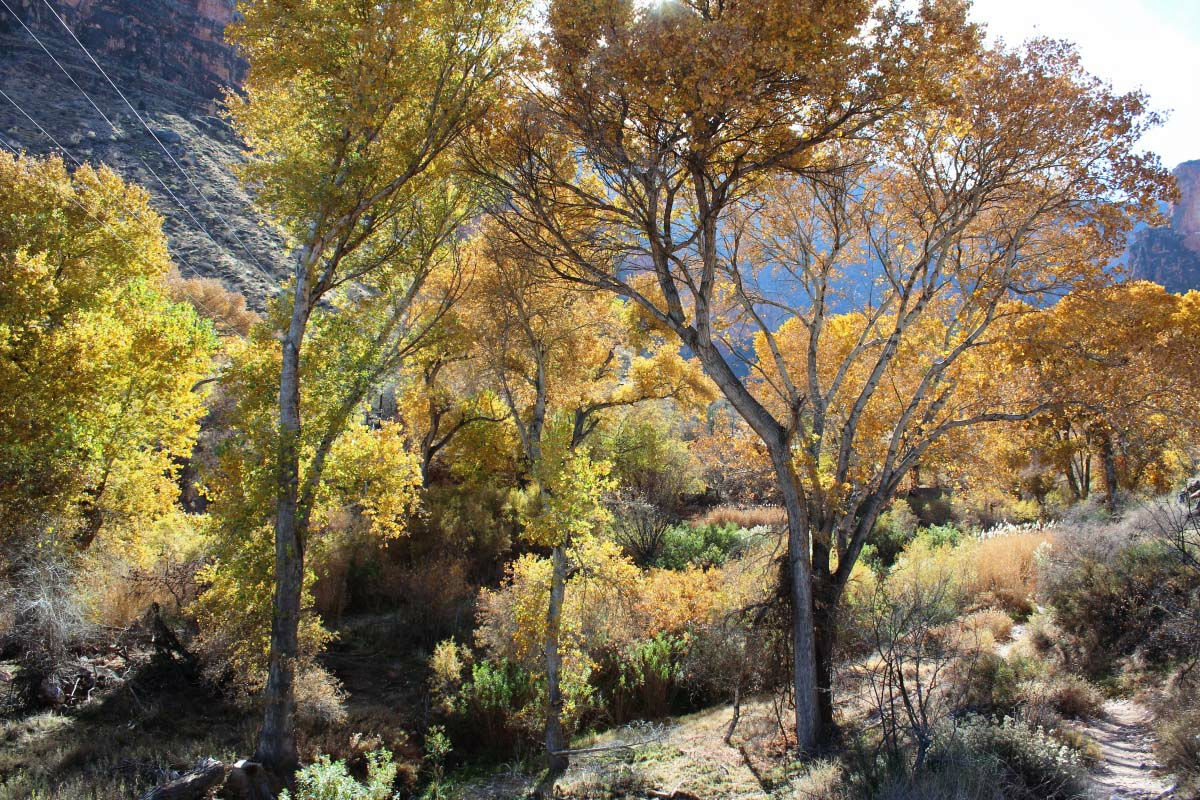
From the Indian Garden to the Plateau Point we will walk on flat plants.
A foot extending widely from the rock like a residual hill seen in Monument Valley.
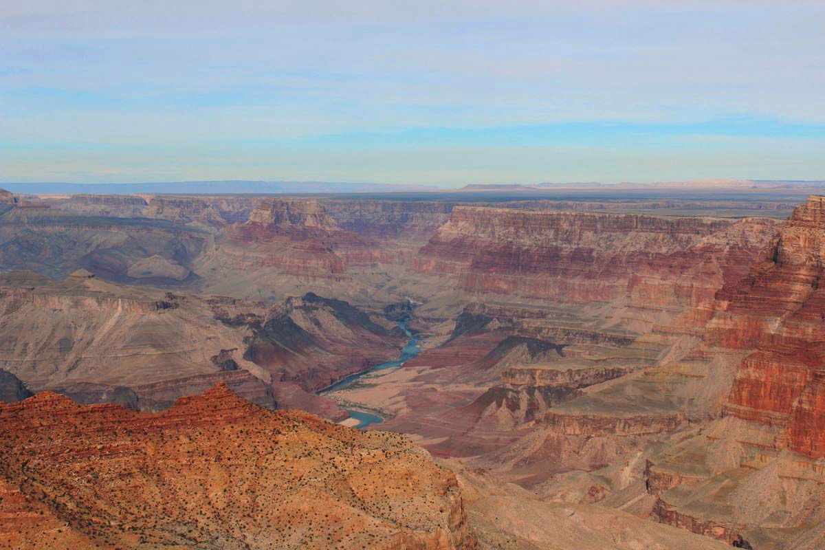
When reaching the plateau point Condor welcomes you.
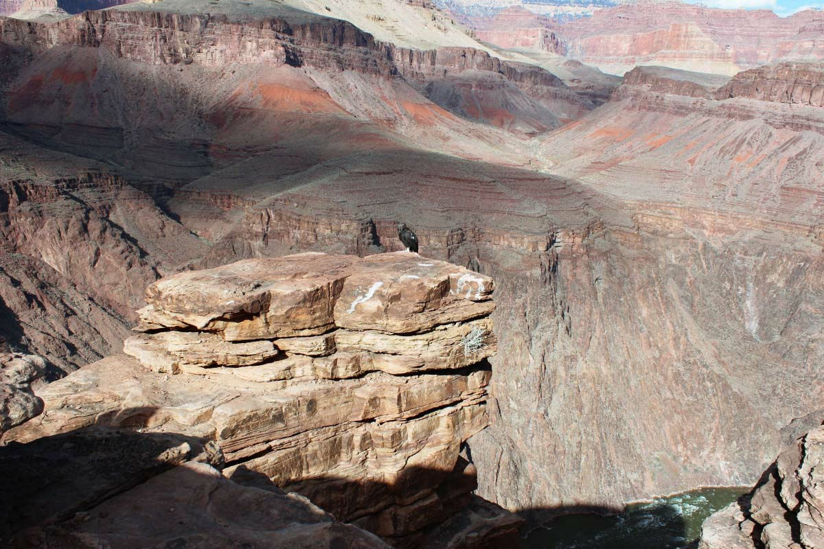
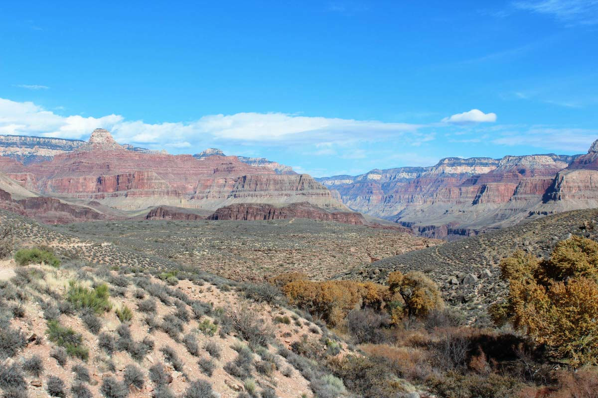
What are you thinking about the Colorado River?
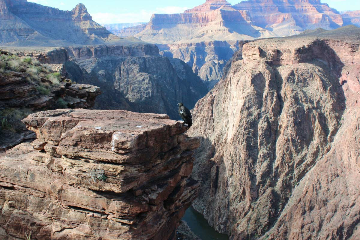
This is the Colorado River which is scraping the Grand Canyon. The altitude difference from the plateau point to the bottom of the river is about 400 m.
From another angle. From the plateau point I saw the flow of the river clearly.
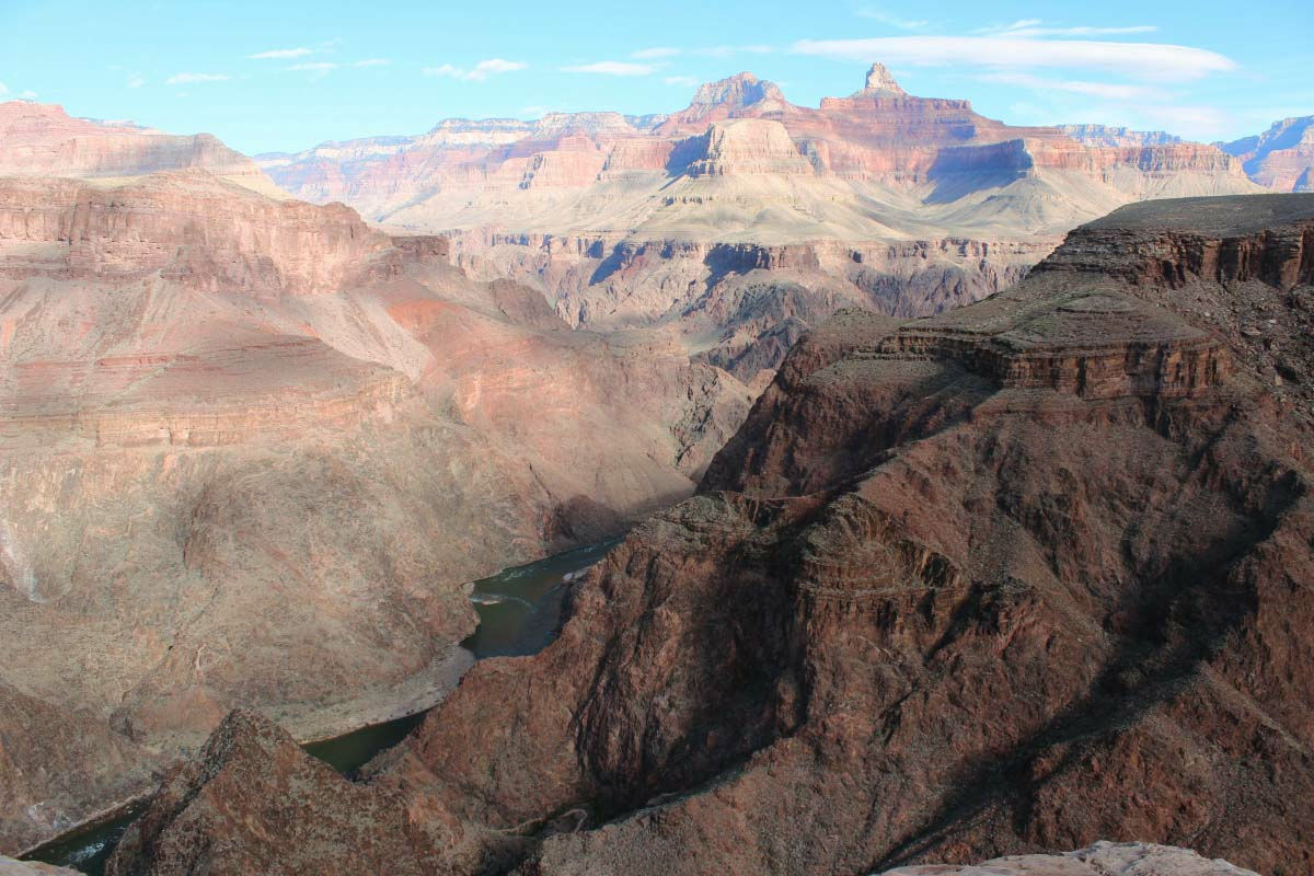
A flat place seems to collapse.
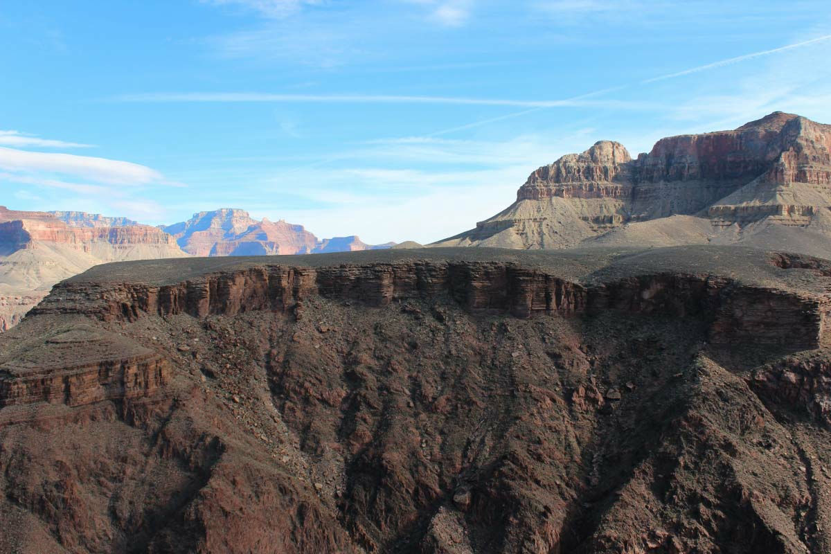
There are many overlapping strata.
Grand Canyon seen from Plateau Point - YouTube
Because there is no one, the scenery which I had the first to take. Only the scenery overlooking the valley floor is a topic, but the scenery looking up from the valley floor is also nice and I fully enjoyed the charm of the Grand Canyon.
The main line of Bright Angel Trail will cross the Colorado River and continue to "Phantom Ranch" which is the only inn at the bottom of the valley.
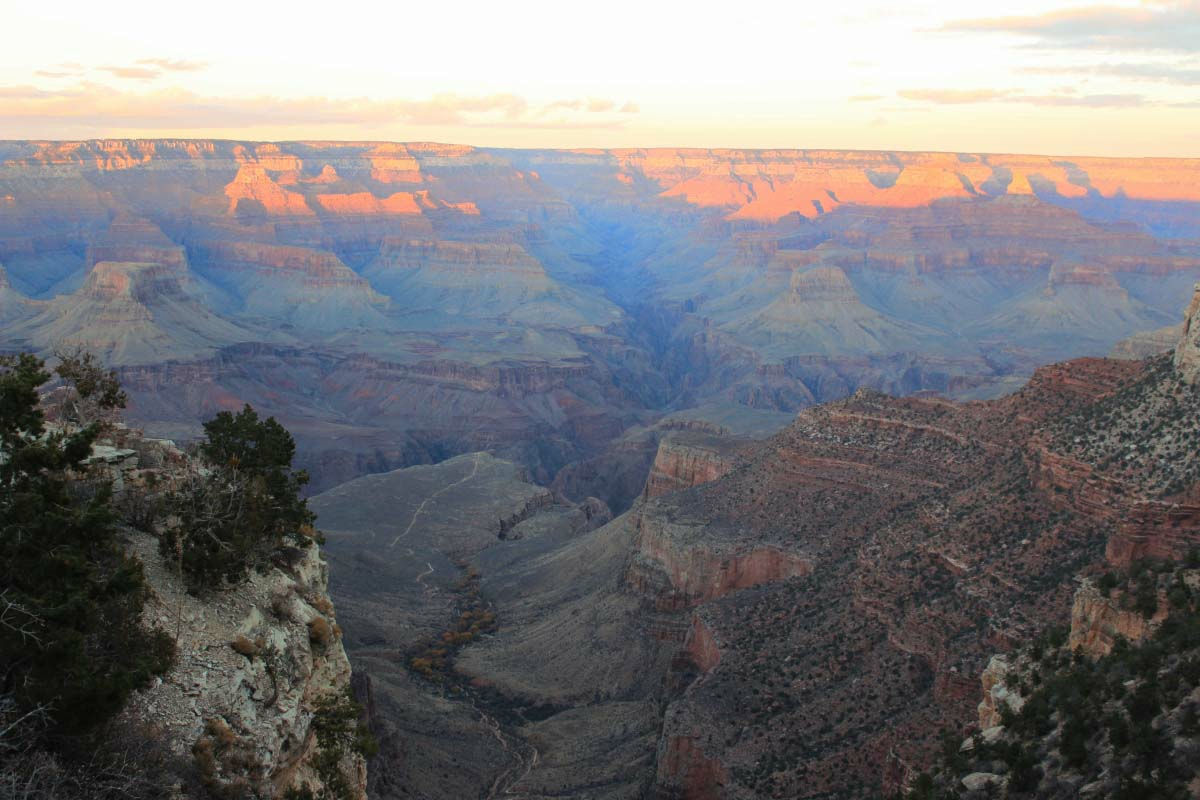
Returning to the village, the Grand Canyon at dusk.
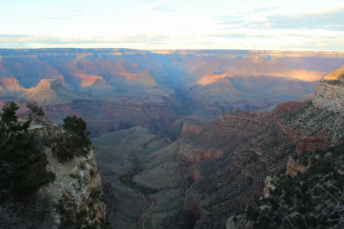
A quiet evening will come.
Dreams finally came true since I was thinking around the world "I want to go to the Grand Canyon absolutely if I run in the USA."
As you go south from the Grand Canyon village, the elevation drops and the cactus shows up. I leave America as it is and the year-over of 2012 becomes Mexico. Thank you for your help this year. Everyone, please have a good year.
(Sentence / photo: Takuya S. Narou Charriderman
Cycling around the world for a bicyclehttp://shuutak.com)
Related Posts:
in Coverage, Posted by logc_nt